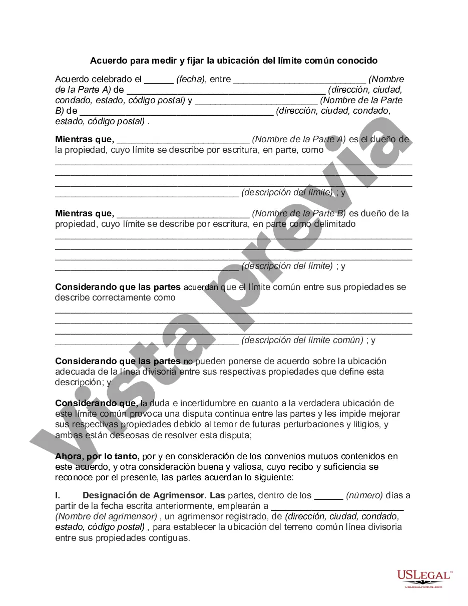
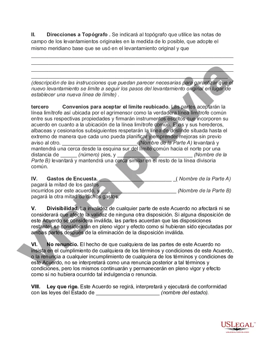
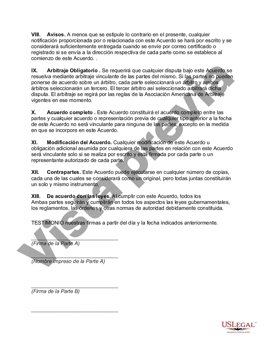
The Arizona Agreement to Survey and Fix Location of Known Common Boundary is a legal document that is used to establish and define the boundaries between two adjoining properties or parcels of land in the state of Arizona. This agreement is a binding contract between the property owners and is executed to ensure accurate identification of the shared boundary. The purpose of the Arizona Agreement to Survey and Fix Location of Known Common Boundary is to prevent any future disputes or conflicts regarding the property boundaries. It establishes a clear understanding between the parties involved, thereby reducing the likelihood of legal disagreements that could arise due to ambiguity or uncertainty in defining the common boundary. The agreement typically includes details about the survey process, which involves a professional surveyor accurately measuring the boundary lines and markers. This survey and subsequent decoration of the agreed-upon boundary serves as an official reference for both property owners and can be used for property tax assessments, title transfers, and other legal purposes. Keywords: Arizona, Agreement to Survey, Fix Location, Common Boundary, legal document, property owners, parcels of land, binding contract, shared boundary, disputes, conflicts, clear understanding, parties involved, legal disagreements, ambiguity, uncertainty, defining, survey process, professional surveyor, boundary lines, markers, records, official reference, property tax assessments, title transfers, legal purposes. Different types of Arizona Agreement to Survey and Fix Location of Known Common Boundary can include variations based on the specific characteristics and requirements of the properties involved. Some common variations may include: 1. Residential Agreement to Survey and Fix Location of Known Common Boundary: This type of agreement is specifically crafted for residential properties and aims to establish and define boundaries between neighboring houses, condos, or apartments. 2. Commercial Agreement to Survey and Fix Location of Known Common Boundary: This specific type of agreement is designed for commercial properties, including office buildings, shopping centers, or industrial complexes. It outlines the boundary lines between these properties and provides a legal reference for any future boundary disputes. 3. Agricultural Agreement to Survey and Fix Location of Known Common Boundary: This agreement caters to agricultural properties, such as farms, ranches, or vineyards. It helps property owners clearly demarcate their boundaries to avoid any potential conflicts with neighboring agricultural operations. 4. Land Development Agreement to Survey and Fix Location of Known Common Boundary: In cases where land is being developed for future housing projects, commercial buildings, or any large-scale construction, this type of agreement is crucial. It ensures accurate boundary surveying and fixation to avoid any complications during the development process. These variations of the Arizona Agreement to Survey and Fix Location of Known Common Boundary exist to address the unique requirements and considerations of different types of properties, providing a tailored approach to boundary agreement formation in various contexts.
Para su conveniencia, debajo del texto en español le brindamos la versión completa de este formulario en inglés. For your convenience, the complete English version of this form is attached below the Spanish version.Arizona Acuerdo para medir y fijar la ubicación del límite común conocido - Agreement to Survey and Fix Location of Known Common Boundary
Description

How to fill out Arizona Acuerdo Para Medir Y Fijar La Ubicación Del Límite Común Conocido?
Are you presently within a position the place you require papers for both organization or personal reasons almost every day? There are a lot of legitimate record templates accessible on the Internet, but finding versions you can trust isn`t simple. US Legal Forms delivers a huge number of form templates, such as the Arizona Agreement to Survey and Fix Location of Known Common Boundary, which are written in order to meet state and federal specifications.
In case you are already acquainted with US Legal Forms internet site and possess a merchant account, simply log in. Afterward, it is possible to acquire the Arizona Agreement to Survey and Fix Location of Known Common Boundary format.
Unless you provide an accounts and wish to begin using US Legal Forms, adopt these measures:
- Find the form you will need and make sure it is for the right town/state.
- Use the Preview switch to analyze the shape.
- Read the information to ensure that you have chosen the correct form.
- In case the form isn`t what you are looking for, take advantage of the Look for area to find the form that fits your needs and specifications.
- Once you find the right form, click on Get now.
- Pick the costs prepare you would like, fill in the specified info to produce your money, and pay money for the order utilizing your PayPal or bank card.
- Select a practical file structure and acquire your copy.
Locate each of the record templates you possess purchased in the My Forms food selection. You can obtain a extra copy of Arizona Agreement to Survey and Fix Location of Known Common Boundary at any time, if possible. Just select the necessary form to acquire or print out the record format.
Use US Legal Forms, the most extensive variety of legitimate varieties, to conserve efforts and stay away from errors. The service delivers skillfully created legitimate record templates which can be used for a range of reasons. Produce a merchant account on US Legal Forms and begin producing your daily life a little easier.