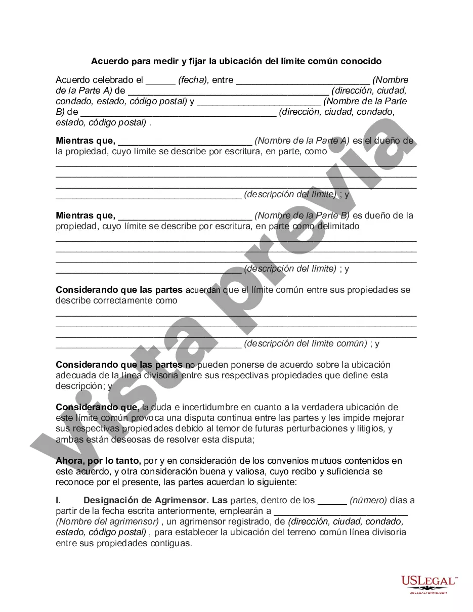
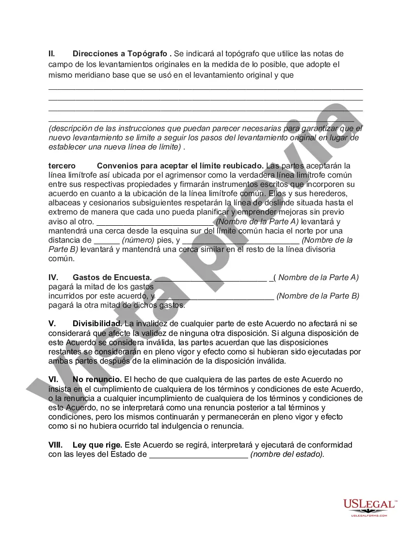
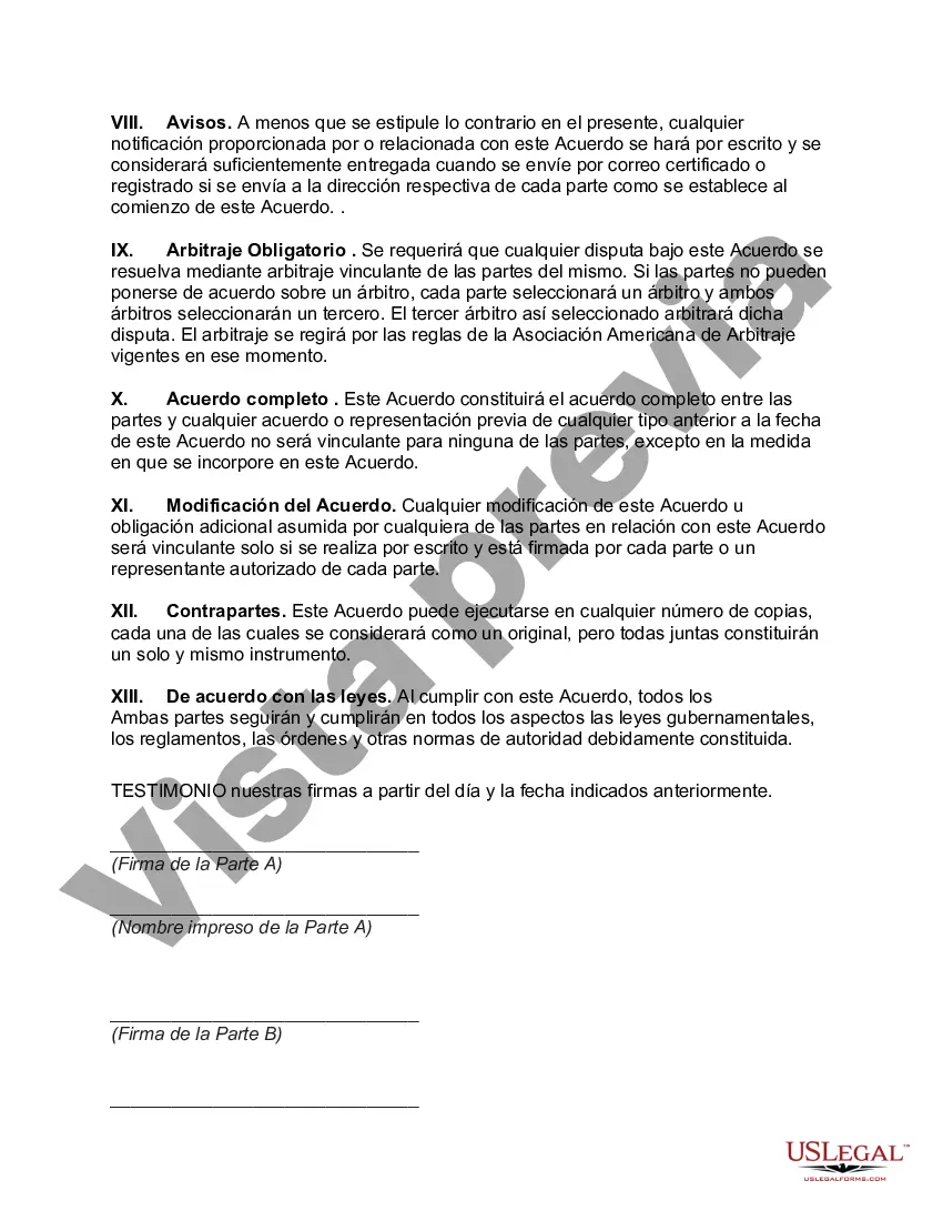
Oklahoma Agreement to Survey and Fix Location of Known Common Boundary is a legal document used in the state of Oklahoma to resolve boundary disputes between two adjoining properties. This agreement is crucial when there is ambiguity or disagreement regarding where the exact property line lies between the neighboring properties. The purpose of the Oklahoma Agreement to Survey and Fix Location of Known Common Boundary is to establish a clear and definitive boundary line that both parties agree upon. The agreement typically requires the appointment of a professional surveyor who will survey the area and collect data to determine the exact location of the common boundary. This legally binding agreement ensures that both property owners have a mutual understanding of the boundary's location, eliminating any potential future conflicts or misunderstandings. Furthermore, it helps prevent costly and time-consuming litigation that may arise from boundary disputes. Various types of Oklahoma Agreements to Survey and Fix Location of Known Common Boundary may exist, depending on the specific circumstances and characteristics of the disputed area. For instance, one common type of agreement may apply to disputes in rural areas, where physical landmarks or natural features might be used to establish the boundary line. Another type may be used in urban or suburban areas, relying on precise measurements and surveying techniques. The process of executing an Oklahoma Agreement to Survey and Fix Location of Known Common Boundary involves several key steps. Initially, both property owners must agree to participate in the survey and sign the agreement. Then, a qualified surveyor conducts a thorough examination of the property and adjoining areas to gather necessary data. The surveyor may use boundary monuments, historical records, aerial imagery, and advanced surveying equipment to determine the precise location of the boundary. Once the survey is completed, the surveyor presents the findings to both parties. If they agree with the established boundary line, they can sign off on the agreement, formalizing the common boundary's location. This agreement may need to be notarized and recorded in the official land records of the county where the properties are located. In conclusion, an Oklahoma Agreement to Survey and Fix Location of Known Common Boundary is a crucial legal document used to resolve boundary disputes in Oklahoma. It helps establish a clear and definitive boundary line that both parties agree upon, reducing the likelihood of future conflicts. Different types of agreements may exist depending on the nature of the disputed area, and the process typically involves the participation of a professional surveyor.
Para su conveniencia, debajo del texto en español le brindamos la versión completa de este formulario en inglés. For your convenience, the complete English version of this form is attached below the Spanish version.Oklahoma Acuerdo para medir y fijar la ubicación del límite común conocido - Agreement to Survey and Fix Location of Known Common Boundary
Description
How to fill out Oklahoma Acuerdo Para Medir Y Fijar La Ubicación Del Límite Común Conocido?
If you need to total, download, or print out legal document templates, use US Legal Forms, the most important collection of legal types, which can be found on the Internet. Utilize the site`s simple and easy handy look for to find the papers you need. A variety of templates for company and personal uses are sorted by classes and states, or keywords. Use US Legal Forms to find the Oklahoma Agreement to Survey and Fix Location of Known Common Boundary in just a handful of clicks.
In case you are already a US Legal Forms buyer, log in in your profile and click the Acquire switch to find the Oklahoma Agreement to Survey and Fix Location of Known Common Boundary. You can also gain access to types you earlier saved within the My Forms tab of your respective profile.
If you work with US Legal Forms the very first time, refer to the instructions under:
- Step 1. Make sure you have selected the form for your correct metropolis/land.
- Step 2. Make use of the Review method to examine the form`s content material. Never neglect to see the outline.
- Step 3. In case you are not satisfied with all the form, use the Research area at the top of the monitor to find other versions of your legal form format.
- Step 4. Upon having identified the form you need, go through the Purchase now switch. Opt for the rates strategy you like and add your references to register to have an profile.
- Step 5. Approach the deal. You should use your charge card or PayPal profile to complete the deal.
- Step 6. Select the format of your legal form and download it on your product.
- Step 7. Comprehensive, revise and print out or indicator the Oklahoma Agreement to Survey and Fix Location of Known Common Boundary.
Every single legal document format you acquire is yours eternally. You might have acces to every single form you saved inside your acccount. Click on the My Forms area and choose a form to print out or download once again.
Be competitive and download, and print out the Oklahoma Agreement to Survey and Fix Location of Known Common Boundary with US Legal Forms. There are thousands of skilled and express-specific types you can use to your company or personal requirements.