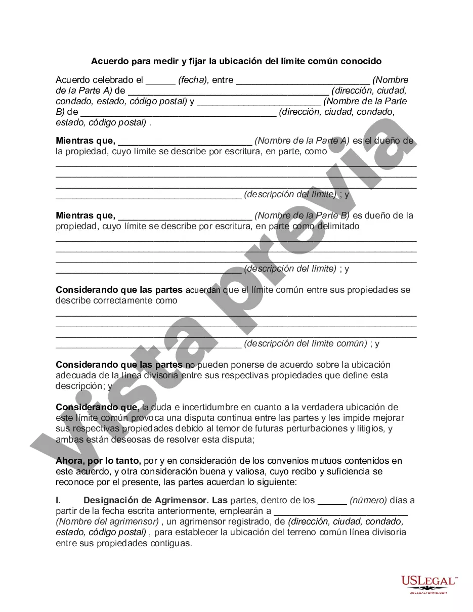
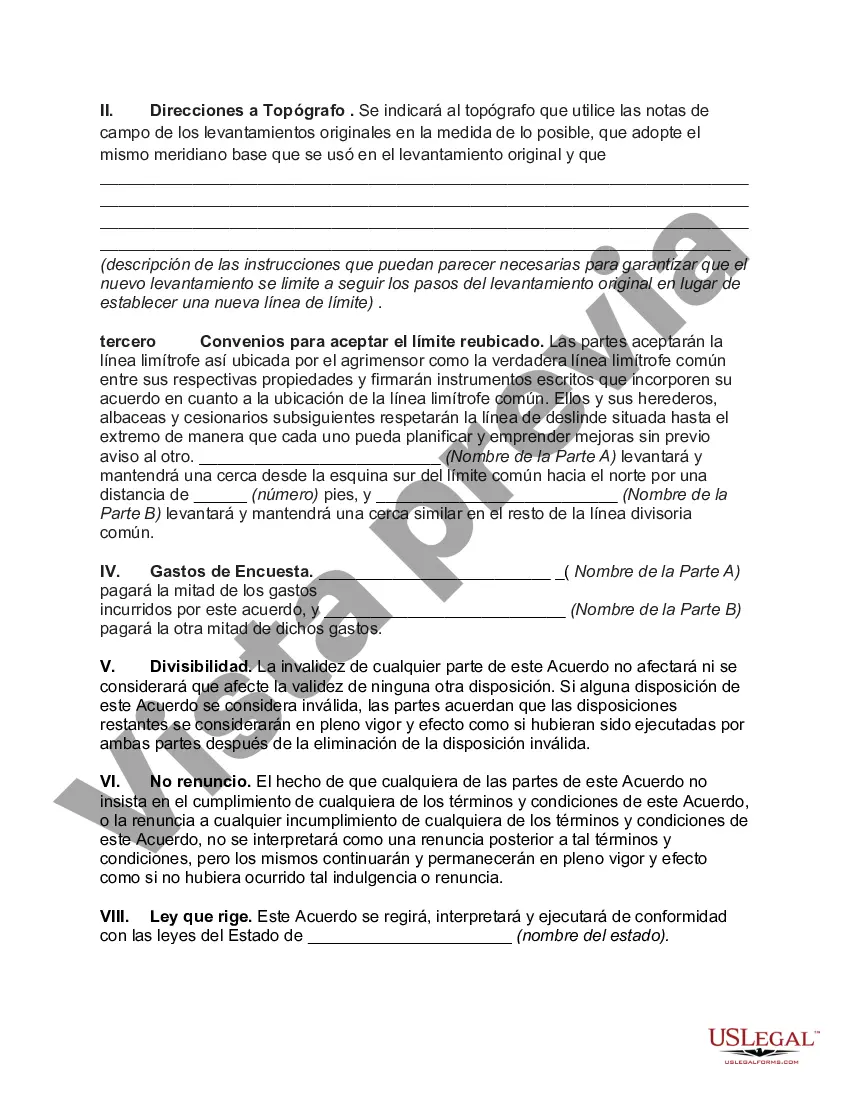
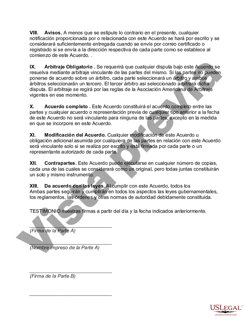
The Maricopa Arizona Agreement to Survey and Fix Location of Known Common Boundary is an important legal document that helps establish and clarify property boundaries within the Maricopa County area in the state of Arizona. This agreement serves as a means to resolve any disputes regarding property lines among adjacent landowners. The purpose of the Maricopa Arizona Agreement to Survey and Fix Location of Known Common Boundary is to accurately determine and register the exact location of common boundaries between adjoining properties. This agreement is crucial in ensuring that landowners have a clear understanding of their property limits and avoid any potential conflicts or encroachments. By entering into this agreement, property owners agree to hire a professional surveyor who will conduct a detailed examination of the properties involved. The surveyor will review existing land records, physically measure the boundaries, and draw an accurate depiction of the common boundary lines. The Maricopa Arizona Agreement to Survey and Fix Location of Known Common Boundary typically includes the following key elements: 1. Identification of the properties involved: It clearly states the legal description and the identification of the properties being surveyed. 2. Appointment of a professional surveyor: The agreement outlines the responsibilities of the surveyor, including their selection and compensation. 3. Surveying procedures: It details the methods and techniques to be employed by the surveyor for accurate boundary determination, such as reviewing existing land records, conducting on-site inspections, and utilizing modern surveying tools. 4. Boundary determination: The process of establishing and marking the common boundaries, ensuring that all parties involved agree with the surveyor's findings. 5. Legal documentation: Once the survey is complete, the agreement highlights the creation of legal documents, such as new property descriptions or amendments to existing ones, reflecting the accurate boundaries as determined by the surveyor. It is worth noting that there may not be different types of Maricopa Arizona Agreement to Survey and Fix Location of Known Common Boundary. However, variations in the specifics of the agreement can occur depending on the complexity of the boundary dispute and the preferences of the involved parties. These variations may include additional clauses for resolution measures, cost-sharing arrangements, or timelines for completion. To summarize, the Maricopa Arizona Agreement to Survey and Fix Location of Known Common Boundary is a critical legal tool for resolving property boundary disputes in the Maricopa County area. It ensures that landowners have a clear understanding of their property limits and helps prevent conflicts and encroachments. By hiring a professional surveyor and following the agreed-upon procedure, the accurate determination of common boundaries is achieved, providing lasting documentation for all parties involved.
Para su conveniencia, debajo del texto en español le brindamos la versión completa de este formulario en inglés. For your convenience, the complete English version of this form is attached below the Spanish version.Maricopa Arizona Acuerdo para medir y fijar la ubicación del límite común conocido - Agreement to Survey and Fix Location of Known Common Boundary
Description
How to fill out Maricopa Arizona Acuerdo Para Medir Y Fijar La Ubicación Del Límite Común Conocido?
Whether you plan to start your company, enter into an agreement, apply for your ID renewal, or resolve family-related legal concerns, you must prepare certain paperwork meeting your local laws and regulations. Finding the right papers may take a lot of time and effort unless you use the US Legal Forms library.
The service provides users with more than 85,000 expertly drafted and checked legal documents for any individual or business case. All files are collected by state and area of use, so picking a copy like Maricopa Agreement to Survey and Fix Location of Known Common Boundary is quick and simple.
The US Legal Forms library users only need to log in to their account and click the Download key next to the required form. If you are new to the service, it will take you several more steps to get the Maricopa Agreement to Survey and Fix Location of Known Common Boundary. Adhere to the guide below:
- Make sure the sample meets your personal needs and state law regulations.
- Look through the form description and check the Preview if there’s one on the page.
- Use the search tab specifying your state above to locate another template.
- Click Buy Now to obtain the file once you find the right one.
- Select the subscription plan that suits you most to continue.
- Log in to your account and pay the service with a credit card or PayPal.
- Download the Maricopa Agreement to Survey and Fix Location of Known Common Boundary in the file format you require.
- Print the copy or fill it out and sign it electronically via an online editor to save time.
Forms provided by our library are reusable. Having an active subscription, you are able to access all of your previously acquired paperwork at any moment in the My Forms tab of your profile. Stop wasting time on a endless search for up-to-date official documents. Join the US Legal Forms platform and keep your paperwork in order with the most comprehensive online form collection!