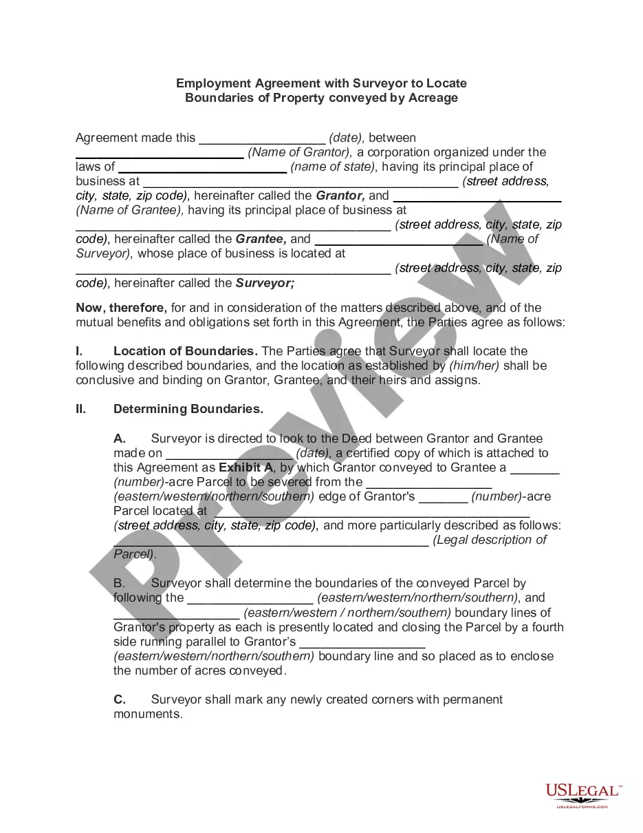
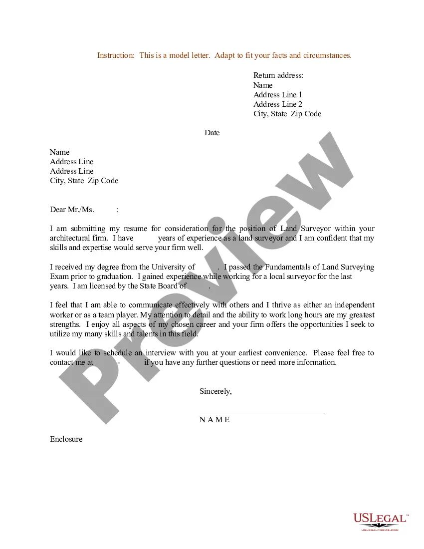
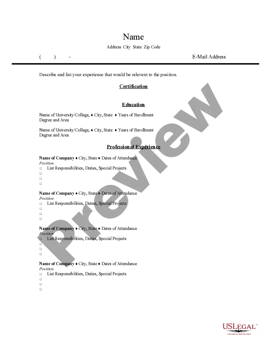
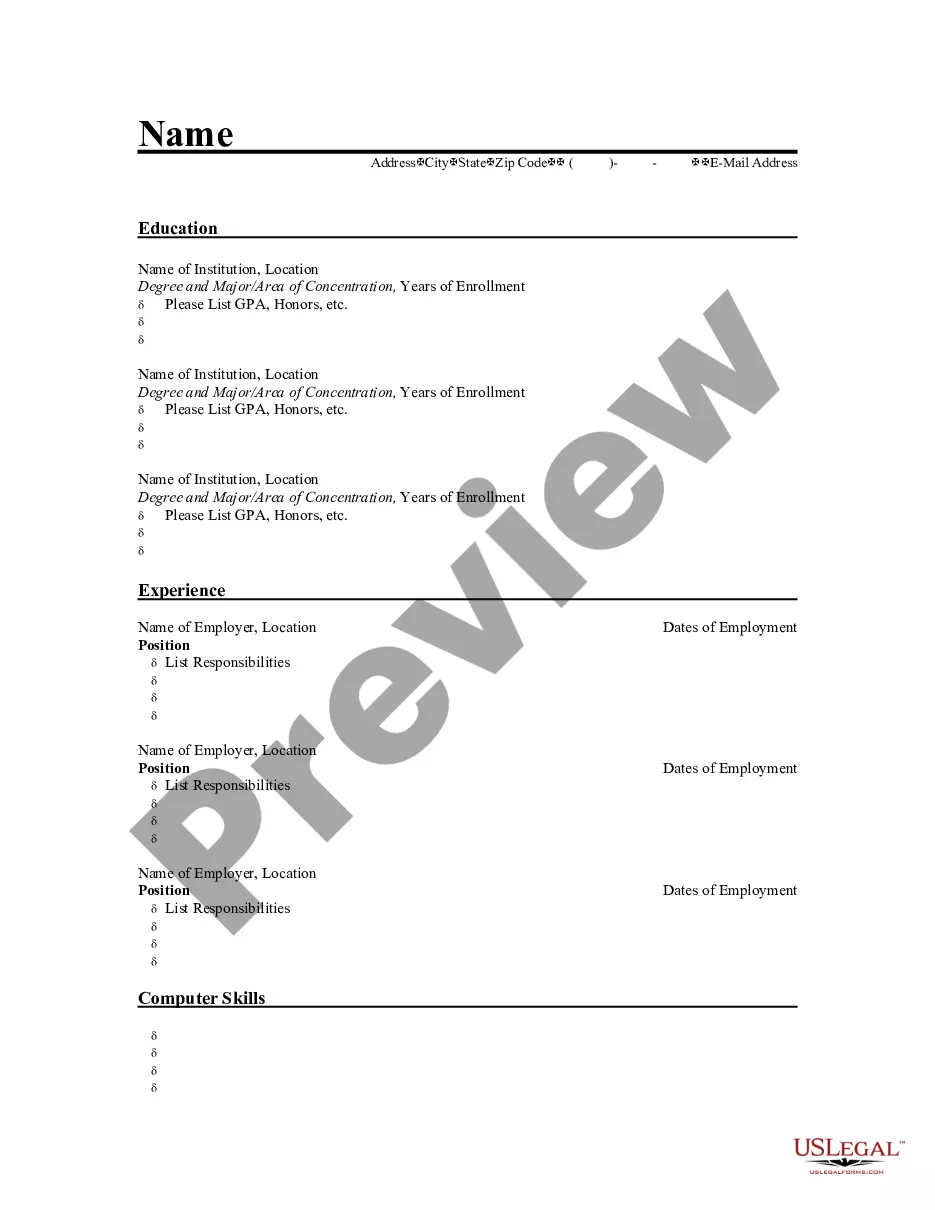
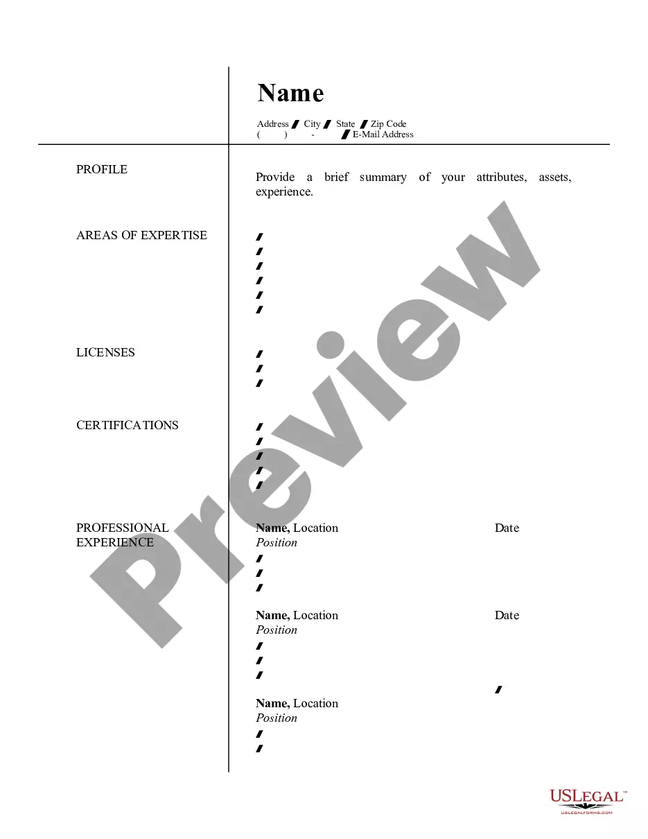
Travis Texas Currículum para agrimensor - Resume for Land Surveyor

State:
Multi-State
County:
Travis
Control #:
US-RES-20
Format:
Word
Instant download

Description

This is a sample of a resume, which should be used when seeking a position as a land surveyor. Travis Texas Resume for Land Surveyor: A Travis Texas Resume for Land Surveyor is a comprehensive document highlighting the skills, qualifications, and experience of a land surveyor based in Travis, Texas. This type of resume serves as an essential tool for professionals seeking employment opportunities in the land surveying field. Keywords: 1. Land surveyor: A land surveyor is an individual responsible for measuring and mapping the specific characteristics of geographic areas. They use various tools and technology to determine property boundaries, establish legal property lines, and provide accurate survey data. 2. Travis County: Travis County is a county located in Central Texas, which includes the city of Austin, the state capital. This keyword highlights the geographic location and specialization of the land surveyor within the region. 3. Geographic information system (GIS): A GIS refers to a system that captures, stores, analyzes, and manages spatial and geographical data. It is a crucial tool used by land surveyors to create detailed maps and conduct data analysis. 4. Topographic survey: A topographic survey is an important type of survey conducted by land surveyors. It involves measuring and mapping the surface features of a particular area, including land elevation, valleys, hills, bodies of water, and other natural and man-made features. 5. Construction survey: A construction survey is conducted by land surveyors to determine the precise location of structures, boundaries, and infrastructure before the construction process begins. It involves staking out points and ensuring accurate measurements. 6. Global Positioning System (GPS): GPS is a satellite-based navigation system used by land surveyors to establish precise positions and navigate in outdoor environments. Land surveyors proficient in GPS technology can provide accurate location data. 7. Boundary survey: A boundary survey is conducted to establish the exact legal boundaries of a property. Land surveyors meticulously measure and analyze property lines, corners, and any encroachments or disputes to ensure accurate boundary descriptions. 8. Legal land description: Land surveyors must have a strong understanding of legal land descriptions and boundary laws. They are responsible for examining historical records, reviewing title deeds, and interpreting legal documentation related to land ownership. 9. AutoCAD: AutoCAD is a computer-aided drafting software commonly used in land surveying. Land surveyors proficient in AutoCAD can create, edit, and modify precise survey drawings and maps. 10. Professional licensure: Land surveyors in Travis County must possess a valid professional license issued by the Texas Board of Professional Land Surveying. Applicants should highlight their licensure and adherence to professional standards. By incorporating these relevant keywords into a Travis Texas Resume for Land Surveyor, the applicant can showcase their expertise, experience, and familiarity with the specific requirements of land surveying in Travis County, Texas.

Travis Texas Resume for Land Surveyor: A Travis Texas Resume for Land Surveyor is a comprehensive document highlighting the skills, qualifications, and experience of a land surveyor based in Travis, Texas. This type of resume serves as an essential tool for professionals seeking employment opportunities in the land surveying field. Keywords: 1. Land surveyor: A land surveyor is an individual responsible for measuring and mapping the specific characteristics of geographic areas. They use various tools and technology to determine property boundaries, establish legal property lines, and provide accurate survey data. 2. Travis County: Travis County is a county located in Central Texas, which includes the city of Austin, the state capital. This keyword highlights the geographic location and specialization of the land surveyor within the region. 3. Geographic information system (GIS): A GIS refers to a system that captures, stores, analyzes, and manages spatial and geographical data. It is a crucial tool used by land surveyors to create detailed maps and conduct data analysis. 4. Topographic survey: A topographic survey is an important type of survey conducted by land surveyors. It involves measuring and mapping the surface features of a particular area, including land elevation, valleys, hills, bodies of water, and other natural and man-made features. 5. Construction survey: A construction survey is conducted by land surveyors to determine the precise location of structures, boundaries, and infrastructure before the construction process begins. It involves staking out points and ensuring accurate measurements. 6. Global Positioning System (GPS): GPS is a satellite-based navigation system used by land surveyors to establish precise positions and navigate in outdoor environments. Land surveyors proficient in GPS technology can provide accurate location data. 7. Boundary survey: A boundary survey is conducted to establish the exact legal boundaries of a property. Land surveyors meticulously measure and analyze property lines, corners, and any encroachments or disputes to ensure accurate boundary descriptions. 8. Legal land description: Land surveyors must have a strong understanding of legal land descriptions and boundary laws. They are responsible for examining historical records, reviewing title deeds, and interpreting legal documentation related to land ownership. 9. AutoCAD: AutoCAD is a computer-aided drafting software commonly used in land surveying. Land surveyors proficient in AutoCAD can create, edit, and modify precise survey drawings and maps. 10. Professional licensure: Land surveyors in Travis County must possess a valid professional license issued by the Texas Board of Professional Land Surveying. Applicants should highlight their licensure and adherence to professional standards. By incorporating these relevant keywords into a Travis Texas Resume for Land Surveyor, the applicant can showcase their expertise, experience, and familiarity with the specific requirements of land surveying in Travis County, Texas.

Para su conveniencia, debajo del texto en español le brindamos la versión completa de este formulario en inglés. For your convenience, the complete English version of this form is attached below the Spanish version.
Free preview
  • Form preview
  • Form preview

How to fill out Travis Texas Currículum Para Agrimensor?

Dealing with legal forms is a necessity in today's world. Nevertheless, you don't always need to look for qualified assistance to draft some of them from scratch, including Travis Resume for Land Surveyor, with a platform like US Legal Forms.

US Legal Forms has over 85,000 forms to choose from in different types ranging from living wills to real estate paperwork to divorce papers. All forms are arranged based on their valid state, making the searching experience less overwhelming. You can also find detailed materials and guides on the website to make any tasks associated with document execution straightforward.

Here's how you can purchase and download Travis Resume for Land Surveyor.

  1. Go over the document's preview and description (if provided) to get a basic information on what you’ll get after downloading the document.
  2. Ensure that the document of your choice is specific to your state/county/area since state regulations can affect the legality of some records.
  3. Examine the related forms or start the search over to locate the correct document.
  4. Click Buy now and register your account. If you already have an existing one, select to log in.
  5. Choose the pricing {plan, then a suitable payment method, and buy Travis Resume for Land Surveyor.
  6. Choose to save the form template in any available format.
  7. Visit the My Forms tab to re-download the document.

If you're already subscribed to US Legal Forms, you can locate the appropriate Travis Resume for Land Surveyor, log in to your account, and download it. Of course, our platform can’t replace a lawyer completely. If you have to deal with an exceptionally challenging situation, we recommend getting an attorney to check your form before signing and filing it.

With more than 25 years on the market, US Legal Forms proved to be a go-to platform for many different legal forms for millions of users. Become one of them today and purchase your state-compliant paperwork with ease!

Trusted and secure by over 3 million people of the world’s leading companies

Travis Texas Currículum para agrimensor