Alabama Geophysical Permit
Description
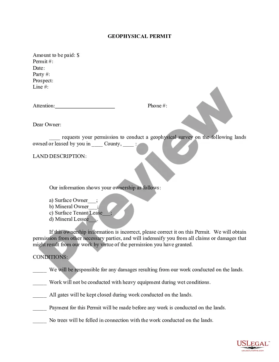

How to fill out Alabama Geophysical Permit?
US Legal Forms - one of many greatest libraries of legal varieties in America - gives a wide range of legal record templates you may acquire or printing. While using site, you may get a large number of varieties for organization and specific purposes, categorized by groups, suggests, or keywords.You can get the most up-to-date models of varieties such as the Alabama Geophysical Permit in seconds.
If you already possess a membership, log in and acquire Alabama Geophysical Permit from your US Legal Forms catalogue. The Acquire key can look on each and every develop you see. You gain access to all previously delivered electronically varieties in the My Forms tab of the account.
If you would like use US Legal Forms initially, here are basic instructions to help you get began:
- Ensure you have selected the best develop for your personal metropolis/county. Click the Preview key to analyze the form`s content. Browse the develop description to actually have chosen the appropriate develop.
- In case the develop doesn`t satisfy your specifications, use the Lookup area towards the top of the monitor to discover the one which does.
- Should you be happy with the shape, validate your option by visiting the Acquire now key. Then, choose the rates plan you want and provide your credentials to register for the account.
- Method the deal. Utilize your bank card or PayPal account to accomplish the deal.
- Select the file format and acquire the shape on the product.
- Make modifications. Complete, modify and printing and indicator the delivered electronically Alabama Geophysical Permit.
Each and every format you added to your money does not have an expiration particular date and is yours for a long time. So, if you want to acquire or printing yet another backup, just proceed to the My Forms segment and click on about the develop you will need.
Obtain access to the Alabama Geophysical Permit with US Legal Forms, one of the most extensive catalogue of legal record templates. Use a large number of specialist and express-specific templates that fulfill your company or specific requirements and specifications.
Form popularity
FAQ
Once a mineral deposit has been found it has to be extracted from the ground to access the valuable minerals it contains. This can be done by opencast quarrying or underground mining. Certain minerals can also be extracted by pumping.
Geography Total Area ? 52,424 square miles. Highest point ? 2,407 feet above sea level (Mt. Cheaha) 35,469 square miles of forest (71%) 1,776 square miles of water. 53 miles of coastline. 1,350 miles of navigable waterways. Accessible minerals ? limestone, salt, quartz, and iron ore.
Alabama produces bentonite, construction and industrial sand and gravel, crushed stone, lime, and iron oxide pigments, portland cement, and salt. Bauxite mined in Alabama is used for cement.
Alabama State Mineral: Hematite Hematite, also called red iron ore, crystallizes from the reaction of dissolved iron and oxygen. Roughly 375 million tons of hematite were mined in central and eastern Alabama between 1840 and 1975.
Ashland, Rockford, Alexander City, Erin, Tuscaloosa, Alabama Gold Camp in Lineville, Gibson Mine, Shirley Mine, Pleasant Grove Road, and the banks of the Flint River are just some of the spots where Quartz crystals can be found.
Alabama produces bentonite, construction and industrial sand and gravel, crushed stone, lime, and iron oxide pigments, portland cement, and salt. Bauxite mined in Alabama is used for cement.