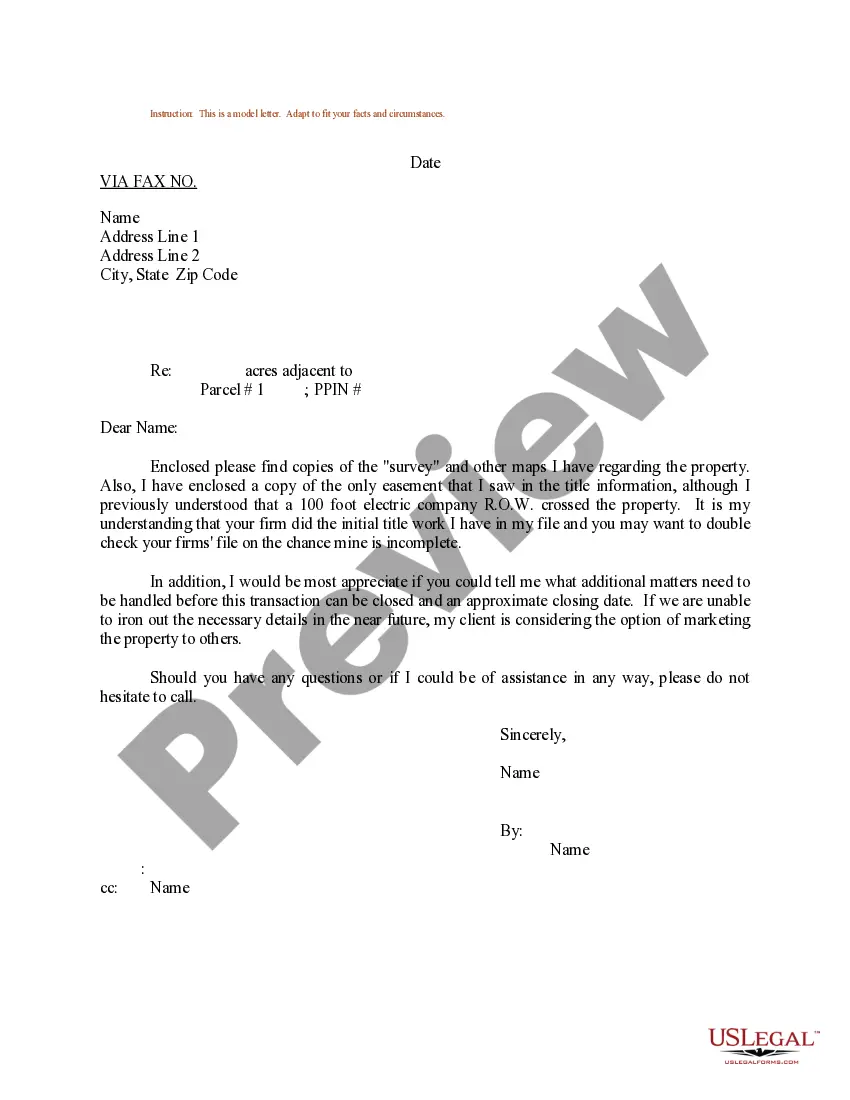
Dear [Recipient], I am writing to provide detailed information about the Arkansas Sample Letter regarding Survey Maps. This letter serves as a comprehensive guide to acquaint you with the various types and uses of survey maps in the state of Arkansas. 1. Preliminary Survey Map: A Preliminary Survey Map is the initial document created by licensed surveyors during the preliminary stages of a land survey. It outlines measurements, boundaries, and other relevant data to aid in further planning and development. 2. Cadastral Survey Map: Cadastral Survey Maps are official records that depict property boundaries, easements, rights-of-way, and land ownership patterns. These maps are crucial for property valuations, transfers, and resolving land disputes. 3. Topographic Survey Map: A Topographic Survey Map represents the natural and man-made features present on a specific plot of land, including elevation contours, bodies of water, vegetation, infrastructure, and other relevant details. These maps are pivotal for engineering design, urban planning, and environmental assessments. 4. Boundary Survey Map: Boundary Survey Maps determine and mark the precise boundaries of a particular parcel of land. These maps are typically prepared when purchasing property, settling boundary disputes, or transitioning ownership. 5. Subdivision Survey Map: Subdivision Survey Maps are essential when dividing a larger parcel of land into smaller lots for residential, commercial, or industrial purposes. These maps indicate lot dimensions, building setbacks, road access, and other necessary information for proper land development. 6. ALTA/NPS Survey Map: ALTA/NPS Survey Maps adhere to the standards set by the American Land Title Association (ALTA) and the National Society of Professional Surveyors (NPS). They provide detailed information about land boundaries, improvements, and encumbrances, primarily used for title insurance purposes. 7. Floodplain Survey Map: Floodplain Survey Maps identify areas susceptible to flooding, highlighting flood zones, watercourses, and related infrastructure. These maps assist in determining flood insurance requirements, land usage regulations, and hazard mitigation planning. When utilizing the Arkansas Sample Letter to request survey maps, ensure that the letter is appropriately addressed to the responsible authority, such as the Arkansas State Board of Licensure for Professional Engineers and Land Surveyors or the county surveyor's office. Clearly state the type of survey map required, provide relevant details about the area of interest, and outline the purpose of acquiring the map. It is also important to mention any specific legal requirements or deadlines to expedite the process. Additionally, include your contact information to facilitate communication regarding the survey map request if further clarification is needed. In conclusion, the Arkansas Sample Letter regarding Survey Maps encompasses various types of survey maps, such as preliminary, cadastral, boundary, topographic, subdivision, ALTA/NPS, and floodplain survey maps. By utilizing this letter and addressing it to the appropriate authority, you can effectively request accurate and detailed survey maps to support your specific needs. Thank you for your attention, and please don't hesitate to reach out if you require any further assistance. Sincerely, [Your Name]
Arkansas Sample Letter regarding Survey Maps
Description
How to fill out Arkansas Sample Letter Regarding Survey Maps?
Have you been inside a position in which you need to have papers for either organization or individual functions almost every time? There are tons of legal papers layouts available on the net, but finding kinds you can rely on isn`t effortless. US Legal Forms delivers thousands of develop layouts, like the Arkansas Sample Letter regarding Survey Maps, that are published to meet federal and state demands.
Should you be previously familiar with US Legal Forms website and possess a free account, just log in. Afterward, you can obtain the Arkansas Sample Letter regarding Survey Maps template.
Unless you offer an account and need to begin to use US Legal Forms, follow these steps:
- Find the develop you will need and ensure it is for that appropriate metropolis/region.
- Take advantage of the Review option to check the form.
- Browse the information to actually have chosen the proper develop.
- When the develop isn`t what you`re searching for, take advantage of the Search discipline to obtain the develop that fits your needs and demands.
- When you obtain the appropriate develop, simply click Get now.
- Opt for the rates program you desire, fill in the specified info to produce your money, and pay money for your order utilizing your PayPal or bank card.
- Select a convenient file format and obtain your version.
Get all the papers layouts you have purchased in the My Forms menu. You can aquire a extra version of Arkansas Sample Letter regarding Survey Maps any time, if possible. Just click the needed develop to obtain or produce the papers template.
Use US Legal Forms, one of the most considerable selection of legal kinds, in order to save some time and steer clear of faults. The assistance delivers expertly made legal papers layouts that you can use for an array of functions. Produce a free account on US Legal Forms and commence creating your life a little easier.