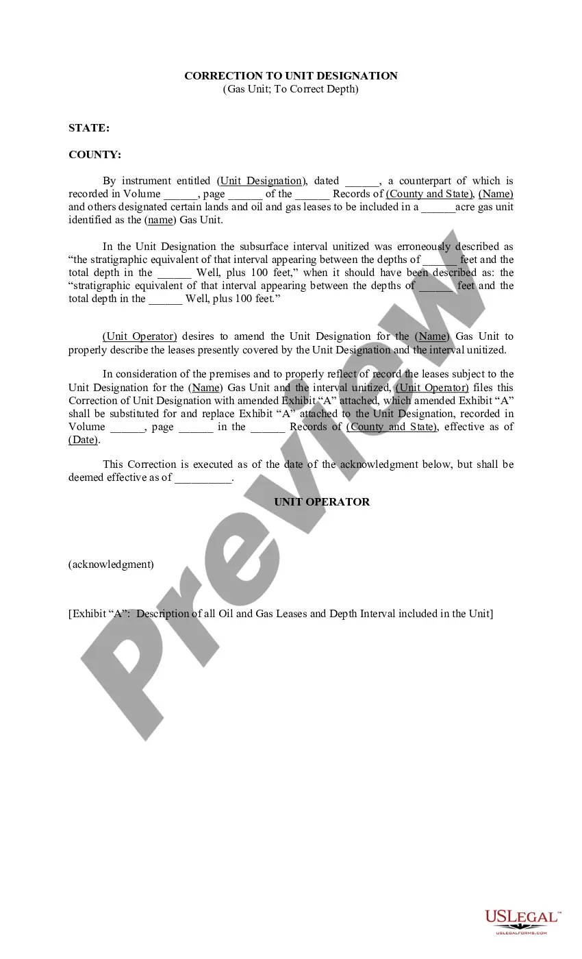
Arkansas Correction to Unit Designation to Correct Depth is a crucial process in the field of geology and geotechnical engineering. It involves rectifying errors related to unit designations and depths of various geological layers within the Arkansas region. This correction is essential to ensure accurate data interpretation and analysis for a wide range of applications such as construction, infrastructure development, and mineral exploration. The correction process begins with a thorough review of existing geological data, including borehole logs, geological maps, and subsurface exploration reports. The objective is to identify any discrepancies or inconsistencies in the unit designation and depth representation. These errors can occur due to human errors during data collection, misinterpretation of data, or outdated mapping techniques. Once the discrepancies are identified, a systematic approach is taken to correct the unit designations and depth values. This involves cross-referencing different data sources, consulting with experts in the field, and performing site visits for ground rushing. Advanced software and modeling tools are often employed to visualize and manipulate the data accurately. It is crucial to note that Arkansas Correction to Unit Designation to Correct Depth can be subdivided into different types based on the specific geological units being corrected. Some of these types include: 1. Sedimentary Unit Correction: This type focuses on correcting mistakes related to the identification and classification of various sedimentary units like sandstone, shale, limestone, or conglomerates. Accurate identification is vital to understanding the geological history, depositional environments, and hydro geological characteristics of these formations. 2. Igneous and Metamorphic Unit Correction: This type focuses on rectifying errors in the classification and delineation of igneous and metamorphic rock units. Correct identification is essential for geological mapping, assessing rock strength, and understanding the tectonic evolution of the Arkansas region. 3. Stratigraphic Unit Correction: Stratigraphic unit correction primarily deals with fixing inaccuracies in the representation of different stratigraphic layers, such as formations, members, and beds. Accurate stratigraphic correlation is essential for regional geological mapping, identifying key geological boundaries, and understanding the geological framework of the area. 4. Depth Correction: This type solely concentrates on correcting errors related to depth determinations. Various factors like drilling method, measurement techniques, and datum selection can contribute to inaccuracies in depth determination. Correcting these errors ensures precise depth representation, which is vital for engineering projects involving foundations, tunnels, and site evaluations. In conclusion, Arkansas Correction to Unit Designation to Correct Depth is a meticulous process aimed at rectifying errors in geological unit designations and depth representation. This process plays a pivotal role in ensuring accurate geological data interpretation and analysis. With various types of corrections specific to different geological units, it is crucial to conduct a comprehensive review and employ advanced tools for precise corrections.
Arkansas Correction to Unit Designation to Correct Depth
Description
How to fill out Arkansas Correction To Unit Designation To Correct Depth?
Have you been inside a position where you need documents for both business or specific reasons almost every working day? There are plenty of legitimate papers layouts available on the net, but discovering versions you can rely on isn`t effortless. US Legal Forms gives a huge number of type layouts, just like the Arkansas Correction to Unit Designation to Correct Depth, which can be published to meet state and federal demands.
Should you be currently acquainted with US Legal Forms internet site and also have your account, merely log in. Afterward, you are able to down load the Arkansas Correction to Unit Designation to Correct Depth template.
Unless you come with an account and would like to begin to use US Legal Forms, adopt these measures:
- Get the type you need and make sure it is for the correct metropolis/area.
- Make use of the Preview button to review the shape.
- Browse the outline to ensure that you have selected the correct type.
- If the type isn`t what you`re looking for, use the Search discipline to find the type that suits you and demands.
- Once you discover the correct type, simply click Acquire now.
- Select the prices prepare you want, submit the specified information to create your bank account, and pay money for the order utilizing your PayPal or bank card.
- Pick a convenient paper format and down load your backup.
Get every one of the papers layouts you possess bought in the My Forms food selection. You can obtain a additional backup of Arkansas Correction to Unit Designation to Correct Depth any time, if necessary. Just select the essential type to down load or print out the papers template.
Use US Legal Forms, the most comprehensive collection of legitimate forms, to save some time and avoid blunders. The service gives appropriately made legitimate papers layouts which can be used for a range of reasons. Produce your account on US Legal Forms and start creating your daily life easier.