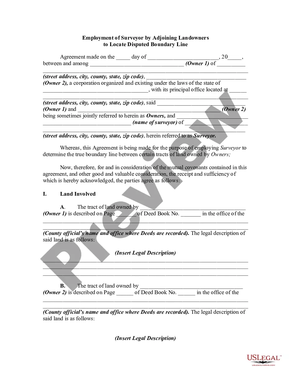
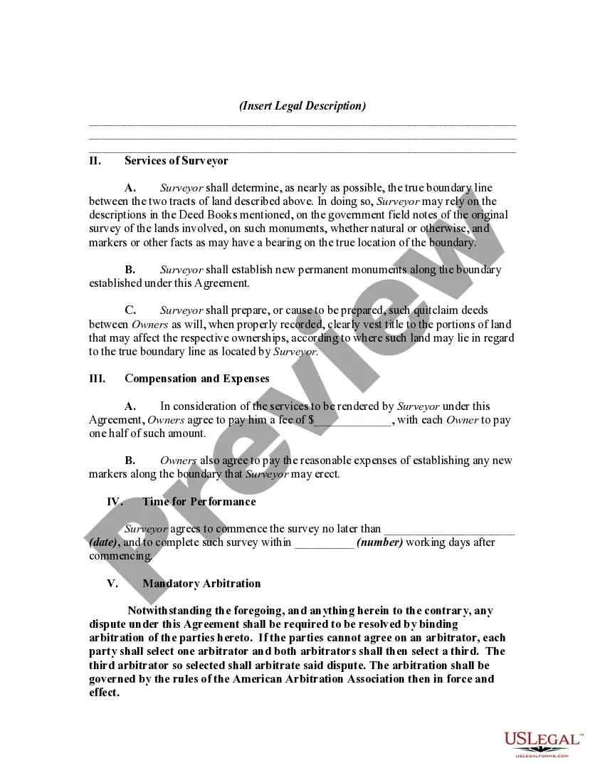
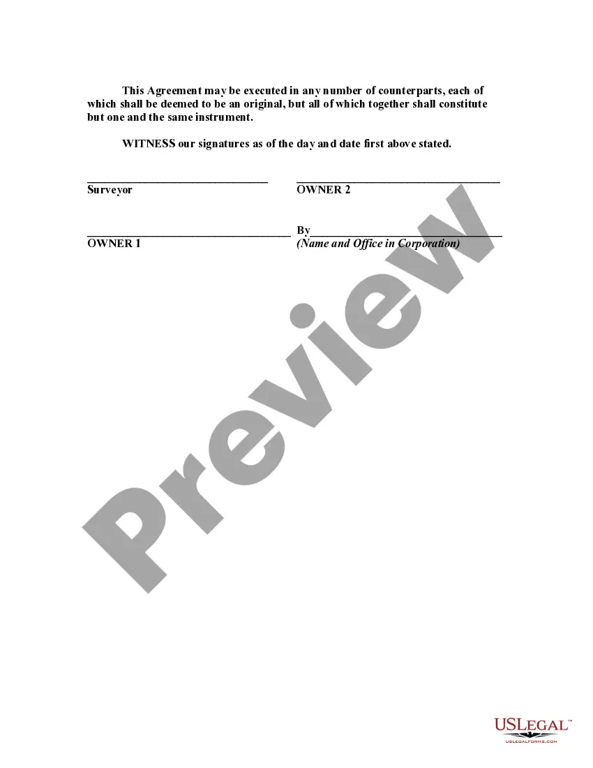
This is a generic sample of an agreement between two adjoining landowners to hire a surveyor to survey their lands in order to settle a dispute as to where the true boundary is regarding their properties.
Title: Arizona Employment of Surveyor by Adjoining Landowners to Locate Disputed Boundary Line: A Comprehensive Overview Introduction: In the state of Arizona, land disputes related to property boundaries can arise among adjoining landowners. To resolve such disputes accurately and fairly, employing a professional surveyor is crucial. This article aims to provide a detailed description of the Arizona Employment of Surveyor by Adjoining Landowners to Locate Disputed Boundary Line, highlighting its importance and various types of boundary surveys. 1. Understanding the Importance of Employing a Surveyor for Boundary Disputes: Boundary disputes between neighboring landowners can lead to legal conflicts, strained relationships, and potential financial losses. Engaging a surveyor specialized in boundary surveys helps ensure an unbiased understanding of land boundaries, resolving conflicts amicably, and preventing further disputes. Adjoining landowners in Arizona often choose this option to safeguard their property interests. 2. Different Types of Surveys Utilized in Resolving Boundary Disputes: a. ALTA/NPS Surveys: These surveys comply with the American Land Title Association (ALTA) and National Society of Professional Surveyors (NPS) standards. They involve a detailed examination of a property, including boundary lines, encroachments, easements, and improvements. ALTA/NPS surveys are commonly requested during property transactions or complex boundary disputes. b. Replacement Surveys: Replacement surveys focus on accurately retracing original property lines based on existing legal documents, historical records, and physical evidence. These surveys are crucial when boundary disputes arise due to discrepancies or uncertainties regarding previous surveys or documentation. c. Boundary Line Adjustment Surveys: When two or more landowners agree to exchange portions of their properties to resolve boundary disputes or accommodate development plans, boundary line adjustment surveys are employed. These surveys help formalize the changes to property boundaries as agreed upon by the respective landowners. d. Pre-Purchase Boundary Surveys: Prior to purchasing land, potential buyers may employ surveyors to conduct pre-purchase boundary surveys. These surveys provide detailed information about the property's boundaries, easements, rights-of-way, or encroachments, helping buyers make informed decisions and avoid potential boundary disputes in the future. 3. The Role of Surveyors and the Surveying Process: a. Initial Consultation: Adjoining landowners consult a professional surveyor, discussing the nature of the boundary dispute, concerns, and relevant details such as past surveys, property plans, and legal documents. b. Field Work: The surveyor visits the site to collect measurements, assess physical markers, and gather data regarding property boundaries and neighboring structures. c. Research and Analysis: The surveyor meticulously examines historical records, legal documents, and available surveys to verify existing property lines, potential encroachments, or any relevant changes affecting the boundary dispute. d. Report Generation: Based on the collected field data and research, the surveyor prepares an extensive report, including detailed maps, measurements, legal descriptions, and professional opinions regarding the disputed boundary line. e. Expert Testimony: If the dispute escalates and reaches the court, the surveyor may provide expert testimony, presenting their findings to support their professional opinions. Conclusion: Employing a surveyor to locate disputed boundary lines is crucial for neighboring landowners in Arizona, contributing to the fair resolution of conflicts while maintaining property rights. Understanding different survey types and the surveying process helps landowners make informed decisions when faced with boundary disputes, enhancing the overall effectiveness of the Arizona Employment of Surveyor by Adjoining Landowners to Locate Disputed Boundary Line.Title: Arizona Employment of Surveyor by Adjoining Landowners to Locate Disputed Boundary Line: A Comprehensive Overview Introduction: In the state of Arizona, land disputes related to property boundaries can arise among adjoining landowners. To resolve such disputes accurately and fairly, employing a professional surveyor is crucial. This article aims to provide a detailed description of the Arizona Employment of Surveyor by Adjoining Landowners to Locate Disputed Boundary Line, highlighting its importance and various types of boundary surveys. 1. Understanding the Importance of Employing a Surveyor for Boundary Disputes: Boundary disputes between neighboring landowners can lead to legal conflicts, strained relationships, and potential financial losses. Engaging a surveyor specialized in boundary surveys helps ensure an unbiased understanding of land boundaries, resolving conflicts amicably, and preventing further disputes. Adjoining landowners in Arizona often choose this option to safeguard their property interests. 2. Different Types of Surveys Utilized in Resolving Boundary Disputes: a. ALTA/NPS Surveys: These surveys comply with the American Land Title Association (ALTA) and National Society of Professional Surveyors (NPS) standards. They involve a detailed examination of a property, including boundary lines, encroachments, easements, and improvements. ALTA/NPS surveys are commonly requested during property transactions or complex boundary disputes. b. Replacement Surveys: Replacement surveys focus on accurately retracing original property lines based on existing legal documents, historical records, and physical evidence. These surveys are crucial when boundary disputes arise due to discrepancies or uncertainties regarding previous surveys or documentation. c. Boundary Line Adjustment Surveys: When two or more landowners agree to exchange portions of their properties to resolve boundary disputes or accommodate development plans, boundary line adjustment surveys are employed. These surveys help formalize the changes to property boundaries as agreed upon by the respective landowners. d. Pre-Purchase Boundary Surveys: Prior to purchasing land, potential buyers may employ surveyors to conduct pre-purchase boundary surveys. These surveys provide detailed information about the property's boundaries, easements, rights-of-way, or encroachments, helping buyers make informed decisions and avoid potential boundary disputes in the future. 3. The Role of Surveyors and the Surveying Process: a. Initial Consultation: Adjoining landowners consult a professional surveyor, discussing the nature of the boundary dispute, concerns, and relevant details such as past surveys, property plans, and legal documents. b. Field Work: The surveyor visits the site to collect measurements, assess physical markers, and gather data regarding property boundaries and neighboring structures. c. Research and Analysis: The surveyor meticulously examines historical records, legal documents, and available surveys to verify existing property lines, potential encroachments, or any relevant changes affecting the boundary dispute. d. Report Generation: Based on the collected field data and research, the surveyor prepares an extensive report, including detailed maps, measurements, legal descriptions, and professional opinions regarding the disputed boundary line. e. Expert Testimony: If the dispute escalates and reaches the court, the surveyor may provide expert testimony, presenting their findings to support their professional opinions. Conclusion: Employing a surveyor to locate disputed boundary lines is crucial for neighboring landowners in Arizona, contributing to the fair resolution of conflicts while maintaining property rights. Understanding different survey types and the surveying process helps landowners make informed decisions when faced with boundary disputes, enhancing the overall effectiveness of the Arizona Employment of Surveyor by Adjoining Landowners to Locate Disputed Boundary Line.