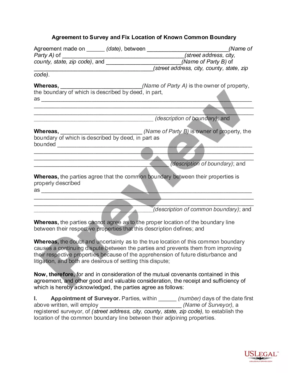
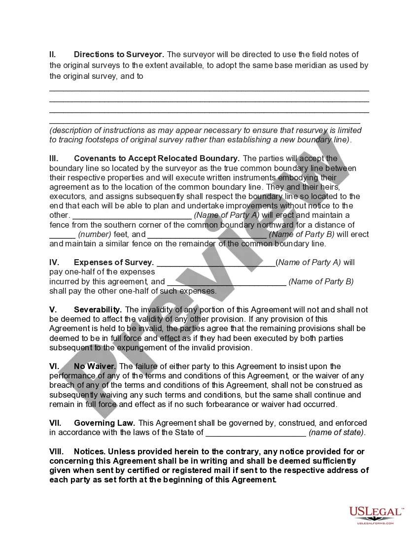
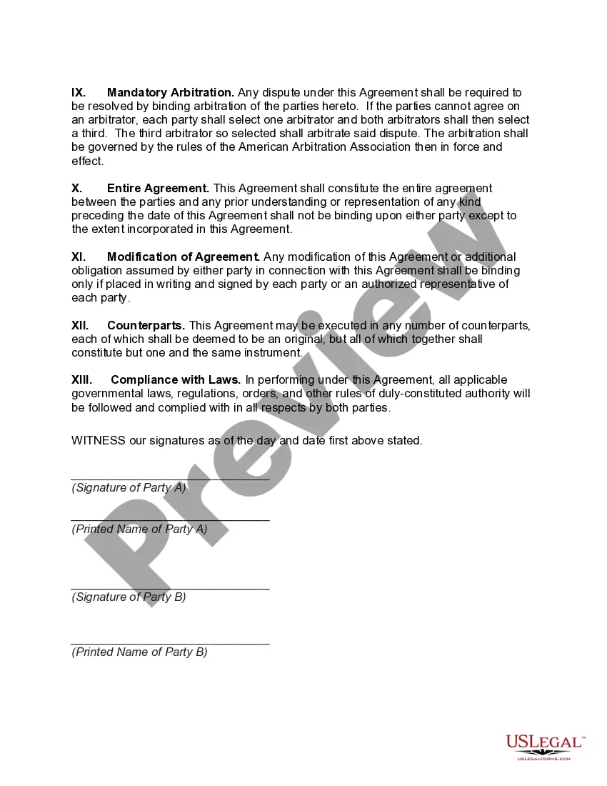
The District of Columbia Agreement to Survey and Fix Location of Known Common Boundary is a legal document used to establish and define the boundaries between different jurisdictions within the District of Columbia. This agreement is crucial for ensuring clarity and accuracy in determining the exact location of these boundaries, helping to avoid disputes and misunderstandings in the future. One type of District of Columbia Agreement to Survey and Fix Location of Known Common Boundary is the interstate boundary agreement. This type of agreement is made between neighboring states that share a common boundary within the District of Columbia. It involves a thorough survey and assessment of the physical markers and landmarks that define the boundary, and details how any discrepancies or ambiguities will be resolved. Another type of agreement is the municipal boundary agreement. This agreement is made between different municipalities or local government entities within the District of Columbia. It aims to establish and fix the boundaries between these jurisdictions, ensuring that there is a clear understanding of where one municipality ends and another begins. This type of agreement is particularly significant in urban areas where multiple municipalities coexist. The District of Columbia Agreement to Survey and Fix Location of Known Common Boundary includes several key elements. First, it identifies the parties involved in the agreement, which may include states, municipalities, and other entities. It also includes a detailed description of the boundary line, referencing specific survey markers and physical features. Any relevant maps or plats are attached as exhibits to further illustrate the boundary location. Furthermore, the agreement outlines the process for conducting surveys, including the use of professional surveyors and the standards and methods to be applied. It includes provisions for resolving any discrepancies or disputes that may arise during the survey, such as through arbitration or mediation. The agreement may also address ongoing maintenance and upkeep of the boundary markers and provide for periodic reviews to ensure the accuracy and integrity of the established boundary. In conclusion, the District of Columbia Agreement to Survey and Fix Location of Known Common Boundary is a critical legal tool for establishing, defining, and maintaining the boundaries within the District of Columbia. By ensuring accuracy and clarity, this agreement helps prevent conflicts and disputes between neighboring states and municipalities. The various types of agreements, such as interstate and municipal boundary agreements, address different scenarios and entities within the District, ensuring that each jurisdiction knows its limits and responsibilities.
District of Columbia Agreement to Survey and Fix Location of Known Common Boundary
Description
How to fill out District Of Columbia Agreement To Survey And Fix Location Of Known Common Boundary?
Have you been in a placement that you need documents for either enterprise or individual uses nearly every day time? There are tons of legitimate papers layouts available on the Internet, but discovering types you can rely isn`t straightforward. US Legal Forms provides a huge number of form layouts, such as the District of Columbia Agreement to Survey and Fix Location of Known Common Boundary, which can be published to fulfill federal and state requirements.
If you are already acquainted with US Legal Forms website and possess a free account, just log in. Afterward, you may obtain the District of Columbia Agreement to Survey and Fix Location of Known Common Boundary format.
Should you not offer an accounts and would like to begin to use US Legal Forms, follow these steps:
- Discover the form you require and make sure it is for your appropriate metropolis/region.
- Utilize the Review switch to examine the shape.
- Read the outline to ensure that you have selected the right form.
- In case the form isn`t what you are looking for, utilize the Research field to discover the form that fits your needs and requirements.
- If you get the appropriate form, just click Get now.
- Opt for the prices program you need, fill out the required information and facts to produce your money, and pay money for the order utilizing your PayPal or credit card.
- Choose a handy file file format and obtain your version.
Get each of the papers layouts you possess purchased in the My Forms menus. You can obtain a further version of District of Columbia Agreement to Survey and Fix Location of Known Common Boundary any time, if possible. Just select the required form to obtain or printing the papers format.
Use US Legal Forms, one of the most considerable selection of legitimate kinds, to save lots of time and avoid faults. The assistance provides expertly produced legitimate papers layouts that you can use for a range of uses. Make a free account on US Legal Forms and initiate making your life easier.