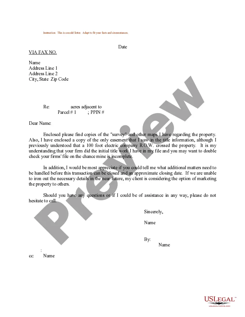
Delaware Sample Letter regarding Survey Maps is a comprehensive document that provides detailed information about the various survey maps available in the state of Delaware. This letter serves as a valuable resource for individuals, organizations, and businesses who require accurate and up-to-date information about survey maps. The Delaware Sample Letter regarding Survey Maps begins by explaining the importance of survey maps in land-related matters. It highlights that survey maps are essential for determining property boundaries, understanding land ownership, and facilitating development projects. It emphasizes the need for accurate survey maps to avoid disputes and legal complications. The letter then proceeds to describe the different types of survey maps available in Delaware: 1. Boundary Survey Maps: These maps depict the precise boundaries of a property, including any legal descriptions, markers, or measurements that define the limits of the land. 2. Topographic Survey Maps: These maps provide detailed information about the natural and man-made features present on a property. They include elevation contours, vegetation, bodies of water, buildings, roads, and other significant elements. 3. Subdivision Plats: These maps are prepared when a property is divided into two or more lots. They illustrate the location, size, and layout of individual lots, streets, and utility easements within a subdivision. 4. Construction Survey Maps: These maps are crucial during the construction phase of a project. They show the exact placement of structures, utilities, roads, and other features according to the approved plans. The Delaware Sample Letter regarding Survey Maps also highlights the importance of hiring professional land surveyors who are licensed by the state to ensure accuracy and regulatory compliance. It encourages recipients to consult licensed land surveyors for obtaining the most current and reliable survey maps for their specific needs. Additionally, the letter provides contact information for authorized agencies and surveyors who can offer further assistance. It emphasizes the necessity of following the appropriate legal and procedural requirements when accessing and utilizing survey maps. In conclusion, the Delaware Sample Letter regarding Survey Maps serves as a comprehensive guide, acquainting recipients with the different types of survey maps available in the state. It underlines the importance of accurate survey maps, highlights the necessity of collaborating with licensed land surveyors, and provides valuable resources for accessing such maps. By following the guidelines outlined in this letter, individuals and organizations can ensure that they have the necessary information to make informed decisions regarding land-related matters.
Delaware Sample Letter regarding Survey Maps
Description
How to fill out Delaware Sample Letter Regarding Survey Maps?
If you wish to total, down load, or produce authorized file web templates, use US Legal Forms, the largest variety of authorized forms, that can be found on-line. Utilize the site`s basic and hassle-free look for to discover the paperwork you require. Various web templates for business and individual functions are categorized by groups and suggests, or key phrases. Use US Legal Forms to discover the Delaware Sample Letter regarding Survey Maps in just a number of click throughs.
In case you are previously a US Legal Forms client, log in to your bank account and click on the Obtain switch to find the Delaware Sample Letter regarding Survey Maps. Also you can accessibility forms you previously acquired from the My Forms tab of your respective bank account.
If you use US Legal Forms for the first time, follow the instructions below:
- Step 1. Be sure you have selected the form to the appropriate metropolis/nation.
- Step 2. Make use of the Review choice to check out the form`s information. Never forget to read the outline.
- Step 3. In case you are not happy together with the type, take advantage of the Research field near the top of the monitor to discover other types of the authorized type web template.
- Step 4. After you have found the form you require, go through the Purchase now switch. Choose the rates plan you choose and add your references to register to have an bank account.
- Step 5. Procedure the transaction. You can use your Мisa or Ьastercard or PayPal bank account to complete the transaction.
- Step 6. Pick the structure of the authorized type and down load it on your product.
- Step 7. Complete, change and produce or indicator the Delaware Sample Letter regarding Survey Maps.
Each authorized file web template you get is your own property eternally. You possess acces to each and every type you acquired in your acccount. Go through the My Forms segment and decide on a type to produce or down load once more.
Contend and down load, and produce the Delaware Sample Letter regarding Survey Maps with US Legal Forms. There are millions of specialist and condition-distinct forms you may use to your business or individual requires.