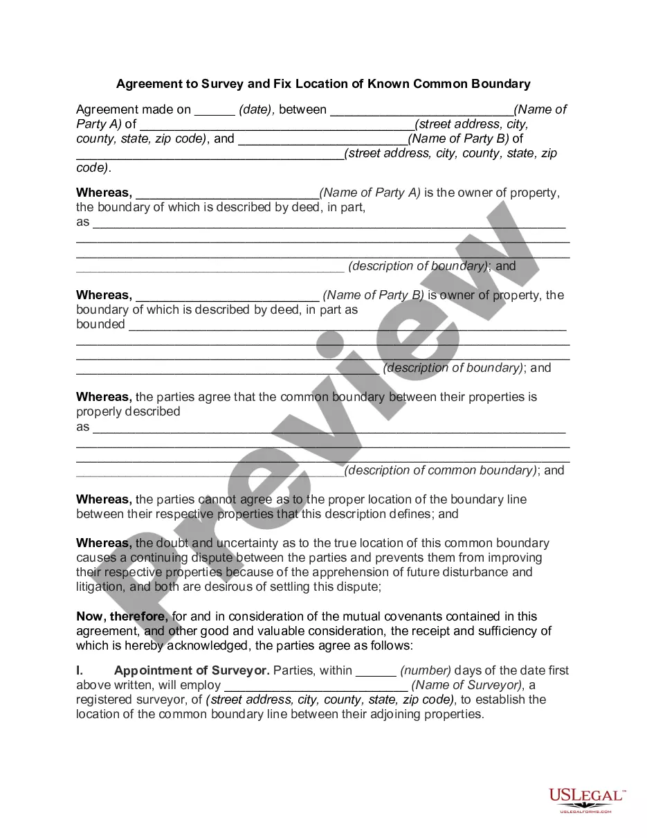
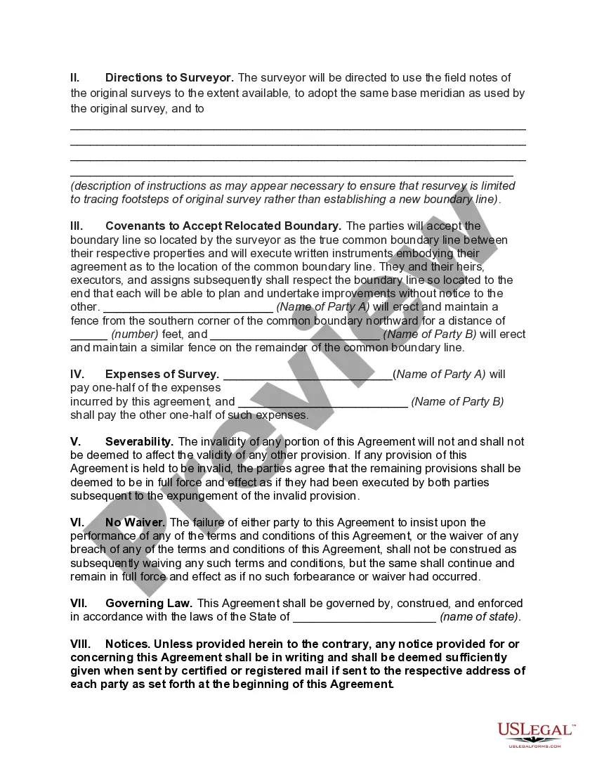
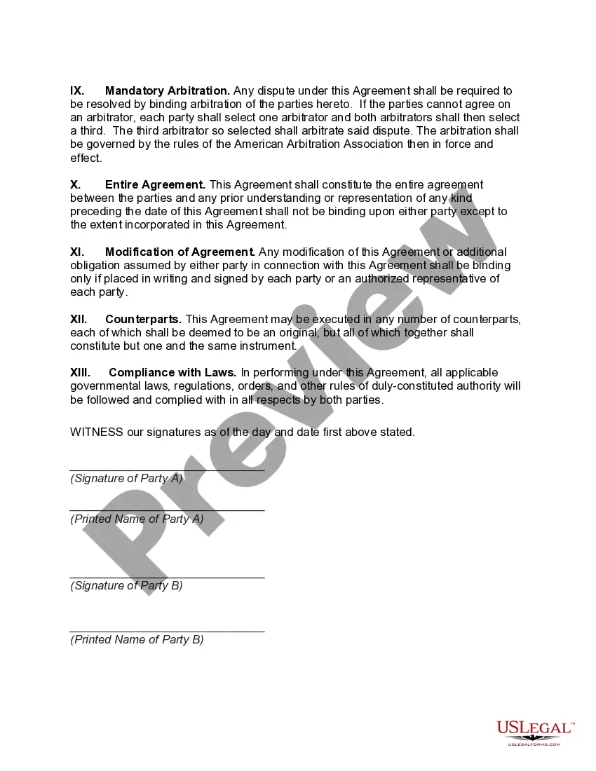
The Georgia Agreement to Survey and Fix Location of Known Common Boundary is a legal document utilized to establish and confirm the boundary lines between adjacent properties. This agreement is commonly used in real estate transactions, particularly in cases where there may be disputes or uncertainties regarding property boundaries. The purpose of the Georgia Agreement to Survey and Fix Location of Known Common Boundary is to provide a clear and definitive understanding of the exact location and extent of the common boundary between two parcels of land. It aims to prevent conflicts between property owners and foster a peaceful coexistence by resolving any existing boundary issues. This agreement typically involves the hiring of a licensed professional land surveyor who will conduct a thorough survey of the properties involved. The surveyor will assess historical documents, physical markers, measurements, and other relevant data to determine the precise boundary lines. This comprehensive survey ensures accurate demarcation and provides legally recognized evidence of the agreed-upon boundary. Different types of Georgia Agreements to Survey and Fix Location of Known Common Boundary may include: 1. Residential Property Agreement: This type of agreement is commonly used when the adjacent properties are residential, such as houses or single-family homes. It aims to settle boundary disputes or uncertainties between neighboring homeowners and establish clear property lines. 2. Commercial Property Agreement: In cases where the properties involved are commercial or industrial, this agreement is employed to resolve any boundary-related conflicts or uncertainties. It serves as a legally binding document between business owners or entities regarding their respective property limits. 3. Agricultural Land Agreement: When neighboring agricultural lands or farms require precise demarcation of boundaries, an agricultural land agreement is utilized. This agreement focuses on resolving any issues related to shared fences, access rights, water resources, or land utilization. 4. Boundary Agreement for Government Properties: This type of agreement is employed when boundary disputes or uncertainties arise between different government-owned properties or agencies. The agreement aims to provide a definitive understanding of the shared boundary to prevent conflicts between government entities and promote effective administrative practices. In conclusion, the Georgia Agreement to Survey and Fix Location of Known Common Boundary is a crucial legal instrument to establish clear property boundaries and resolve any disputes or uncertainties. By employing a licensed land surveyor, property owners can rely on accurate survey results to ensure an amicable coexistence and avoid potential legal conflicts.
Georgia Agreement to Survey and Fix Location of Known Common Boundary
Description
How to fill out Georgia Agreement To Survey And Fix Location Of Known Common Boundary?
US Legal Forms - among the largest libraries of authorized varieties in the United States - delivers a wide array of authorized file web templates you may obtain or printing. Using the web site, you can get a huge number of varieties for organization and personal uses, sorted by types, claims, or search phrases.You can find the most up-to-date models of varieties such as the Georgia Agreement to Survey and Fix Location of Known Common Boundary in seconds.
If you currently have a registration, log in and obtain Georgia Agreement to Survey and Fix Location of Known Common Boundary from the US Legal Forms catalogue. The Acquire key will show up on each and every form you see. You gain access to all formerly acquired varieties within the My Forms tab of your own profile.
If you want to use US Legal Forms the first time, here are simple guidelines to get you started out:
- Make sure you have selected the proper form to your city/area. Click the Preview key to examine the form`s articles. Read the form information to actually have selected the correct form.
- When the form doesn`t match your needs, make use of the Lookup area towards the top of the screen to obtain the one which does.
- When you are satisfied with the shape, confirm your selection by clicking on the Purchase now key. Then, opt for the rates plan you want and provide your qualifications to register on an profile.
- Approach the purchase. Use your credit card or PayPal profile to finish the purchase.
- Find the structure and obtain the shape in your device.
- Make modifications. Fill out, change and printing and sign the acquired Georgia Agreement to Survey and Fix Location of Known Common Boundary.
Each template you included in your bank account lacks an expiration time and it is your own eternally. So, in order to obtain or printing one more backup, just check out the My Forms segment and click on about the form you will need.
Get access to the Georgia Agreement to Survey and Fix Location of Known Common Boundary with US Legal Forms, the most substantial catalogue of authorized file web templates. Use a huge number of specialist and express-specific web templates that satisfy your business or personal requires and needs.