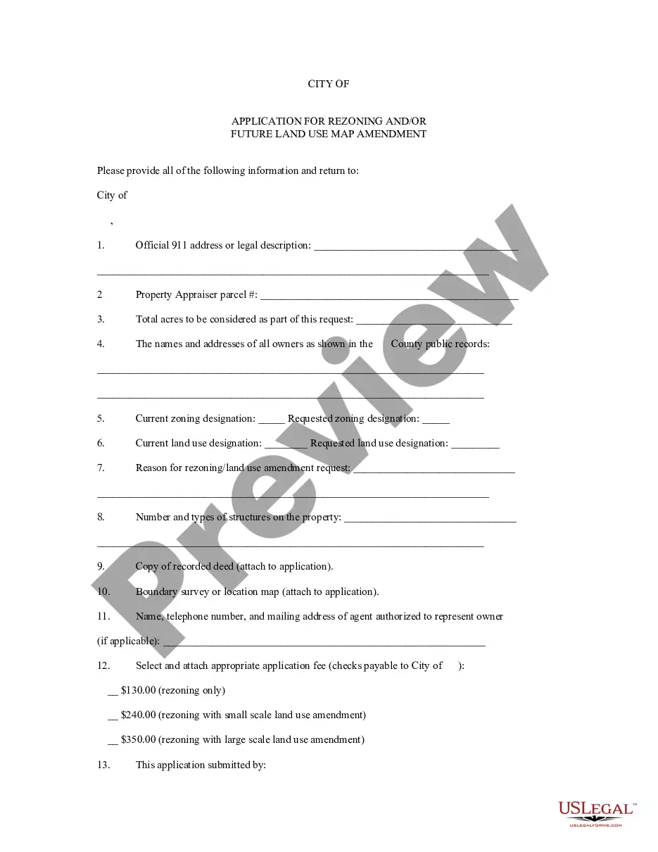
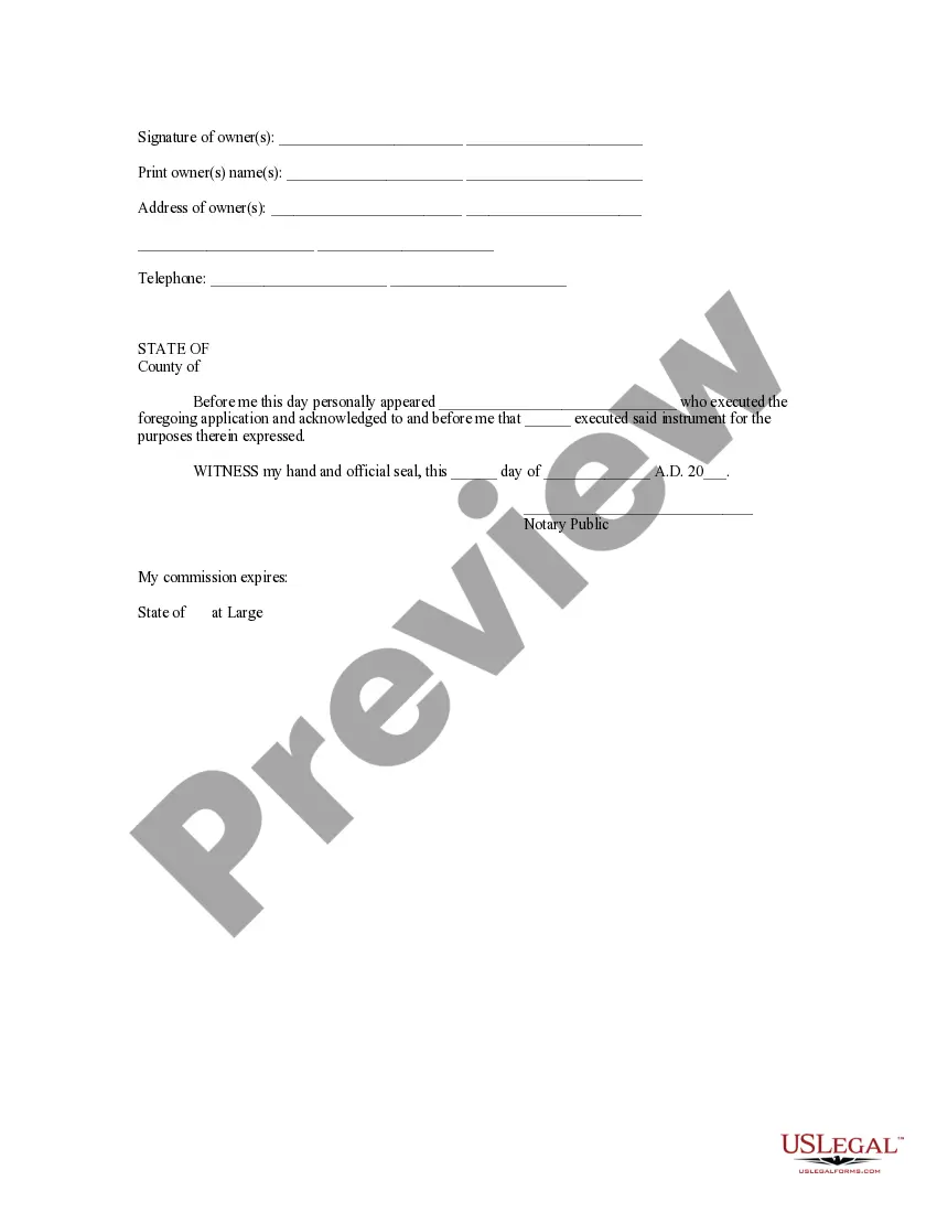
In the state of Iowa, the Application for Rezoning and/or Future Land Use Map Amendment is an important process that allows property owners, developers, and local jurisdictions to propose changes in land use regulations. This application serves as a formal request to alter the existing zoning designation or update the future land use map to accommodate new development projects or address changing community needs. Here, we will delve into what these applications entail, provide an overview of the process, and discuss different types of Iowa Application for Rezoning and/or Future Land Use Map Amendment. The Iowa Application for Rezoning involves seeking a change in the current zoning designation of a specific parcel or area. Zoning dictates how land can be utilized within a jurisdiction, such as residential, commercial, industrial, or agricultural purposes. By submitting a rezoning application, property owners or developers aim to amend these regulations to align with their intended land use, thus enabling the realization of their proposed development plans. On the other hand, Future Land Use Map Amendment (FLUME) application seeks to modify the long-term vision and allocation of land uses within a particular jurisdiction. A Future Land Use Map identifies the desired types of land uses for various areas, considering factors like population growth, economic trends, natural resources, and community goals. FLUME applications allow stakeholders to propose changes to this map, ensuring it reflects the current and future needs of the community. Both rezoning and FLUME applications involve a similar process. Interested parties must first complete an application form, often available on the official website of the local planning department. This generally requires providing details about the property, proposed changes, rationale, potential impact, and any accompanying supporting documentation, such as site plans or environmental reports. Once the application is submitted, it undergoes a review process by the local planning commission or zoning board. This stage involves evaluating the proposal's conformity with the existing zoning or future land use designations, its compatibility with the surrounding area, and its compliance with community comprehensive plans or zoning codes. Public hearings may be conducted, allowing community members and neighboring property owners to voice their concerns or support for the proposed changes. Based on the findings of the review process and public input, the planning commission or zoning board makes a recommendation to the local governing body, which could be a city council, county board of supervisors, or planning commission. The governing body then reviews the application and recommendation before making a final decision. Different types of Iowa's rezoning and FLUME applications may encompass various purposes, such as rezoning from residential to commercial, rezoning from agricultural to industrial, rezoning to allow mixed-use development, or FLUME amendments to update land use patterns for designated growth areas. The specific names of these applications may vary across different local jurisdictions within Iowa. In conclusion, the Iowa Application for Rezoning and/or Future Land Use Map Amendment plays a crucial role in shaping land use regulations and ensuring that development aligns with community needs. These applications facilitate the evaluation and approval process for proposed changes, enabling stakeholders to modify zoning designations or update future land use plans. By adhering to the respective local jurisdiction's guidelines and regulations, applicants can navigate the process successfully and contribute to the responsible and sustainable growth of Iowa communities.
Iowa Application for Rezoning and / or Future Land Use Map Amendment
Description
How to fill out Iowa Application For Rezoning And / Or Future Land Use Map Amendment?
You may devote time on the web looking for the authorized record format that meets the federal and state requirements you require. US Legal Forms gives a huge number of authorized kinds which can be evaluated by specialists. It is simple to download or print the Iowa Application for Rezoning and / or Future Land Use Map Amendment from the service.
If you already possess a US Legal Forms account, it is possible to log in and click the Acquire button. Afterward, it is possible to total, edit, print, or indicator the Iowa Application for Rezoning and / or Future Land Use Map Amendment. Every authorized record format you buy is yours eternally. To get yet another copy for any obtained form, go to the My Forms tab and click the corresponding button.
If you use the US Legal Forms web site the first time, follow the basic recommendations under:
- Initially, ensure that you have chosen the best record format for the county/city that you pick. See the form explanation to ensure you have picked out the correct form. If readily available, utilize the Preview button to look with the record format as well.
- In order to locate yet another model of your form, utilize the Search discipline to discover the format that meets your requirements and requirements.
- Upon having identified the format you need, click Purchase now to continue.
- Pick the prices strategy you need, type in your credentials, and sign up for an account on US Legal Forms.
- Full the financial transaction. You can use your bank card or PayPal account to purchase the authorized form.
- Pick the file format of your record and download it to the gadget.
- Make changes to the record if necessary. You may total, edit and indicator and print Iowa Application for Rezoning and / or Future Land Use Map Amendment.
Acquire and print a huge number of record web templates while using US Legal Forms web site, which offers the greatest variety of authorized kinds. Use professional and express-specific web templates to handle your organization or personal requirements.