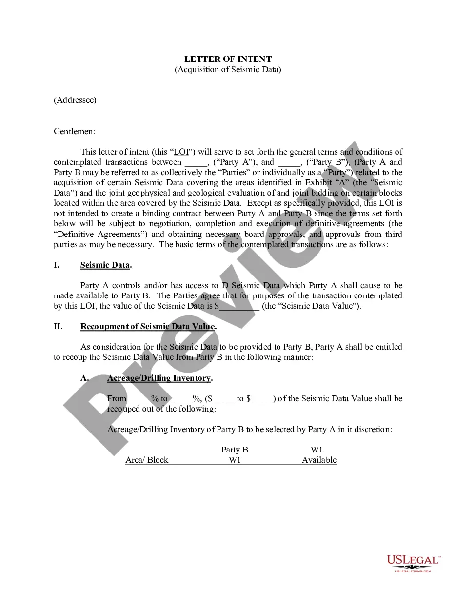
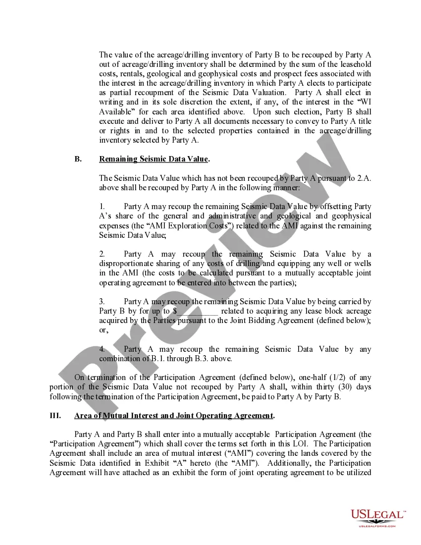
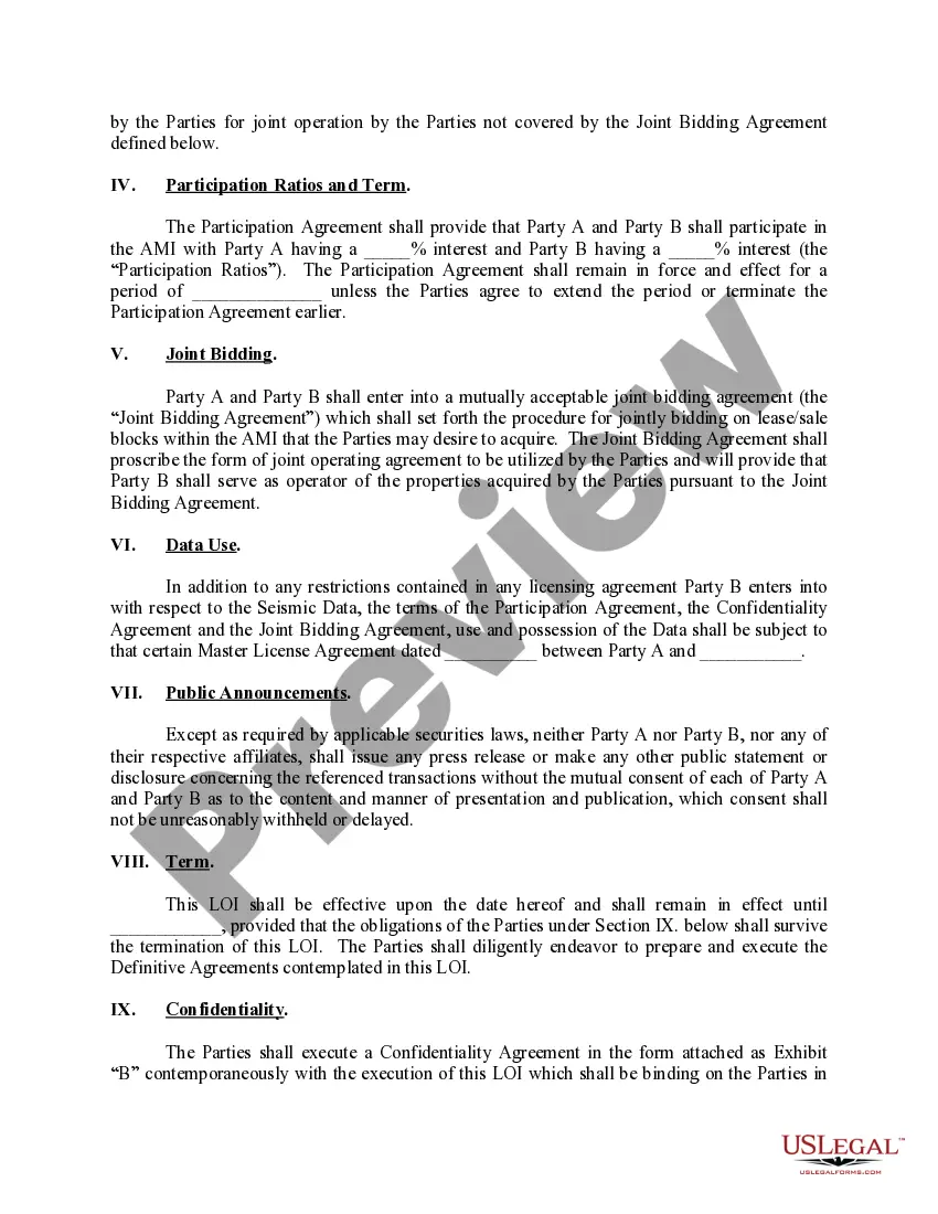
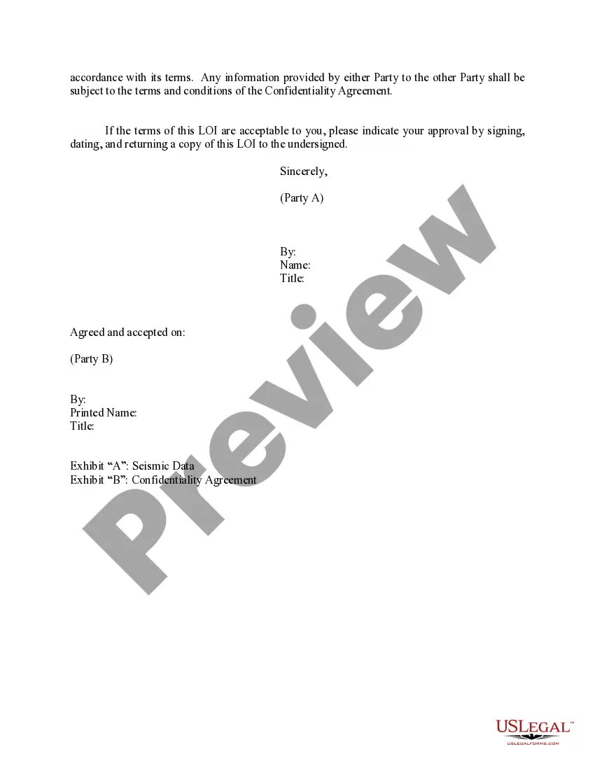
The Indiana Letter of Intent Acquisition of 3-D Data is a crucial document used by individuals and organizations seeking to obtain three-dimensional (3-D) data in the state of Indiana. This legal instrument outlines the intentions, terms, and conditions under which the acquisition of 3-D data will take place, ensuring compliance with applicable laws, regulations, and procedures. The acquisition of 3-D data refers to the geospatial mapping of Indiana's physical landscape, infrastructure, and resources, capturing intricate details and dimensions. This data can be obtained through various methods such as aerial photogrammetry, LiDAR (Light Detection and Ranging) scanning, or other advanced surveying techniques. The Indiana Letter of Intent Acquisition of 3-D Data serves as a preliminary agreement between the data acquiring entity, often a government agency, private corporation, or research institution, and the owner or custodian of the targeted geographic area. It outlines the purpose of the data acquisition, the intended use of the 3-D data, the scope of the project, and any associated restrictions or limitations. Furthermore, the Indiana Letter of Intent Acquisition of 3-D Data may include specific details regarding the technical specifications of the data collection, such as the resolution, accuracy requirements, and the desired level of detail. It also addresses the timeline of the project, budget considerations, and any financial arrangements between the parties involved. Multiple types of Indiana Letters of Intent Acquisition of 3-D Data may exist, depending on the purpose and scale of the project. These may include: 1. Government Agency Acquisition: In cases where a government agency intends to acquire 3-D data for urban planning, infrastructure development, or emergency response purposes. This type of letter acknowledges the governmental interest and commitment to utilizing technology for the benefit of the state and its constituents. 2. Private Corporation Acquisition: When a private corporation or business entity wishes to acquire 3-D data for commercial purposes, such as real estate development, energy resource exploration, or environmental impact assessment. This type of letter typically includes provisions regarding data ownership, intellectual property rights, and confidentiality. 3. Research Institution Acquisition: Research institutions, universities, or scientific organizations may seek to acquire 3-D data to support academic studies, environmental monitoring, or archeological research. This type of letter often emphasizes collaboration, data sharing, and the potential benefits to the scientific community. In conclusion, the Indiana Letter of Intent Acquisition of 3-D Data plays a crucial role in facilitating the legal and technical aspects of acquiring geospatial information in the state. By establishing clear intentions, terms, and conditions, this document ensures transparency, compliance, and a mutually beneficial outcome for all parties involved in the acquisition of 3-D data.
Indiana Letter of Intent Acquisition of 3-D Data
Description
How to fill out Indiana Letter Of Intent Acquisition Of 3-D Data?
Choosing the right lawful file template can be a struggle. Obviously, there are a lot of themes available on the Internet, but how will you find the lawful develop you need? Make use of the US Legal Forms web site. The services provides a large number of themes, for example the Indiana Letter of Intent Acquisition of 3-D Data, that can be used for company and private demands. Each of the types are inspected by professionals and satisfy federal and state needs.
When you are presently authorized, log in to your bank account and click on the Obtain switch to obtain the Indiana Letter of Intent Acquisition of 3-D Data. Make use of your bank account to look with the lawful types you possess purchased in the past. Go to the My Forms tab of your bank account and obtain another duplicate from the file you need.
When you are a fresh customer of US Legal Forms, listed here are easy guidelines that you can follow:
- First, be sure you have chosen the right develop for the city/county. You can look through the form utilizing the Preview switch and look at the form description to make sure it will be the best for you.
- If the develop does not satisfy your expectations, take advantage of the Seach area to get the correct develop.
- Once you are sure that the form is proper, click the Purchase now switch to obtain the develop.
- Choose the prices strategy you desire and enter in the necessary information and facts. Build your bank account and pay for the transaction making use of your PayPal bank account or bank card.
- Choose the document formatting and download the lawful file template to your system.
- Total, modify and produce and signal the obtained Indiana Letter of Intent Acquisition of 3-D Data.
US Legal Forms is definitely the most significant collection of lawful types where you can find a variety of file themes. Make use of the service to download appropriately-produced documents that follow state needs.