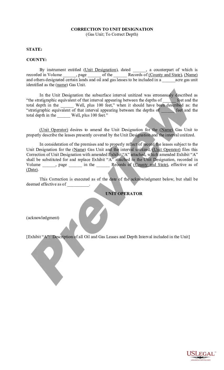
Kansas Correction to Unit Designation to Correct Depth: A Comprehensive Guide to Ensuring Accurate Depths in Kansas Land Surveying In the realm of land surveying, accuracy and precision are of utmost importance in order to avoid legal disputes and ensure proper land usage. One particularly crucial aspect is the correct designation of units for depth measurements. In Kansas, correction to unit designation is an essential practice to rectify any errors or inconsistencies in depth measurements. This detailed description will shed light on the significance of unit designation correction in Kansas land surveying, explaining its purpose, process, and different types. Purpose: The primary purpose of Kansas correction to unit designation is to ensure standardization and consistency in depth measurements across land surveys. Accurate depth data is vital for various applications, such as construction planning, floodplain analysis, irrigation management, and property boundaries determination. By employing correct unit designations, surveyors can guarantee that depth measurements are uniform and comparable, regardless of the type or location of the land. Process: To correct unit designations in Kansas land surveying, surveyors must follow a systematic process. Firstly, they conduct thorough research and analysis of the survey project, including reviewing previously recorded depth measurements and identifying any inconsistencies or errors in the unit designations. Next, they compare the existing unit designations with the recommended Kansas Standard Plan Sheets, which outline the approved units for depth measurements in the state. Based on this assessment, surveyors develop a corrective action plan to rectify the unit designation errors, ensuring they are in compliance with the Kansas Department of Transportation (DOT) guidelines. Types of Correction to Unit Designation: There are several types of correction to unit designation in Kansas land surveying, depending on the specific nature of the error or inconsistency. Some common types include: 1. Conversion Correction: This type of correction involves converting depth measurements from one unit to another. For example, transforming feet to meters or vice versa, or changing inches to feet. 2. Abbreviation Correction: In some cases, surveyors might encounter depth measurements that are improperly abbreviated, leading to confusion or misinterpretation. Correcting the abbreviations to the accepted standards is essential to ensure accuracy and clarity. 3. Consistency Correction: Land survey projects may involve multiple surveys performed at different times, resulting in inconsistent unit designations. This correction type aims to align all depth measurements under a single unified unit designation, ensuring consistency throughout the survey. 4. Systemic Correction: Sometimes, the errors in unit designation are not isolated incidents but rather reflect broader inconsistencies within existing surveying procedures. By addressing systemic issues and implementing standardized unit designations, surveyors can prevent future errors and enhance the overall quality of depth measurements. By implementing Kansas correction to unit designation to correct depth, land surveyors can uphold accuracy, compliance, and consistency in land surveys throughout the state. This practice plays a vital role in supporting various industries, including real estate, infrastructure development, agriculture, and environmental management. Ensuring precise depth measurements contributes to the overall effectiveness and reliability of Kansas land surveying projects, benefiting both surveyors and the broader community.
Kansas Correction to Unit Designation to Correct Depth
Description
How to fill out Kansas Correction To Unit Designation To Correct Depth?
US Legal Forms - one of several most significant libraries of legal varieties in the United States - provides an array of legal papers layouts you can download or print. Using the web site, you can get thousands of varieties for business and personal reasons, categorized by types, states, or keywords.You can get the newest models of varieties like the Kansas Correction to Unit Designation to Correct Depth in seconds.
If you have a monthly subscription, log in and download Kansas Correction to Unit Designation to Correct Depth from your US Legal Forms catalogue. The Down load button can look on every single type you look at. You have access to all earlier saved varieties in the My Forms tab of the profile.
In order to use US Legal Forms for the first time, listed here are basic directions to help you get started off:
- Make sure you have picked out the right type for your personal town/county. Go through the Preview button to review the form`s articles. See the type information to actually have selected the right type.
- If the type doesn`t fit your needs, take advantage of the Look for area on top of the display screen to find the the one that does.
- When you are happy with the form, verify your option by visiting the Get now button. Then, pick the costs plan you like and offer your accreditations to register for the profile.
- Process the deal. Utilize your credit card or PayPal profile to finish the deal.
- Choose the format and download the form on your own system.
- Make changes. Load, modify and print and indication the saved Kansas Correction to Unit Designation to Correct Depth.
Each design you added to your bank account lacks an expiry date which is the one you have forever. So, if you want to download or print yet another version, just go to the My Forms area and then click in the type you need.
Get access to the Kansas Correction to Unit Designation to Correct Depth with US Legal Forms, probably the most extensive catalogue of legal papers layouts. Use thousands of skilled and condition-specific layouts that meet your organization or personal requires and needs.