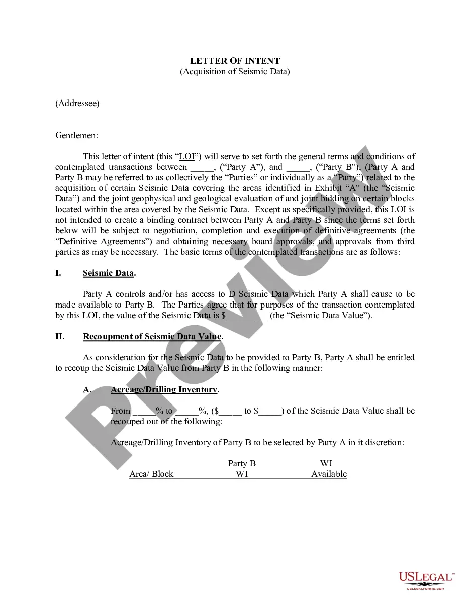
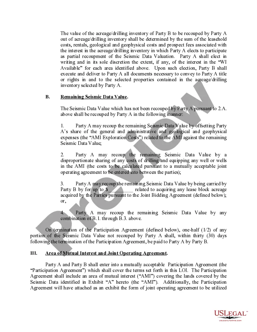
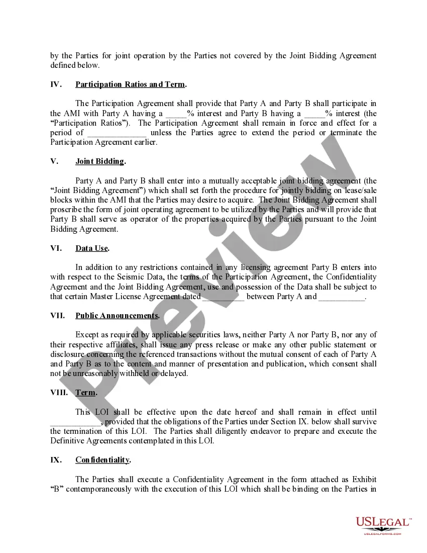
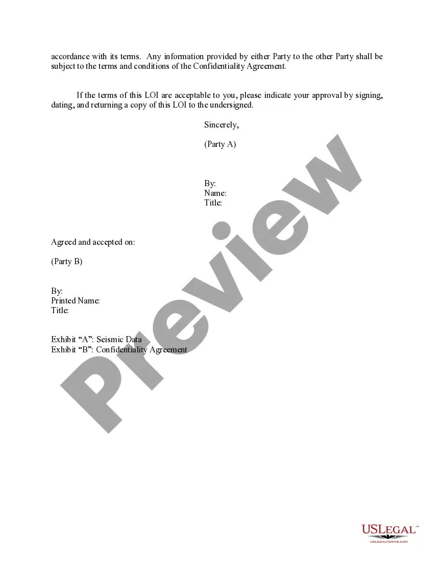
Louisiana Letter of Intent Acquisition of 3-D Data is a formal document that outlines the intention to acquire three-dimensional (3-D) data for various purposes within the state of Louisiana. This data acquisition process involves gathering comprehensive information about the physical, geographical, or architectural properties of a particular area or object and creating a digital representation of it in three dimensions. This letter of intent serves as a preliminary agreement between the requesting party and the data supplier, usually a government agency or research institution specializing in spatial data collection. It outlines the scope, objectives, and terms of the proposed acquisition, ensuring clarity, mutual understanding, and commitment. The acquisition of 3-D data in Louisiana can refer to different types of data collection projects based on the intended application. These may include: 1. Geospatial Mapping: This type of data acquisition focuses on creating accurate and detailed representations of the Earth's surface, capturing features such as terrain, elevation, land cover, and infrastructure. It aids in various applications, such as urban planning, environmental management, disaster risk assessment, and transportation network design. 2. Architectural Documentation: This category involves acquiring 3-D data specifically for architectural purposes. It aims to digitally capture the intricate details and measurements of historical landmarks, buildings, or infrastructure. This information can be used for restoration, preservation, or urban development projects, and is valuable for architectural historians, conservationists, and designers. 3. Industrial or Engineering Surveys: In this case, 3-D data acquisition focuses on capturing the physical characteristics and measurements of industrial sites, facilities, or engineering projects. It enables precise visualization, analysis, and planning for construction, maintenance, or renovation projects in sectors like oil and gas, renewable energy, manufacturing, or transportation. Each type of Louisiana Letter of Intent Acquisition of 3-D Data involves a tailored approach to gathering the necessary information. This may include methods such as aerial or satellite imagery, LiDAR (Light Detection and Ranging) scanning, photogrammetry (using photographs for measurements), or remote sensing. The letter of intent for Louisiana's 3-D data acquisition includes key components such as project objectives, geographical extent, data specifications (resolution, accuracy, format), stipulated timeline, responsible parties, and financial considerations. It also covers legal and confidentiality obligations, quality control measures, deliverables, and any additional terms agreed upon by both parties. The Louisiana Letter of Intent Acquisition of 3-D Data is an important initial step in facilitating effective data acquisition projects. It ensures clear communication and alignment between data suppliers and requesters, guaranteeing that the acquired data meets the specific needs and standards of the intended application.
Louisiana Letter of Intent Acquisition of 3-D Data
Description
How to fill out Louisiana Letter Of Intent Acquisition Of 3-D Data?
US Legal Forms - among the largest libraries of legal varieties in the States - provides a wide range of legal record templates you may obtain or print out. Making use of the internet site, you can get a large number of varieties for company and personal purposes, categorized by categories, claims, or keywords and phrases.You will find the newest versions of varieties much like the Louisiana Letter of Intent Acquisition of 3-D Data within minutes.
If you have a registration, log in and obtain Louisiana Letter of Intent Acquisition of 3-D Data from the US Legal Forms collection. The Download option can look on each develop you view. You have access to all in the past saved varieties inside the My Forms tab of your account.
If you wish to use US Legal Forms for the first time, listed here are simple instructions to get you began:
- Ensure you have picked out the correct develop for your metropolis/region. Select the Preview option to examine the form`s content material. Browse the develop explanation to actually have selected the correct develop.
- In the event the develop does not satisfy your demands, make use of the Search discipline on top of the monitor to discover the one which does.
- In case you are pleased with the shape, validate your selection by clicking on the Acquire now option. Then, choose the rates prepare you favor and supply your qualifications to register on an account.
- Method the transaction. Make use of your charge card or PayPal account to accomplish the transaction.
- Choose the formatting and obtain the shape on the gadget.
- Make modifications. Load, modify and print out and sign the saved Louisiana Letter of Intent Acquisition of 3-D Data.
Every format you included with your bank account does not have an expiration particular date and is also yours permanently. So, if you would like obtain or print out one more copy, just check out the My Forms section and click on in the develop you want.
Get access to the Louisiana Letter of Intent Acquisition of 3-D Data with US Legal Forms, probably the most substantial collection of legal record templates. Use a large number of expert and status-specific templates that meet your small business or personal requires and demands.