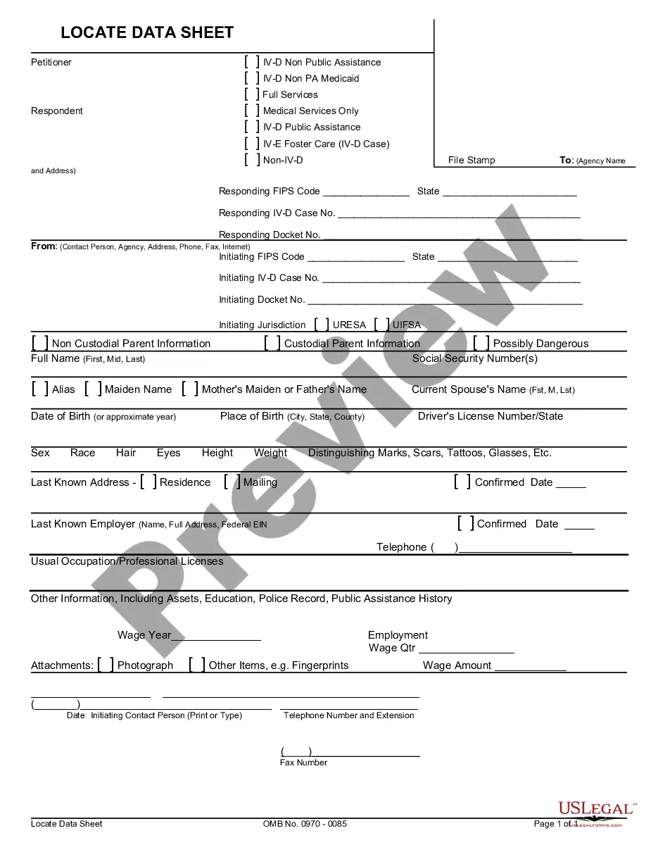
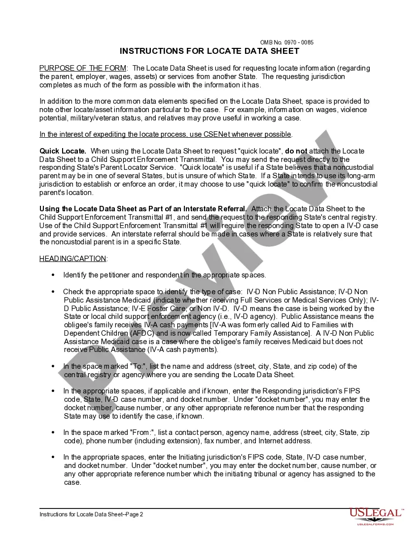
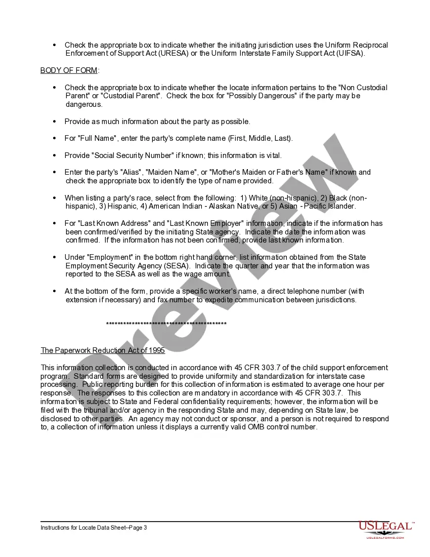
Massachusetts Locate Data Sheet and Instructions are essential documents used for obtaining accurate and up-to-date information about various locations within the state of Massachusetts. These documents contain comprehensive details about the geographical coordinates, boundaries, and other relevant information needed for navigating and identifying specific areas within Massachusetts. The Massachusetts Locate Data Sheet typically includes information such as latitude and longitude coordinates, physical address, ZIP codes, county, town, and district boundaries. It provides users with precise location data that can be utilized for a wide range of applications, including mapping, surveying, emergency response planning, real estate development, transportation, and urban planning. Additionally, the instructions accompanying the data sheet offer guidelines and explanations on how to interpret and use the information effectively. They outline the process of accessing and understanding the data, ensuring that users can make the most of the data sheet and employ it correctly for their particular purposes. While there may not be different types of Massachusetts Locate Data Sheets and Instructions per se, the content and level of detail within these documents can vary depending on the intended use and the presenting authority or agency. For example, there might be specific data sheets dedicated to transportation infrastructure, ecological zones, voting districts, or administrative divisions within the state. Overall, Massachusetts Locate Data Sheet and Instructions serve as invaluable resources for individuals, organizations, and government agencies that require accurate and reliable location information within the state. These documents facilitate efficient decision-making, planning, and analysis by providing precise data and comprehensive guidelines on its usage.
Massachusetts Locate Data Sheet and Instructions
Description
How to fill out Massachusetts Locate Data Sheet And Instructions?
You may commit hrs on the web searching for the legal document design that suits the state and federal needs you need. US Legal Forms supplies thousands of legal forms which are evaluated by pros. You can easily down load or print out the Massachusetts Locate Data Sheet and Instructions from the support.
If you currently have a US Legal Forms account, you are able to log in and then click the Down load option. After that, you are able to total, edit, print out, or sign the Massachusetts Locate Data Sheet and Instructions. Every single legal document design you purchase is yours permanently. To acquire an additional version for any bought type, go to the My Forms tab and then click the corresponding option.
If you are using the US Legal Forms web site the first time, stick to the simple guidelines under:
- Initially, ensure that you have chosen the proper document design for your state/metropolis of your choice. Read the type outline to make sure you have picked out the proper type. If offered, take advantage of the Review option to look with the document design at the same time.
- In order to get an additional edition from the type, take advantage of the Search industry to get the design that meets your requirements and needs.
- Upon having found the design you desire, click on Get now to carry on.
- Find the pricing plan you desire, type your credentials, and sign up for your account on US Legal Forms.
- Complete the purchase. You may use your charge card or PayPal account to fund the legal type.
- Find the file format from the document and down load it for your product.
- Make adjustments for your document if required. You may total, edit and sign and print out Massachusetts Locate Data Sheet and Instructions.
Down load and print out thousands of document web templates utilizing the US Legal Forms website, that offers the largest selection of legal forms. Use specialist and status-certain web templates to take on your business or person requires.