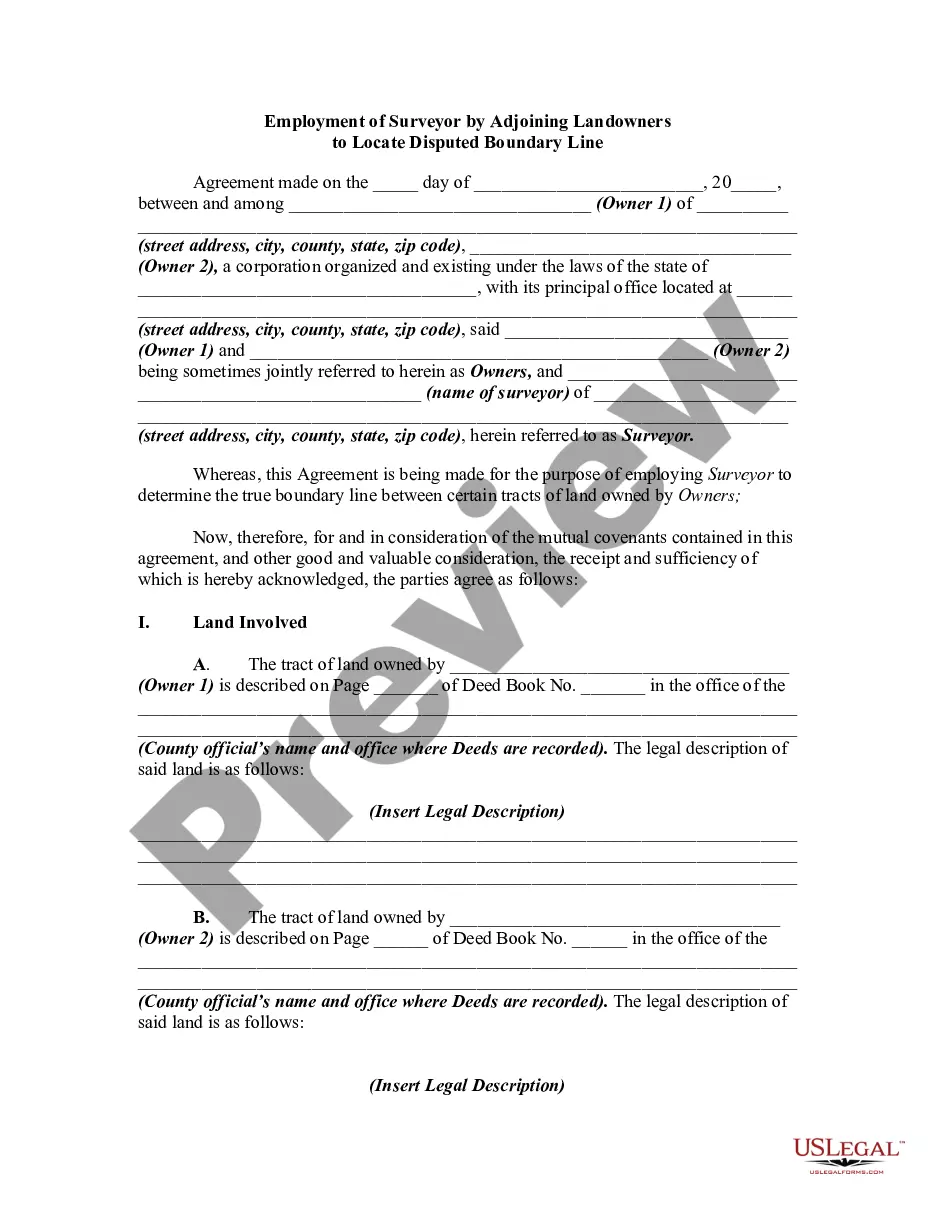
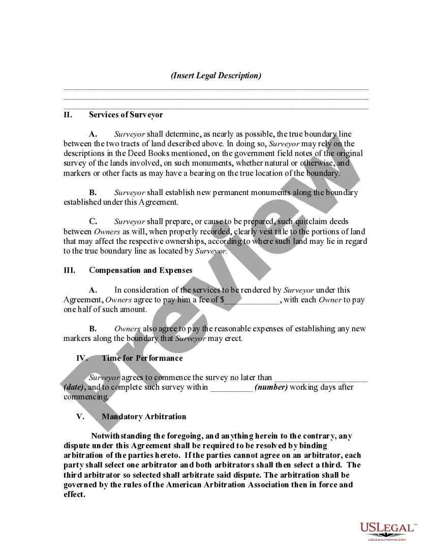
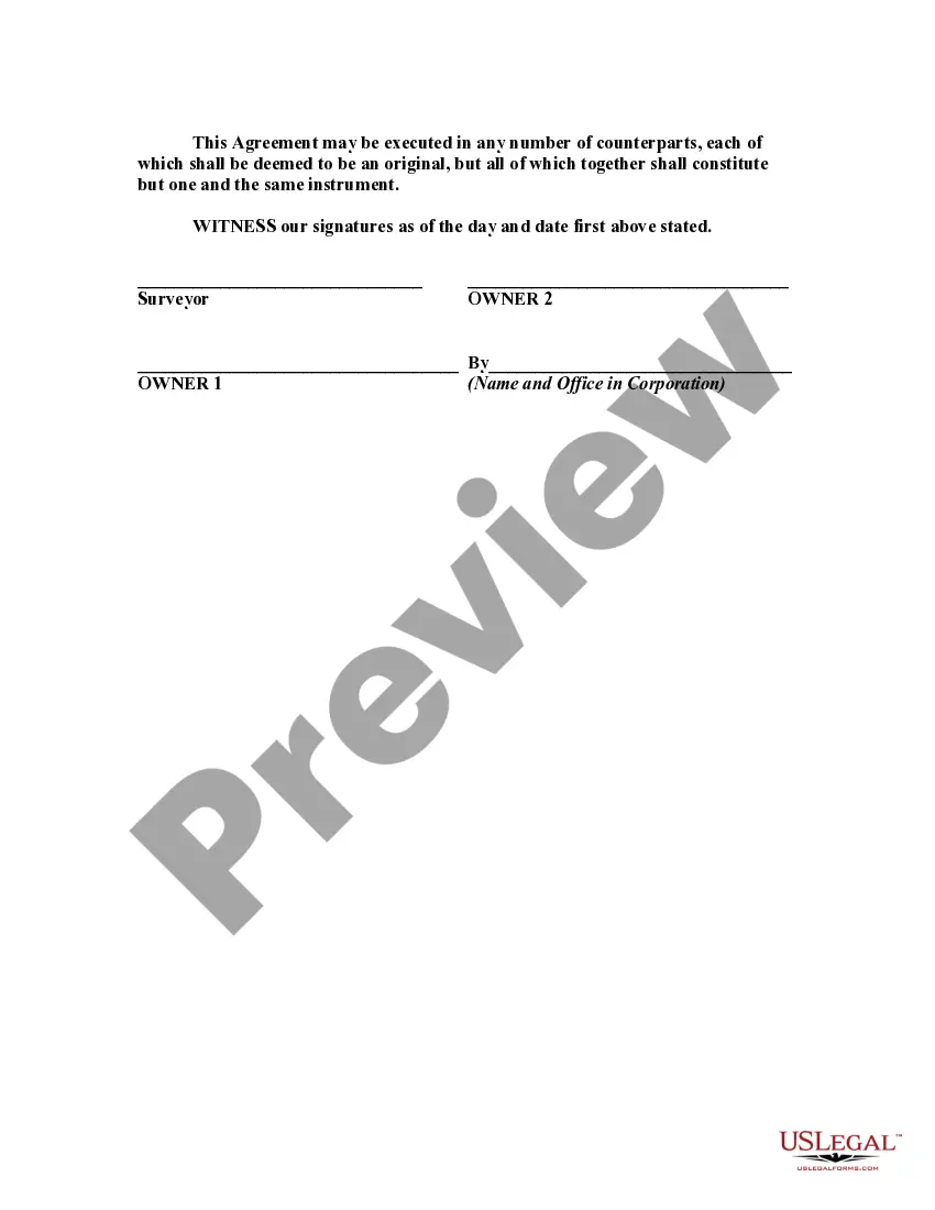
This is a generic sample of an agreement between two adjoining landowners to hire a surveyor to survey their lands in order to settle a dispute as to where the true boundary is regarding their properties.
Maryland Employment of Surveyor by Adjoining Landowners to Locate Disputed Boundary Line When neighboring landowners in Maryland find themselves in disagreement over the location of a disputed boundary line, the employment of a professional surveyor becomes crucial to resolve the issue. Hiring a surveyor is a legally recognized approach to accurately determine the precise location of the boundary line, thus mitigating conflicts and providing a solid foundation for property ownership. A surveyor's role in the employment process involves conducting a thorough investigation, gathering relevant documents, and utilizing land surveying techniques to establish the accurate boundary line. With their expertise and specialized knowledge, surveyors play a vital role in helping landowners understand and respect their property boundaries, preventing potential disputes in the future. In Maryland, there are various types of employment of surveyors by adjoining landowners to locate a disputed boundary line. Some of the most common ones include: 1. Boundary Line Survey: This type of survey focuses on determining the exact location of the boundary line between two adjoining properties. A surveyor inspects physical markers, interprets historic records, and consults with landowners to establish an agreed-upon boundary based on legal and historical evidence. 2. Replacement Survey: When there is a lack of clear documentation or physical markers regarding a disputed boundary line, a replacement survey becomes necessary. Surveyors study historical maps, deeds, and other relevant records to retrace the original surveyed boundary line, considering factors such as surveying methods, natural landmarks, and subdivision plats. 3. Topographic Survey: In certain cases, a topographic survey may be required to identify the boundary line, especially if the land involves significant terrain features or elevation changes. Surveyors use specialized equipment to measure and map the land's surface, establishing accurate boundary lines while considering the impact of topographic features on physical boundaries. 4. Subdivision Survey: When adjacent properties undergo subdivision or re-subdivision, landowners may employ surveyors to delineate new boundary lines. This type of survey ensures compliance with legal requirements and creates precise divisions according to zoning regulations and subdivision plans. Throughout the process of employing a surveyor to locate a disputed boundary line in Maryland, it is essential for the involved landowners to communicate effectively, provide necessary documentation, and cooperate with the surveyor. The surveyor's findings are typically documented in a detailed survey report, which serves as an authoritative reference for resolving boundary disputes and clarifying ownership rights. By employing a qualified and licensed surveyor, Maryland landowners can ensure the accuracy and legal recognition of their property boundaries. These professionals play a pivotal role in maintaining land ownership integrity and preventing conflicts among neighboring landowners.Maryland Employment of Surveyor by Adjoining Landowners to Locate Disputed Boundary Line When neighboring landowners in Maryland find themselves in disagreement over the location of a disputed boundary line, the employment of a professional surveyor becomes crucial to resolve the issue. Hiring a surveyor is a legally recognized approach to accurately determine the precise location of the boundary line, thus mitigating conflicts and providing a solid foundation for property ownership. A surveyor's role in the employment process involves conducting a thorough investigation, gathering relevant documents, and utilizing land surveying techniques to establish the accurate boundary line. With their expertise and specialized knowledge, surveyors play a vital role in helping landowners understand and respect their property boundaries, preventing potential disputes in the future. In Maryland, there are various types of employment of surveyors by adjoining landowners to locate a disputed boundary line. Some of the most common ones include: 1. Boundary Line Survey: This type of survey focuses on determining the exact location of the boundary line between two adjoining properties. A surveyor inspects physical markers, interprets historic records, and consults with landowners to establish an agreed-upon boundary based on legal and historical evidence. 2. Replacement Survey: When there is a lack of clear documentation or physical markers regarding a disputed boundary line, a replacement survey becomes necessary. Surveyors study historical maps, deeds, and other relevant records to retrace the original surveyed boundary line, considering factors such as surveying methods, natural landmarks, and subdivision plats. 3. Topographic Survey: In certain cases, a topographic survey may be required to identify the boundary line, especially if the land involves significant terrain features or elevation changes. Surveyors use specialized equipment to measure and map the land's surface, establishing accurate boundary lines while considering the impact of topographic features on physical boundaries. 4. Subdivision Survey: When adjacent properties undergo subdivision or re-subdivision, landowners may employ surveyors to delineate new boundary lines. This type of survey ensures compliance with legal requirements and creates precise divisions according to zoning regulations and subdivision plans. Throughout the process of employing a surveyor to locate a disputed boundary line in Maryland, it is essential for the involved landowners to communicate effectively, provide necessary documentation, and cooperate with the surveyor. The surveyor's findings are typically documented in a detailed survey report, which serves as an authoritative reference for resolving boundary disputes and clarifying ownership rights. By employing a qualified and licensed surveyor, Maryland landowners can ensure the accuracy and legal recognition of their property boundaries. These professionals play a pivotal role in maintaining land ownership integrity and preventing conflicts among neighboring landowners.