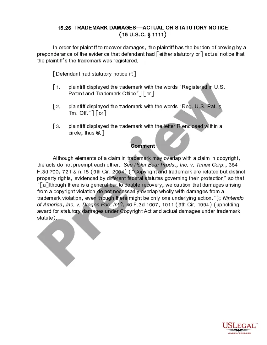
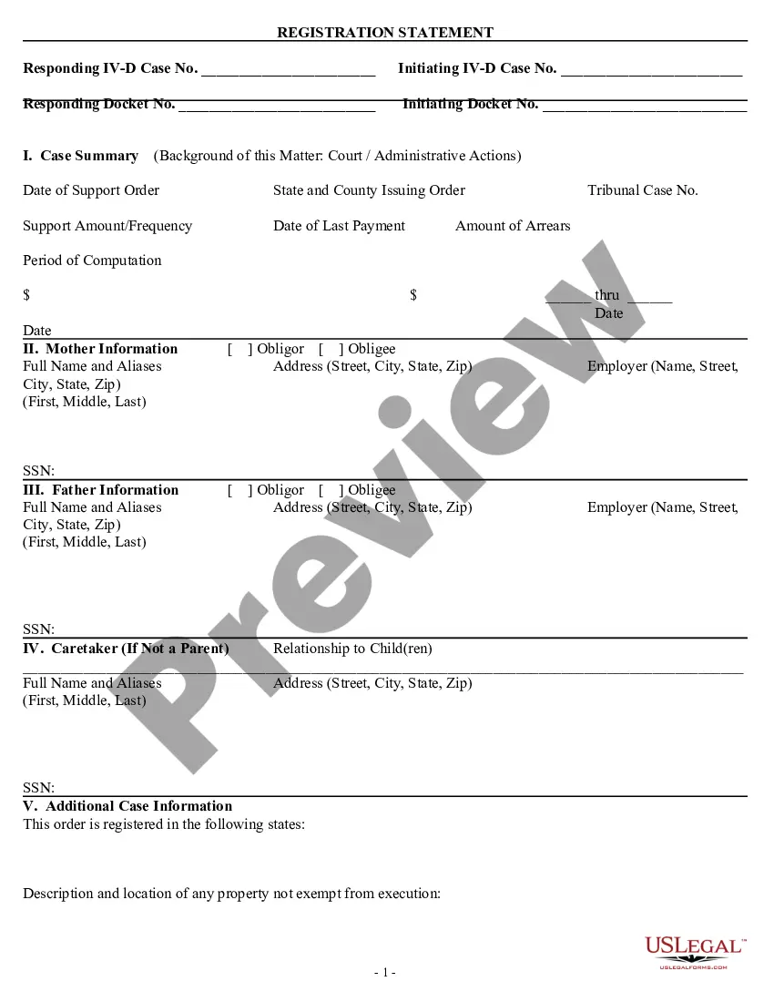
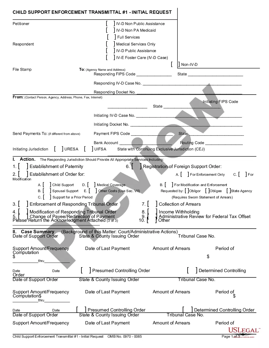
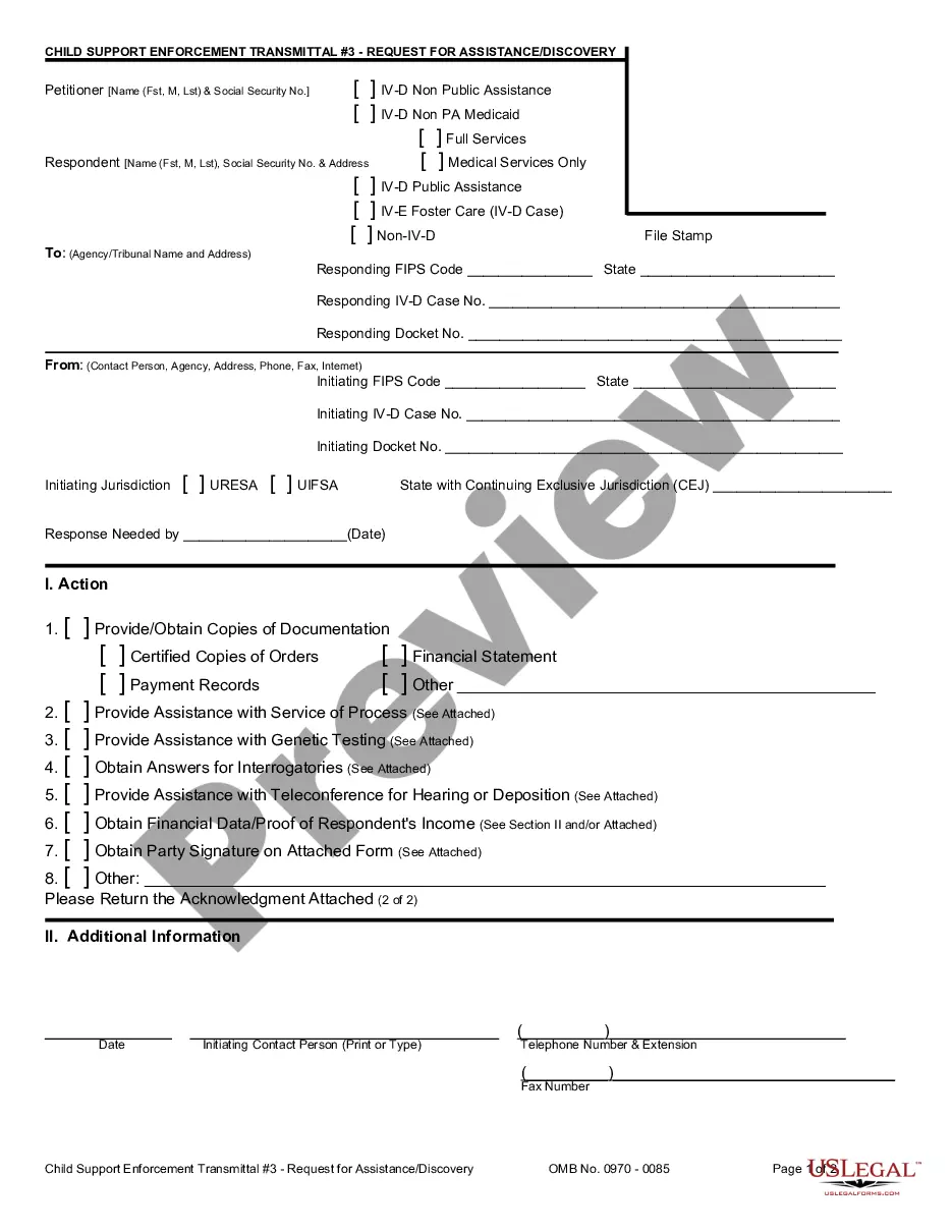
Maryland Locate Data Sheet and Instructions
Description


How to fill out Locate Data Sheet And Instructions?
Locating the appropriate sanctioned document template can be quite a challenge. Naturally, there are numerous templates available online, but how do you acquire the sanctioned version you need? Utilize the US Legal Forms website. This service offers thousands of templates, including the Maryland Locate Data Sheet and Instructions, which can be used for both business and personal purposes. All the forms are reviewed by experts and comply with state and federal regulations.
If you are already registered, Log In to your account and click the Download button to obtain the Maryland Locate Data Sheet and Instructions. Use your account to search for the legal forms you may have purchased previously. Navigate to the My documents section of your account to obtain an additional copy of the document you need.
If you are a new user of US Legal Forms, here are straightforward steps you should follow: First, ensure you have selected the correct form for your specific city/region. You can view the form using the Preview option and read the form description to confirm it is the appropriate one for you. If the form does not meet your needs, utilize the Search bar to find the suitable form. Once you are confident that the form is suitable, click the Buy now button to purchase the form. Select the pricing plan you wish and enter the required information. Create your account and pay for your order using your PayPal account or credit card. Choose the file format and download the legal document template to your device. Complete, edit, print, and sign the acquired Maryland Locate Data Sheet and Instructions.
Make the most of this service to access expertly prepared documents that adhere to legal requirements.
- US Legal Forms is the largest repository of legal forms.
- Find various document templates.
- Utilize the service to download professionally crafted files.
- All documents meet state regulations.
- Access templates that suit various legal needs.
- Explore thousands of options available online.
Form popularity
FAQ
Tax Return Copies of Returns PREPARED via eFile.com Description:The last three years of your returns are stored here for free. Select the PDF icon for the respective tax year; based on your browser settings, the PDF will either open in a tab or prompt you to download the file.
You can request copies of your IRS tax returns from the most recent seven tax years. To obtain copies of your tax return from the IRS, download file Form 4506 from the IRS website, complete it, sign it, and mail it to the appropriate IRS address. As of 2023, the IRS charges $43 for each return you request.
You can check the status of your current year refund online, or by calling the automated line at (410) 260-7701 or 1-800-218-8160. Be sure you have a copy of your return on hand to verify information. You can also e-mail us at taxhelp@marylandtaxes.gov to check on your refund.
To obtain a Comptroller copy of your state returns, visit Request a Copy of Returns and click on Form 129. Please have all certified returns sent to your home address. You can visit one of the branch locations found here. This process could take as long as 15 business days.
You may be able to obtain a free copy of your California tax return. Go to MyFTB for information on how to register for your account. You may also request a copy of your tax return by submitting a Request for Copy of Tax Return (Form FTB 3516 ) or written request.
Maryland uses Form 505 to file a composite return on behalf of nonresident partners. There are two processing options. Go to the Partners > Partner Information worksheet. In the Summary grid, select the name or number of the appropriate partner.
The Maryland Form 511 An Electing PTE Income Tax Return must be filed electronically if the pass-through entity has generated a business tax credit from Form 500CR or a Heritage Structure Rehabilitation Tax Credit from Form 502S to pass on to its members. taxhelp@marylandtaxes.gov.
2 form from each employer. Other earning and interest statements (1099 and 1099INT forms) Receipts for charitable donations; mortgage interest; state and local taxes; medical and business expenses; and other taxdeductible expenses if you are itemizing your return.