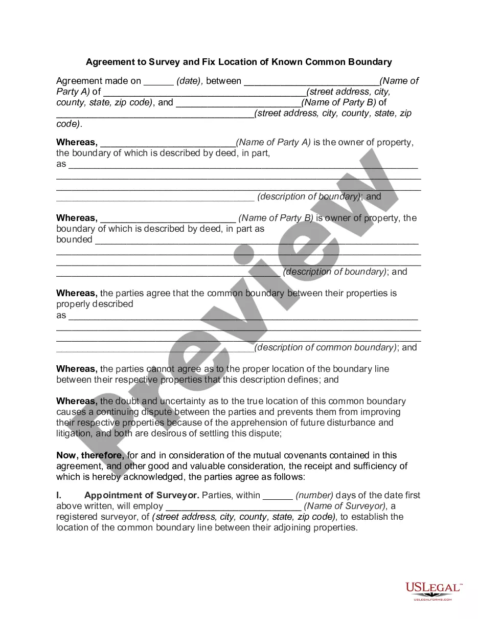
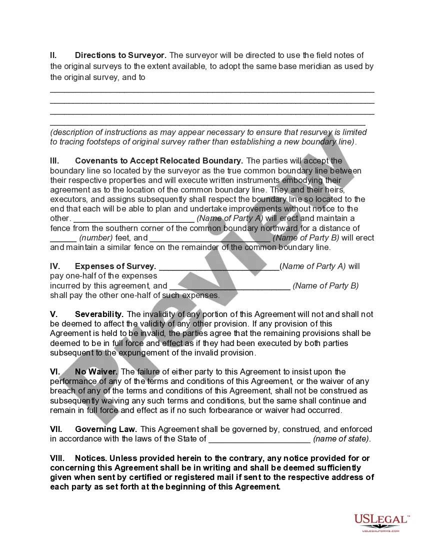
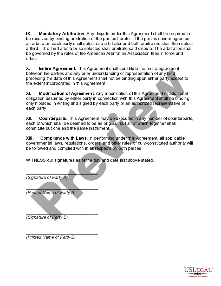
The Minnesota Agreement to Survey and Fix Location of Known Common Boundary is a legal document that serves the purpose of establishing and formalizing the boundary lines between two adjoining properties or parcels in the state of Minnesota. This agreement is often used when there is uncertainty or disputes regarding the accurate location of the common boundary line. Keywords: Minnesota, Agreement to Survey, Fix Location, Known Common Boundary, legal document, boundary lines, adjoining properties, uncertainty, disputes. There are several types of the Minnesota Agreement to Survey and Fix Location of Known Common Boundary, including: 1. Minnesota Agreement to Survey and Fix Location of Known Common Boundary — Residential Property: This type of agreement is specifically designed for residential properties or parcels where neighbors wish to clarify and establish the accurate location of their shared boundary. 2. Minnesota Agreement to Survey and Fix Location of Known Common Boundary — Commercial Property: This variation of the agreement is meant for commercial properties or parcels, such as stores, offices, or industrial spaces. It helps the adjoining property owners to resolve any boundary-related disputes and avoid potential legal conflicts. 3. Minnesota Agreement to Survey and Fix Location of Known Common Boundary — Agricultural Property: This specific agreement is tailored for agricultural properties or parcels, including farms, ranches, or agricultural lands. It allows neighboring landowners to determine and confirm their common boundary lines accurately. 4. Minnesota Agreement to Survey and Fix Location of Known Common Boundary — Natural Resource Area: This type of agreement is applicable when the properties or parcels involved are located in natural resource areas, such as forests, wetlands, or protected habitats. It helps in defining the boundaries to ensure proper land management and conservation efforts. 5. Minnesota Agreement to Survey and Fix Location of Known Common Boundary — Waterfront Property: This agreement variation is used when the properties or parcels are located near bodies of water, like lakes, rivers, or streams. It enables neighboring waterfront property owners to establish their common boundaries, taking into account any water-related considerations. In summary, the Minnesota Agreement to Survey and Fix Location of Known Common Boundary is an essential legal instrument used in Minnesota to resolve boundary disputes and accurately determine the shared property lines between neighboring properties. It offers different variations depending on the type of property involved, including residential, commercial, agricultural, natural resource areas, and waterfront properties.
Minnesota Agreement to Survey and Fix Location of Known Common Boundary
Description
How to fill out Minnesota Agreement To Survey And Fix Location Of Known Common Boundary?
US Legal Forms - one of the biggest libraries of authorized varieties in the USA - delivers a variety of authorized papers templates you may acquire or produce. While using internet site, you will get 1000s of varieties for organization and individual purposes, categorized by categories, claims, or keywords and phrases.You can find the newest versions of varieties just like the Minnesota Agreement to Survey and Fix Location of Known Common Boundary within minutes.
If you already possess a monthly subscription, log in and acquire Minnesota Agreement to Survey and Fix Location of Known Common Boundary from your US Legal Forms catalogue. The Download button will appear on every single type you perspective. You gain access to all in the past downloaded varieties within the My Forms tab of the account.
In order to use US Legal Forms for the first time, listed below are basic instructions to help you get started:
- Be sure you have selected the proper type for your city/state. Click the Review button to check the form`s articles. Read the type outline to actually have chosen the correct type.
- In case the type does not suit your demands, utilize the Search area towards the top of the display to discover the one which does.
- In case you are pleased with the shape, confirm your decision by simply clicking the Get now button. Then, pick the costs program you favor and provide your references to register for the account.
- Method the financial transaction. Utilize your credit card or PayPal account to finish the financial transaction.
- Select the formatting and acquire the shape on your own system.
- Make adjustments. Complete, change and produce and indicator the downloaded Minnesota Agreement to Survey and Fix Location of Known Common Boundary.
Every template you included with your money does not have an expiration particular date and it is the one you have for a long time. So, if you want to acquire or produce yet another duplicate, just proceed to the My Forms area and click in the type you will need.
Obtain access to the Minnesota Agreement to Survey and Fix Location of Known Common Boundary with US Legal Forms, probably the most extensive catalogue of authorized papers templates. Use 1000s of skilled and status-distinct templates that meet your organization or individual demands and demands.