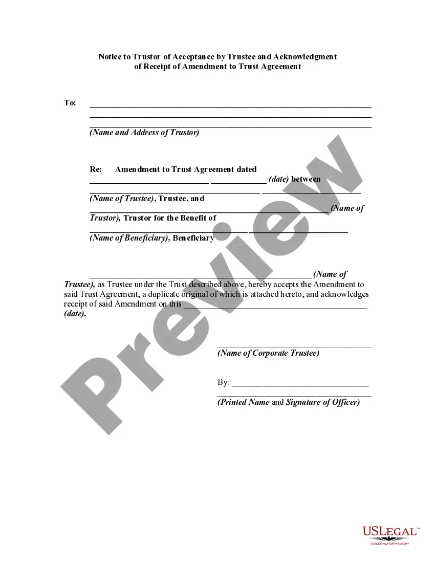
This lease rider form may be used when you are involved in a lease transaction, and have made the decision to utilize the form of Oil and Gas Lease presented to you by the Lessee, and you want to include additional provisions to that Lease form to address specific concerns you may have, or place limitations on the rights granted the Lessee in the “standard” lease form.
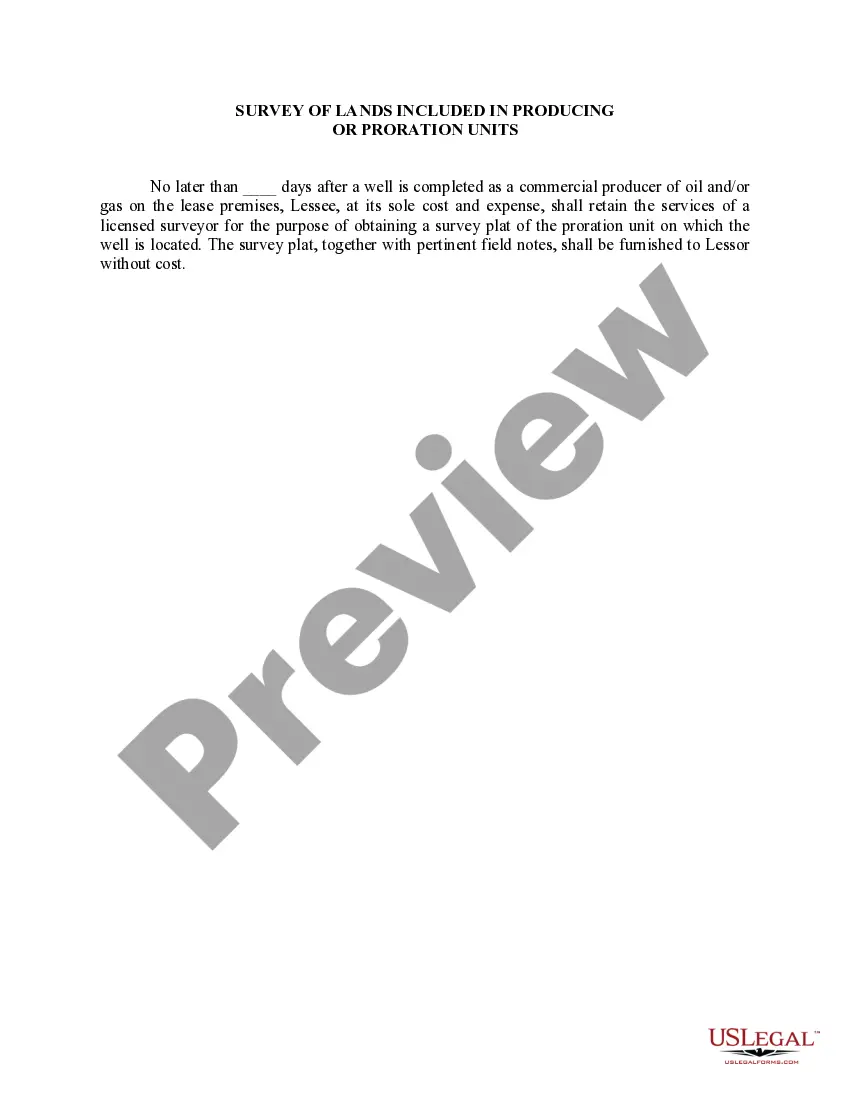
The Minnesota Survey of Lands is a comprehensive and detailed surveying system designed to accurately identify and delineate land boundaries within the state of Minnesota. This survey is an essential component in the process of producing or prorating units for various purposes such as land development, resource management, and legal documentation. The Minnesota Survey of Lands includes various types of surveys that are crucial in determining the exact boundaries and locations of land parcels. These surveys can be broadly classified into the following categories: 1. Section Surveys: These surveys are conducted to divide a township or area of land into smaller sections, commonly known as government sections. Each section represents approximately one square mile and is numbered systematically. Section surveys play a vital role in land management, property taxation, and tiling projects. 2. Traverse Surveys: Traverse surveys focus on establishing accurate measurements of distances, directions, and angles between fixed points. These surveys are essential for creating boundary descriptions, property lines, and resolving any boundary disputes or discrepancies. 3. Land Grant and Private Surveys: These surveys involve the examination and surveying of land parcels granted or obtained through private ownership. They determine the precise boundaries of such lands, ensuring legal compliance and clarification of property rights. 4. Public Land Surveys: Public land surveys are conducted to identify and establish legal descriptions and boundaries of lands owned by the state or federal government. These surveys are crucial for managing and administering public lands, including national parks, forests, and other protected areas. 5. Subdivision Surveys: Subdivision surveys are carried out to divide larger land tracts into smaller sections or lots for residential, commercial, or industrial development. These surveys ensure compliance with local zoning regulations and help with the establishment of individual property boundaries. By conducting the Minnesota Survey of Lands and utilizing its various types of surveys, accurate and reliable information can be obtained for the purpose of producing or prorating units. This information is crucial for landowners, government agencies, developers, and other stakeholders involved in land-related activities, ensuring proper land use planning, resource allocation, and legal documentation.The Minnesota Survey of Lands is a comprehensive and detailed surveying system designed to accurately identify and delineate land boundaries within the state of Minnesota. This survey is an essential component in the process of producing or prorating units for various purposes such as land development, resource management, and legal documentation. The Minnesota Survey of Lands includes various types of surveys that are crucial in determining the exact boundaries and locations of land parcels. These surveys can be broadly classified into the following categories: 1. Section Surveys: These surveys are conducted to divide a township or area of land into smaller sections, commonly known as government sections. Each section represents approximately one square mile and is numbered systematically. Section surveys play a vital role in land management, property taxation, and tiling projects. 2. Traverse Surveys: Traverse surveys focus on establishing accurate measurements of distances, directions, and angles between fixed points. These surveys are essential for creating boundary descriptions, property lines, and resolving any boundary disputes or discrepancies. 3. Land Grant and Private Surveys: These surveys involve the examination and surveying of land parcels granted or obtained through private ownership. They determine the precise boundaries of such lands, ensuring legal compliance and clarification of property rights. 4. Public Land Surveys: Public land surveys are conducted to identify and establish legal descriptions and boundaries of lands owned by the state or federal government. These surveys are crucial for managing and administering public lands, including national parks, forests, and other protected areas. 5. Subdivision Surveys: Subdivision surveys are carried out to divide larger land tracts into smaller sections or lots for residential, commercial, or industrial development. These surveys ensure compliance with local zoning regulations and help with the establishment of individual property boundaries. By conducting the Minnesota Survey of Lands and utilizing its various types of surveys, accurate and reliable information can be obtained for the purpose of producing or prorating units. This information is crucial for landowners, government agencies, developers, and other stakeholders involved in land-related activities, ensuring proper land use planning, resource allocation, and legal documentation.