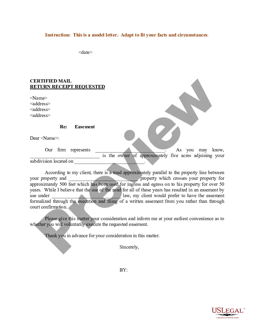
Nebraska Sample Letter regarding Survey Maps
Description
Get your form ready online
Our built-in tools help you complete, sign, share, and store your documents in one place.
Make edits, fill in missing information, and update formatting in US Legal Forms—just like you would in MS Word.
Download a copy, print it, send it by email, or mail it via USPS—whatever works best for your next step.
Sign and collect signatures with our SignNow integration. Send to multiple recipients, set reminders, and more. Go Premium to unlock E-Sign.
If this form requires notarization, complete it online through a secure video call—no need to meet a notary in person or wait for an appointment.
We protect your documents and personal data by following strict security and privacy standards.

Make edits, fill in missing information, and update formatting in US Legal Forms—just like you would in MS Word.

Download a copy, print it, send it by email, or mail it via USPS—whatever works best for your next step.

Sign and collect signatures with our SignNow integration. Send to multiple recipients, set reminders, and more. Go Premium to unlock E-Sign.

If this form requires notarization, complete it online through a secure video call—no need to meet a notary in person or wait for an appointment.

We protect your documents and personal data by following strict security and privacy standards.
Looking for another form?
How to fill out Sample Letter Regarding Survey Maps?
Have you been within a situation in which you need paperwork for both enterprise or person reasons virtually every time? There are a lot of legal papers web templates accessible on the Internet, but getting ones you can rely on isn`t straightforward. US Legal Forms offers 1000s of kind web templates, such as the Nebraska Sample Letter regarding Survey Maps, which can be published to meet state and federal needs.
In case you are presently knowledgeable about US Legal Forms website and have a free account, just log in. Next, it is possible to obtain the Nebraska Sample Letter regarding Survey Maps web template.
If you do not offer an accounts and need to begin to use US Legal Forms, follow these steps:
- Obtain the kind you need and ensure it is for the correct city/area.
- Take advantage of the Review switch to examine the form.
- See the description to actually have selected the appropriate kind.
- In case the kind isn`t what you are searching for, take advantage of the Search area to find the kind that meets your needs and needs.
- If you discover the correct kind, click Buy now.
- Opt for the rates prepare you need, fill in the specified information to make your bank account, and pay money for the order with your PayPal or credit card.
- Decide on a practical document file format and obtain your duplicate.
Get each of the papers web templates you might have purchased in the My Forms menus. You can get a more duplicate of Nebraska Sample Letter regarding Survey Maps anytime, if possible. Just go through the required kind to obtain or print the papers web template.
Use US Legal Forms, the most comprehensive selection of legal forms, to conserve some time and avoid mistakes. The assistance offers expertly created legal papers web templates that you can use for an array of reasons. Make a free account on US Legal Forms and start producing your way of life a little easier.
Form popularity
FAQ
The Public Land Survey System (PLSS) is a way of subdividing and describing land in the United States. PLSS surveys, which are available for portions of land in 30 southern and western states, are made by the Bureau of Land Management (BLM).
EDMs give surveyors much more accuracy than metal measurement tapes. Various surveys, such as detail surveys and a control survey, use this technology. Surveyors calculate the horizontal distance between two control points using an EDM instrument. The device directs the energy to another surveyor holding a reflector.
?Public Land Survey System (PLSS)? - The surveying method developed and used in Nebraska to subdivide land in the public domain into section, township, and range, platted and approved by the General Land Office of the United States of America.
The original surveys of Nebraska were completed in 1883. All land transactions (patents, deeds, and easements) within Nebraska are filed with the register of deeds of each county and reference the corners set during these surveys.
This observation made the plumb bob the earliest surveying instrument. By 2600 BC, we know the Egyptians had taken this concept and created the earliest surveying instruments: the plumb board, the A-Level, T-Level and plumb square.