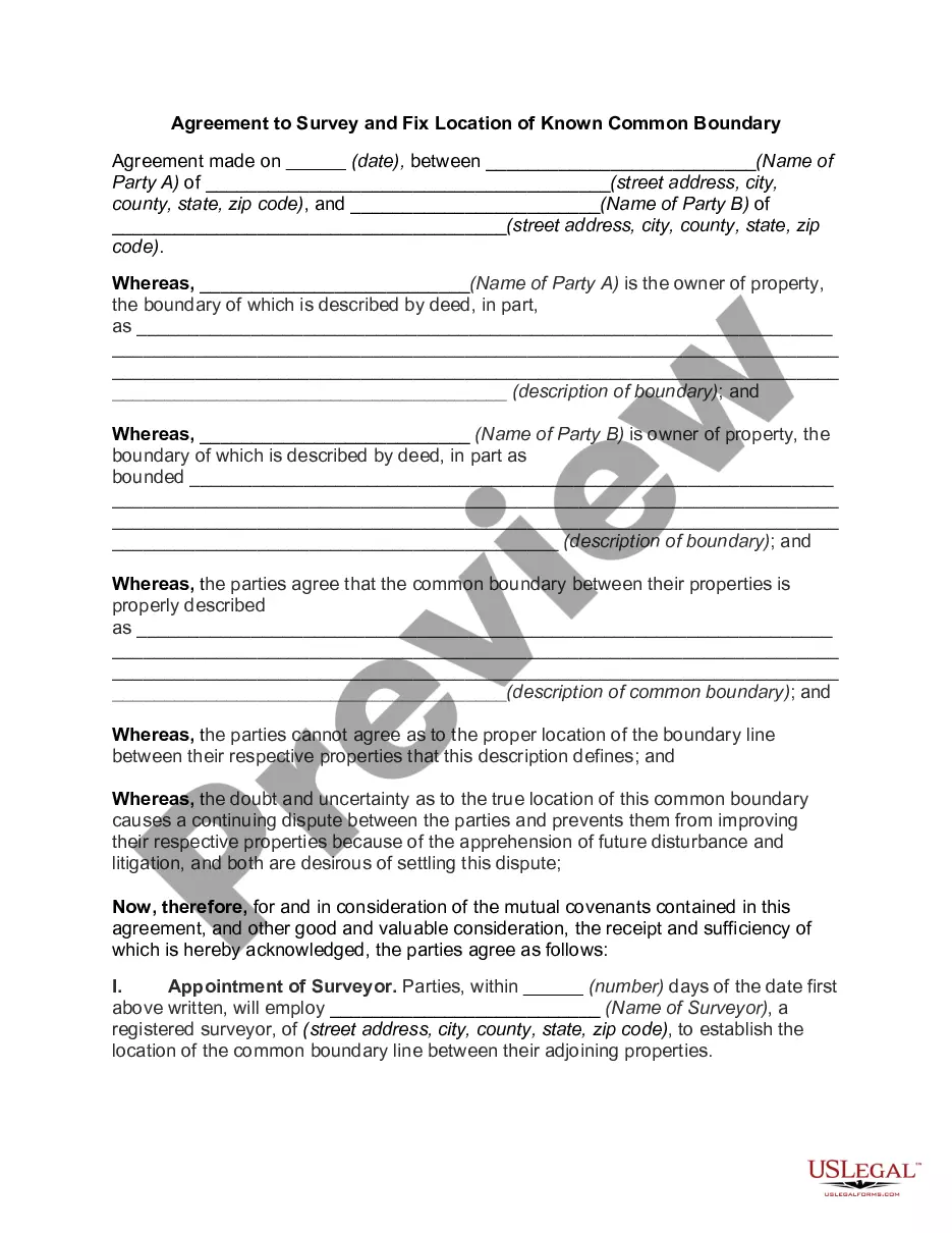
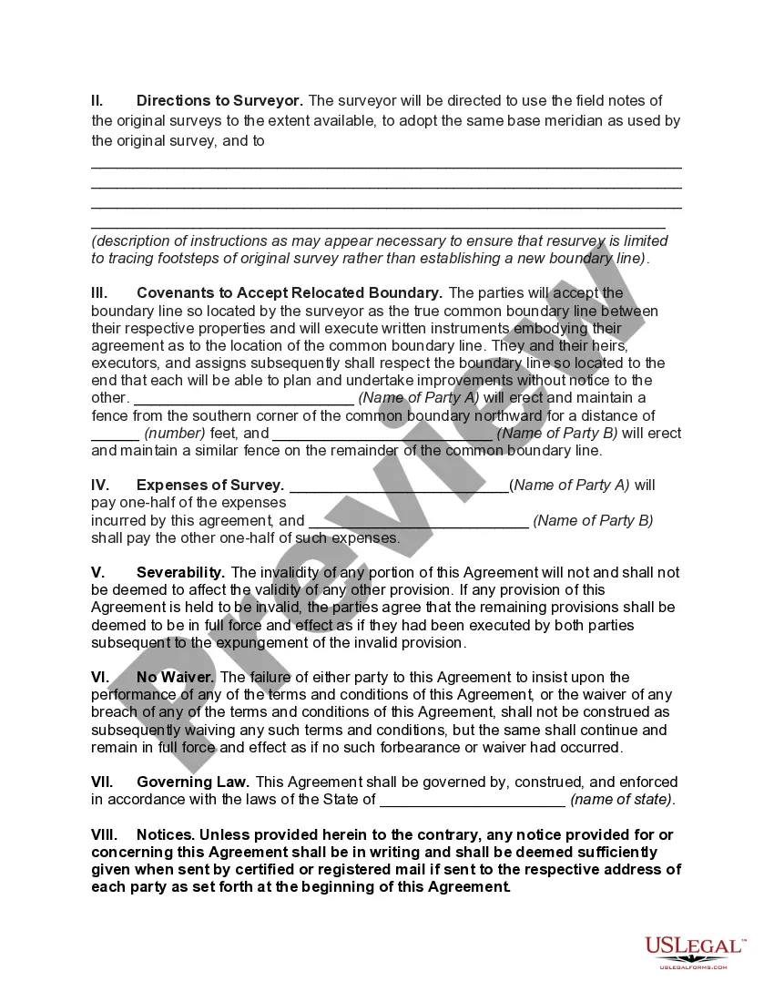
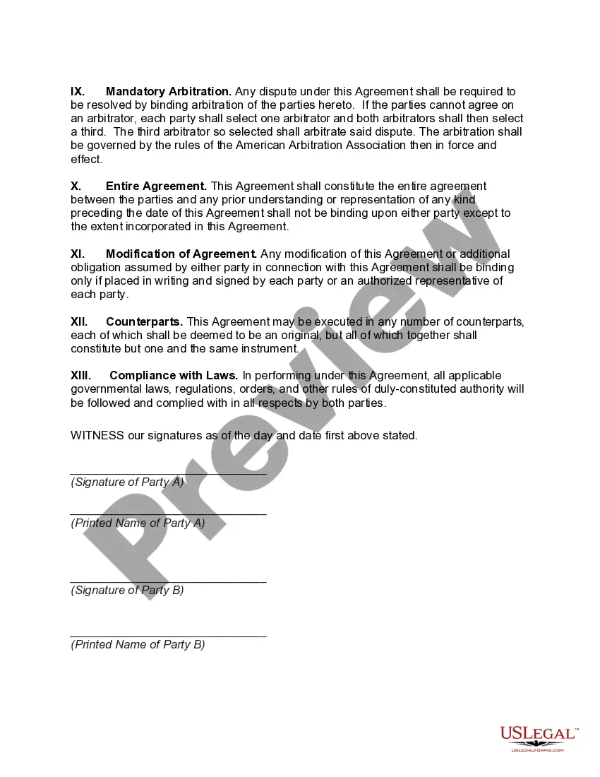
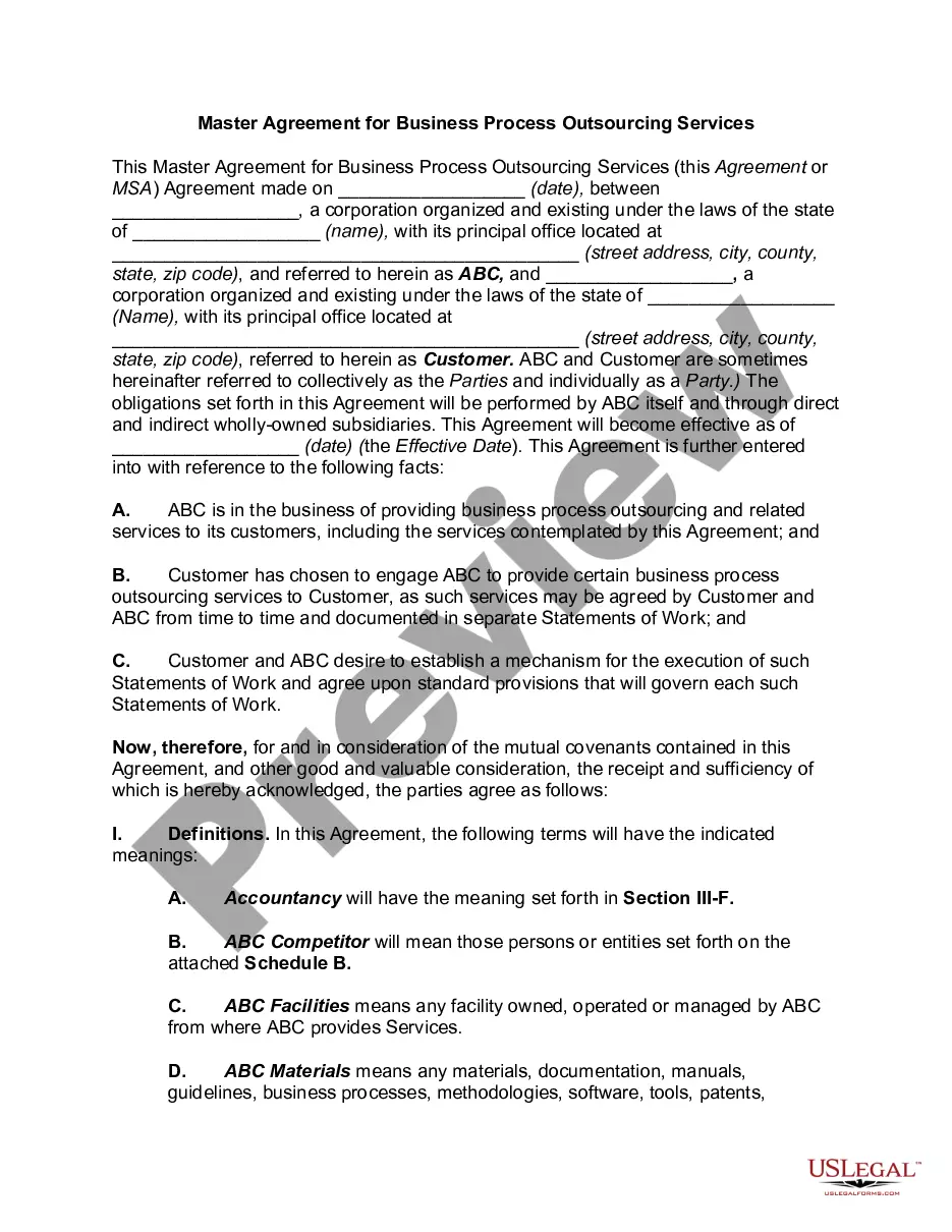
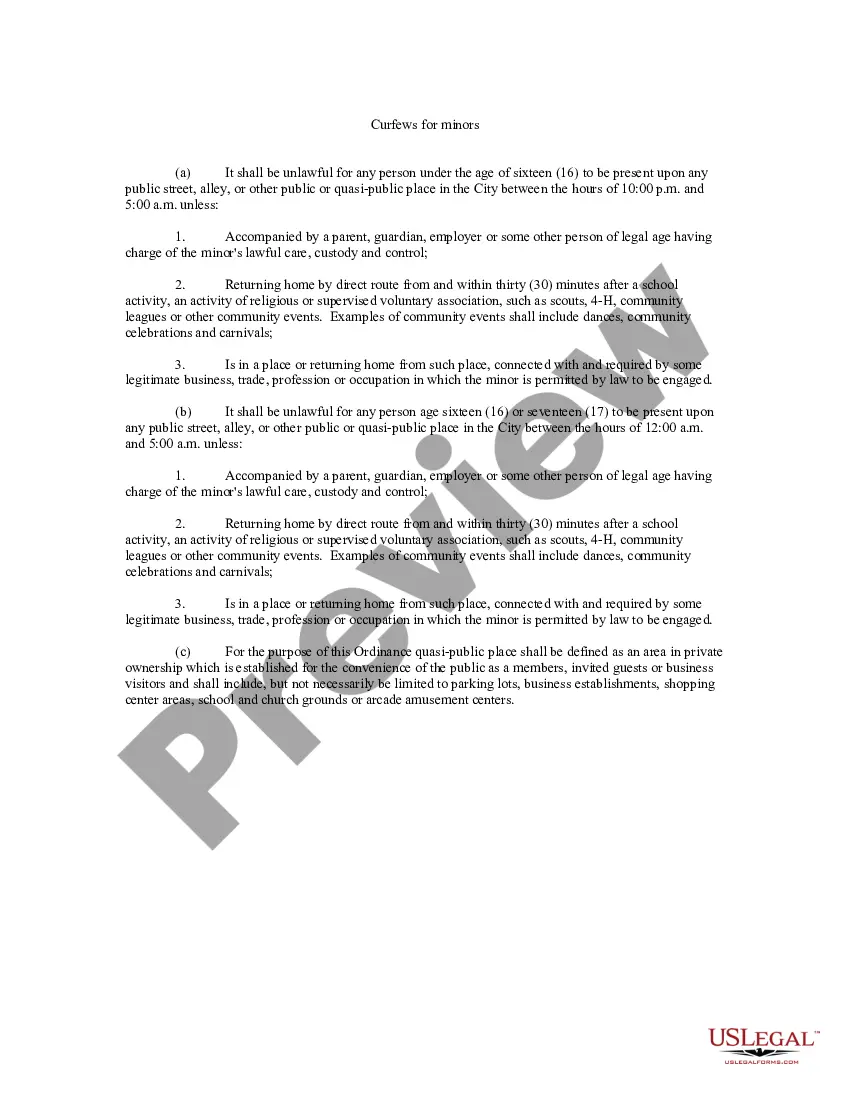
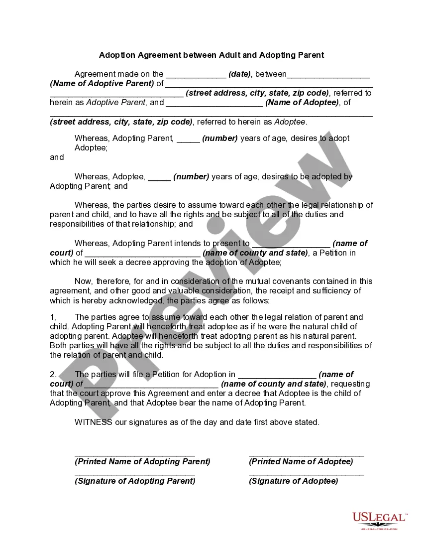
The Nebraska Agreement to Survey and Fix Location of Known Common Boundary is a legal document used in the state of Nebraska to establish and define boundaries between neighboring properties. This agreement is crucial in avoiding disputes and conflicts between landowners regarding the exact location of the common boundary. The purpose of the Nebraska Agreement to Survey and Fix Location of Known Common Boundary is to provide a clear understanding between the parties involved regarding the precise location of the boundary line. It ensures that both landowners mutually agree and acknowledge the exact spot where their properties meet. This agreement begins by identifying the parties involved, typically the adjacent landowners, and their respective legal descriptions of the properties. It may also include a brief history of the properties, previous surveys, or any existing disputes related to the common boundary. The next step is to establish the location of the common boundary line. This is done by conducting a survey conducted by a licensed land surveyor. The surveyor will determine the boundary's exact location, taking into consideration existing markers, physical features, or any previous legal descriptions. The findings of the survey are then documented in the agreement. Once the survey has been completed, the Nebraska Agreement to Survey and Fix Location of Known Common Boundary will outline the exact measurements and geographical coordinates of the boundary line. It will specify the specific points or markers that have been identified as the common boundary, ensuring that both parties are in agreement and have signed off on the document. In some instances, there may be variations or additional types of Nebraska Agreement to Survey and Fix Location of Known Common Boundary. These could include agreements that involve multiple neighboring properties, agreements related to disputed boundaries, or agreements between landowners and governmental entities (such as counties or municipalities) to establish clear boundaries for public lands or roads. In conclusion, the Nebraska Agreement to Survey and Fix Location of Known Common Boundary is an essential legal document that demarcates the boundaries between neighboring properties. It ensures that both parties are in agreement regarding the exact location of the common boundary and prevents potential disputes or conflicts in the future. Conducting a survey and documenting the findings accurately are crucial steps in creating a clear and binding agreement.
The Nebraska Agreement to Survey and Fix Location of Known Common Boundary is a legal document used in the state of Nebraska to establish and define boundaries between neighboring properties. This agreement is crucial in avoiding disputes and conflicts between landowners regarding the exact location of the common boundary. The purpose of the Nebraska Agreement to Survey and Fix Location of Known Common Boundary is to provide a clear understanding between the parties involved regarding the precise location of the boundary line. It ensures that both landowners mutually agree and acknowledge the exact spot where their properties meet. This agreement begins by identifying the parties involved, typically the adjacent landowners, and their respective legal descriptions of the properties. It may also include a brief history of the properties, previous surveys, or any existing disputes related to the common boundary. The next step is to establish the location of the common boundary line. This is done by conducting a survey conducted by a licensed land surveyor. The surveyor will determine the boundary's exact location, taking into consideration existing markers, physical features, or any previous legal descriptions. The findings of the survey are then documented in the agreement. Once the survey has been completed, the Nebraska Agreement to Survey and Fix Location of Known Common Boundary will outline the exact measurements and geographical coordinates of the boundary line. It will specify the specific points or markers that have been identified as the common boundary, ensuring that both parties are in agreement and have signed off on the document. In some instances, there may be variations or additional types of Nebraska Agreement to Survey and Fix Location of Known Common Boundary. These could include agreements that involve multiple neighboring properties, agreements related to disputed boundaries, or agreements between landowners and governmental entities (such as counties or municipalities) to establish clear boundaries for public lands or roads. In conclusion, the Nebraska Agreement to Survey and Fix Location of Known Common Boundary is an essential legal document that demarcates the boundaries between neighboring properties. It ensures that both parties are in agreement regarding the exact location of the common boundary and prevents potential disputes or conflicts in the future. Conducting a survey and documenting the findings accurately are crucial steps in creating a clear and binding agreement.