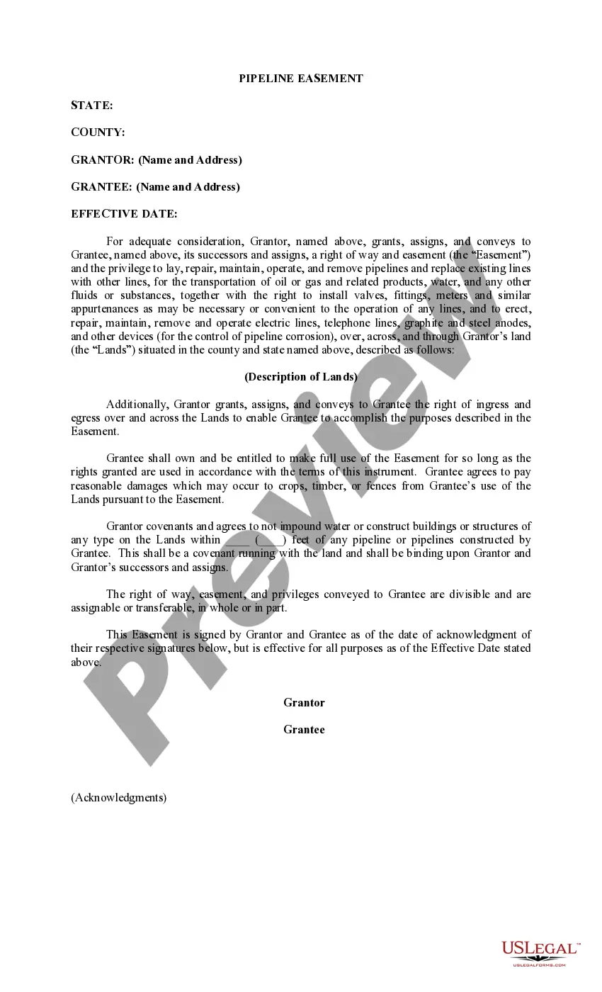
Nebraska Permission to Survey (Pipeline Right of Way)
Description
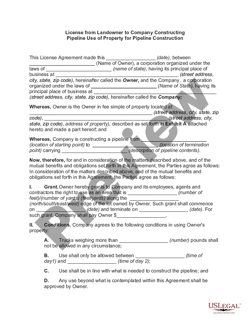
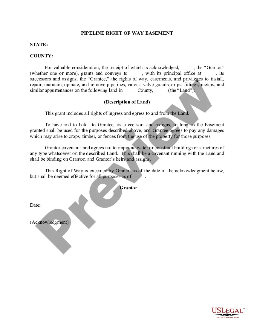
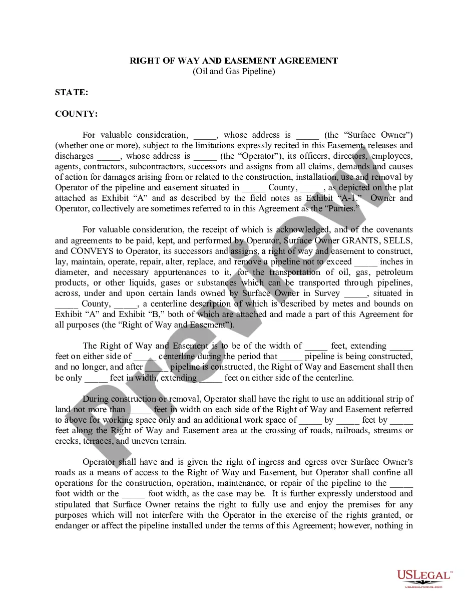
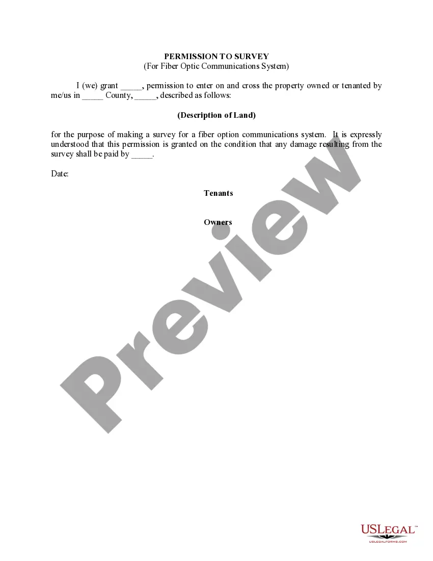

How to fill out Permission To Survey (Pipeline Right Of Way)?
You are able to spend several hours on the Internet looking for the legal document design that fits the federal and state requirements you need. US Legal Forms provides a large number of legal varieties which can be evaluated by professionals. You can actually down load or printing the Nebraska Permission to Survey (Pipeline Right of Way) from my service.
If you already have a US Legal Forms accounts, you may log in and click the Acquire option. After that, you may full, edit, printing, or indicator the Nebraska Permission to Survey (Pipeline Right of Way). Every legal document design you purchase is the one you have for a long time. To get another duplicate for any acquired form, proceed to the My Forms tab and click the related option.
If you use the US Legal Forms site initially, stick to the easy guidelines below:
- Initial, make sure that you have selected the correct document design for the state/metropolis that you pick. Look at the form description to make sure you have chosen the proper form. If readily available, utilize the Preview option to appear through the document design also.
- If you wish to locate another variation from the form, utilize the Search field to obtain the design that meets your needs and requirements.
- Once you have located the design you would like, just click Get now to move forward.
- Choose the rates plan you would like, key in your credentials, and register for a free account on US Legal Forms.
- Full the financial transaction. You should use your Visa or Mastercard or PayPal accounts to purchase the legal form.
- Choose the file format from the document and down load it to the system.
- Make alterations to the document if possible. You are able to full, edit and indicator and printing Nebraska Permission to Survey (Pipeline Right of Way).
Acquire and printing a large number of document web templates making use of the US Legal Forms site, which provides the biggest collection of legal varieties. Use expert and express-specific web templates to deal with your organization or individual needs.
Form popularity
FAQ
Hear this out loud PauseVehicles approaching or entering intersection at same time; right-of-way; entering a highway or roadway. (1) When two vehicles approach or enter an intersection from different roadways at approximately the same time, the driver of the vehicle on the left shall yield the right-of-way to the vehicle on the right.
Hear this out loud PauseYou yield (give up) the right of way to that driver by letting him go first. If you reach an uncontrolled intersection at close to the same time, the vehicle who actually reached the intersection last is the driver who must yield the right of way.
Hear this out loud PauseYou must always accept the right-of-way in any given situation. This statement is false. Given that the right of way is never actually granted by the law, it is crucial to comprehend the notion. Simply put, the law specifies when the right of way must be given up.
ofway easement allows someone to travel through another person's land to get somewhere else. It can be offered to one person, several people, or the public. The landowner who grants an easement can't build structures within a prescribed area surrounding it, and they also can't use fencing to hinder access.
A ?right of way? is an easement which allows the owner of one property to cross another, in order to access it. Further, a right of way may become a 'right to roam. ' This can happen if the landowner has given permission or the local community has used the right of way for many years.
Hear this out loud PauseExample: You are stopped at a stop sign and you are going to go straight through the intersection. A driver on the cross road has stopped at a stop sign on your right and is also going to go straight. You must yield the right-of-way to the other driver.

")