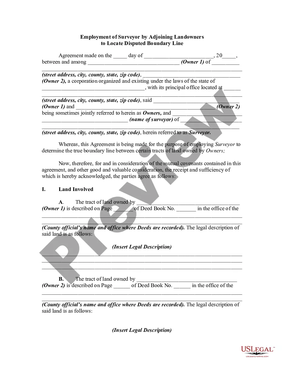
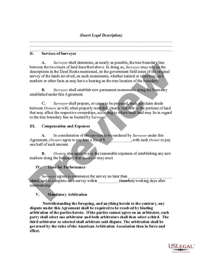
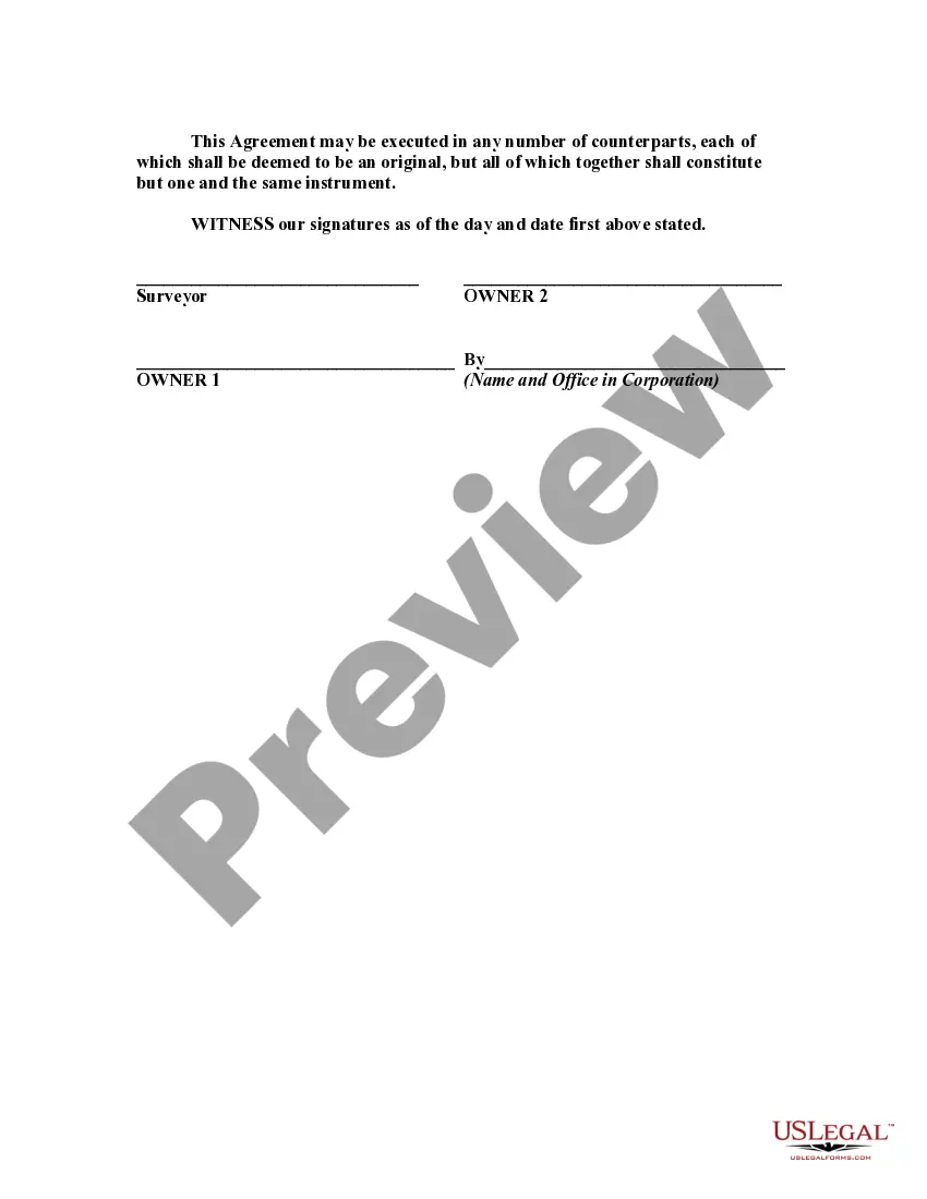
This is a generic sample of an agreement between two adjoining landowners to hire a surveyor to survey their lands in order to settle a dispute as to where the true boundary is regarding their properties.
Ohio Employment of Surveyor by Adjoining Landowners to Locate Disputed Boundary Line: In Ohio, when adjoining landowners find themselves in a dispute over a boundary line, they can employ the services of a surveyor to accurately determine the location of the disputed boundary. By hiring a qualified surveyor, landowners can settle boundary disputes amicably and with legal certainty. Surveyors play a crucial role in resolving boundary disagreements by conducting thorough investigations and utilizing advanced techniques to establish accurate property lines. They employ various tools, such as GPS technology, detailed maps, historical records, and physical measurements to gather reliable data. The employment of a surveyor can help avoid potential conflicts and costly legal disputes related to land boundaries. The surveyor's final report, known as a boundary survey, provides a precise description of the disputed boundary line, including specific measurements and reference points. Types of Ohio Employment of Surveyor by Adjoining Landowners to Locate Disputed Boundary Line: 1. Boundary Line Survey: The most common type of survey conducted in Ohio to resolve boundary disputes. It involves a detailed examination of the properties, gathering relevant documents and permissions, and performing accurate measurements to determine the exact location of the disputed boundary line. 2. Topographic Survey: Occasionally, a topographic survey may be required to identify physical features and natural elements that may influence the boundary. This type of survey encompasses the elevation, contours, existing structures, vegetation, and other important environmental factors. 3. ALTA/NPS Land Title Survey: In complex boundary disputes, landowners may opt for an ALTA/NPS Land Title Survey. This type of survey provides a comprehensive evaluation of the property, including boundaries, easements, encroachments, and other land-related factors. It adheres to specific standards set by the American Land Title Association (ALTA) and the National Society of Professional Surveyors (NPS). 4. Grading Plan Survey: In some cases, landowners may require a grading plan survey to establish the boundaries concerning the land's slope and elevation changes. This information is crucial during construction, landscaping, or any alteration of the property that requires precise grading. 5. Replacement Survey: A replacement survey is conducted when the existing boundary lines are disputed or not adequately defined. It involves retracing property lines based on historical documents, records, and physical measurements. Conclusion: The employment of surveyors by adjoining landowners in Ohio is a vital step in resolving disputed boundary lines. Through various types of surveys, surveyors provide accurate and comprehensive reports, helping landowners reach fair agreements and avoid complex legal battles. Their expertise, combined with advanced surveying tools, ensures reliable data and objective analysis to settle boundary disputes professionally.Ohio Employment of Surveyor by Adjoining Landowners to Locate Disputed Boundary Line: In Ohio, when adjoining landowners find themselves in a dispute over a boundary line, they can employ the services of a surveyor to accurately determine the location of the disputed boundary. By hiring a qualified surveyor, landowners can settle boundary disputes amicably and with legal certainty. Surveyors play a crucial role in resolving boundary disagreements by conducting thorough investigations and utilizing advanced techniques to establish accurate property lines. They employ various tools, such as GPS technology, detailed maps, historical records, and physical measurements to gather reliable data. The employment of a surveyor can help avoid potential conflicts and costly legal disputes related to land boundaries. The surveyor's final report, known as a boundary survey, provides a precise description of the disputed boundary line, including specific measurements and reference points. Types of Ohio Employment of Surveyor by Adjoining Landowners to Locate Disputed Boundary Line: 1. Boundary Line Survey: The most common type of survey conducted in Ohio to resolve boundary disputes. It involves a detailed examination of the properties, gathering relevant documents and permissions, and performing accurate measurements to determine the exact location of the disputed boundary line. 2. Topographic Survey: Occasionally, a topographic survey may be required to identify physical features and natural elements that may influence the boundary. This type of survey encompasses the elevation, contours, existing structures, vegetation, and other important environmental factors. 3. ALTA/NPS Land Title Survey: In complex boundary disputes, landowners may opt for an ALTA/NPS Land Title Survey. This type of survey provides a comprehensive evaluation of the property, including boundaries, easements, encroachments, and other land-related factors. It adheres to specific standards set by the American Land Title Association (ALTA) and the National Society of Professional Surveyors (NPS). 4. Grading Plan Survey: In some cases, landowners may require a grading plan survey to establish the boundaries concerning the land's slope and elevation changes. This information is crucial during construction, landscaping, or any alteration of the property that requires precise grading. 5. Replacement Survey: A replacement survey is conducted when the existing boundary lines are disputed or not adequately defined. It involves retracing property lines based on historical documents, records, and physical measurements. Conclusion: The employment of surveyors by adjoining landowners in Ohio is a vital step in resolving disputed boundary lines. Through various types of surveys, surveyors provide accurate and comprehensive reports, helping landowners reach fair agreements and avoid complex legal battles. Their expertise, combined with advanced surveying tools, ensures reliable data and objective analysis to settle boundary disputes professionally.