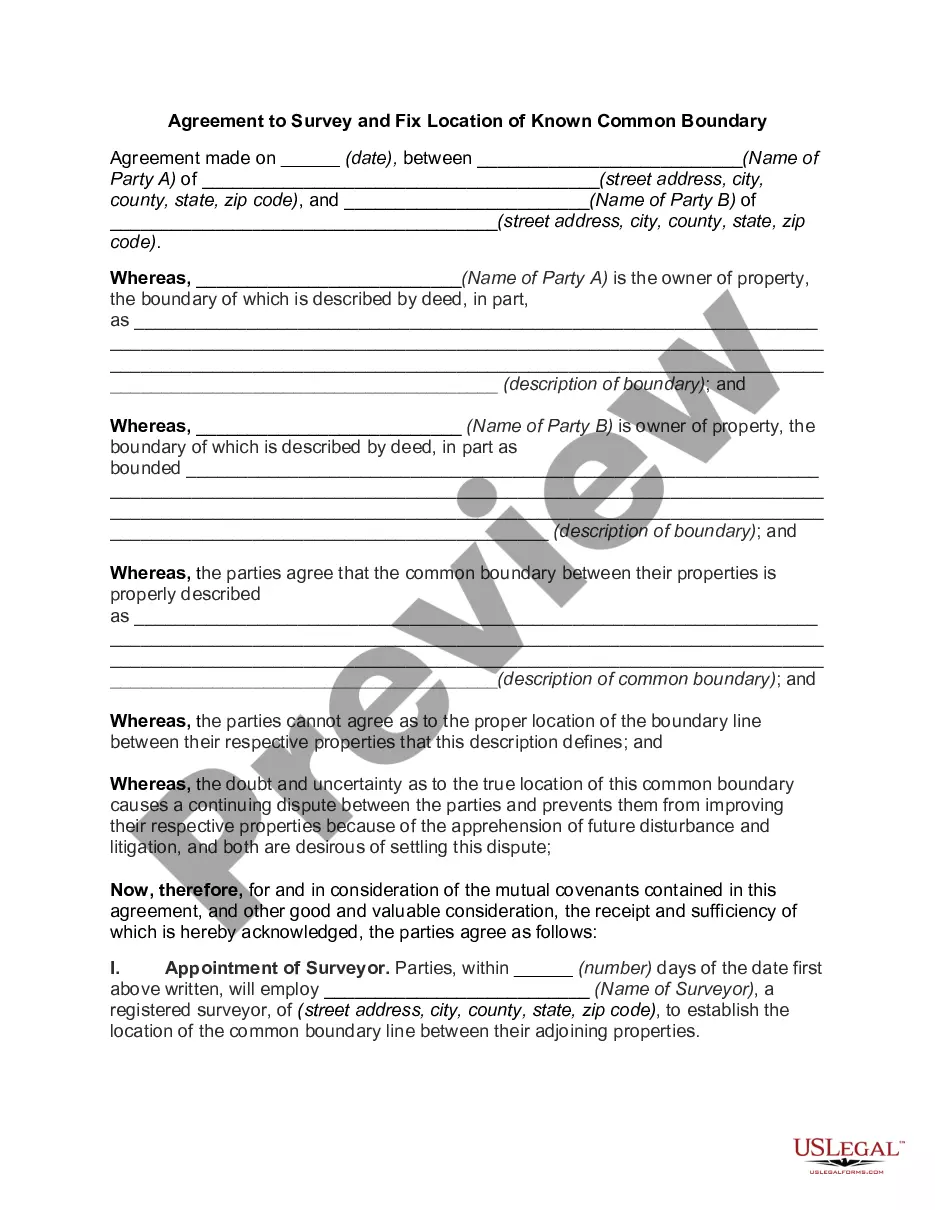
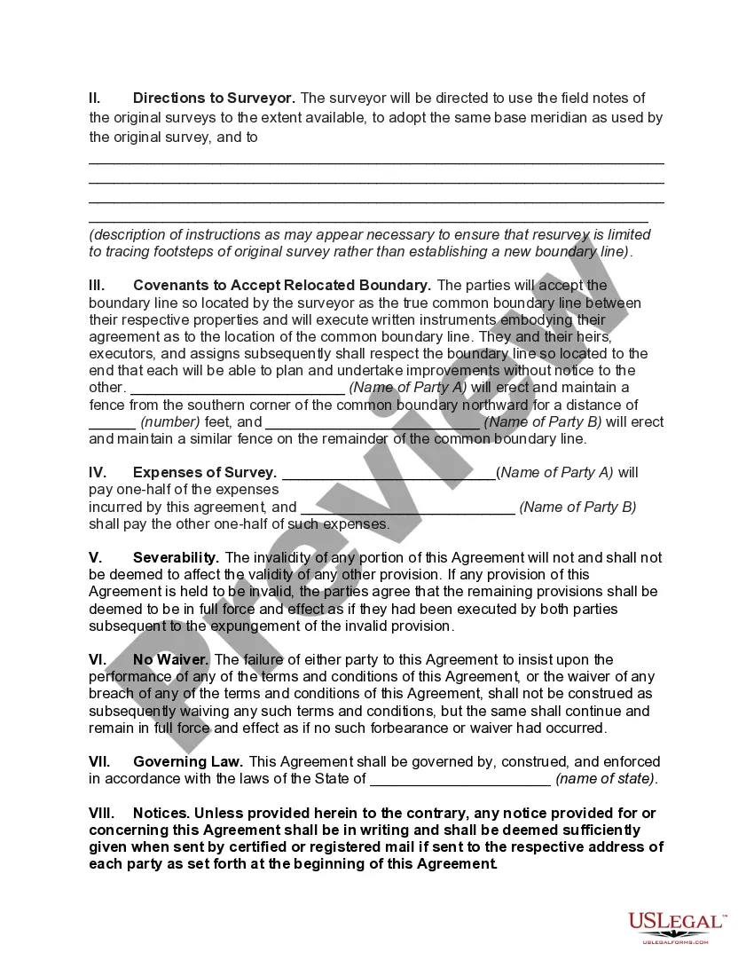
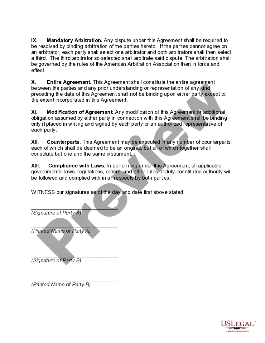
The Ohio Agreement to Survey and Fix Location of Known Common Boundary is a legal document used in Ohio to establish and resolve property boundary disputes between neighboring landowners. This agreement ensures that both parties agree on the exact location of their common property boundary line, avoiding any potential conflicts or confusion in the future. Keywords: Ohio Agreement, Survey, Fix Location, Known Common Boundary, Property Boundary Disputes, Neighboring Landowners, Conflicts, Legal Document. There are two main types of Ohio Agreement to Survey and Fix Location of Known Common Boundary: 1. Voluntary Agreement: This type of agreement is reached between the neighboring landowners without any external legal intervention. Both parties voluntarily agree to survey the property and fix the location of their common boundary line based on their mutual understanding. 2. Court-Mediated Agreement: In some cases, when landowners are unable to reach an agreement on their own, they may involve the court system to resolve the dispute. The court may appoint a surveyor or mediator to determine the exact location of the common boundary line, and both parties must agree to abide by the decision made by the court. Regardless of the type of agreement, the Ohio Agreement to Survey and Fix Location of Known Common Boundary should include the following details: 1. Identification of Parties: The agreement should clearly state the names and addresses of both neighboring landowners involved in the boundary dispute. 2. Property Description: A detailed description of the properties in question should be provided, including legal descriptions, tax map numbers, and any other relevant information that assists in identifying the properties accurately. 3. Boundary Survey: The agreement should outline the process of conducting a boundary survey, which is usually carried out by a professional land surveyor. The survey should be conducted according to state regulations and professional standards. 4. Fixing the Common Boundary Line: The agreement should establish the exact location of the common boundary line based on the survey results. This may involve setting boundary markers or monuments to clearly demarcate the line on the ground. 5. Mutual Agreement: Both parties must consent to the surveyed boundary location and agree to accept it as the official common boundary line. This eliminates any uncertainties or disagreements. 6. Legal Binding: The agreement should state that both parties recognize and accept the surveyed boundary line as the legally binding common boundary between their respective properties. This ensures that both parties are legally obligated to respect and maintain the established boundary line. By utilizing the Ohio Agreement to Survey and Fix Location of Known Common Boundary, landowners can effectively resolve property boundary disputes through an agreed-upon and legally binding solution. It provides a clear and concise definition of the common boundary line, ensuring peaceful coexistence and ownership rights for neighboring landowners. Please note that this is a general description, and it is always recommended consulting with a legal professional or surveyor for specific advice and assistance in drafting and executing an Ohio Agreement to Survey and Fix Location of Known Common Boundary.
Ohio Agreement to Survey and Fix Location of Known Common Boundary
Description
How to fill out Ohio Agreement To Survey And Fix Location Of Known Common Boundary?
Discovering the right authorized papers web template can be a battle. Naturally, there are tons of web templates available online, but how do you discover the authorized form you will need? Utilize the US Legal Forms web site. The services delivers a huge number of web templates, such as the Ohio Agreement to Survey and Fix Location of Known Common Boundary, that you can use for organization and personal requirements. All the varieties are checked by professionals and meet state and federal demands.
Should you be currently signed up, log in for your bank account and click on the Acquire key to obtain the Ohio Agreement to Survey and Fix Location of Known Common Boundary. Make use of bank account to search from the authorized varieties you have bought previously. Visit the My Forms tab of your bank account and have another copy of your papers you will need.
Should you be a whole new consumer of US Legal Forms, here are simple guidelines that you can stick to:
- Initially, ensure you have selected the correct form to your metropolis/county. You can look over the shape making use of the Preview key and read the shape information to make sure it will be the right one for you.
- In case the form fails to meet your expectations, take advantage of the Seach industry to find the appropriate form.
- Once you are positive that the shape would work, select the Buy now key to obtain the form.
- Select the pricing plan you need and enter in the required information and facts. Make your bank account and pay money for the transaction using your PayPal bank account or bank card.
- Pick the data file structure and down load the authorized papers web template for your gadget.
- Full, edit and print and indication the obtained Ohio Agreement to Survey and Fix Location of Known Common Boundary.
US Legal Forms will be the greatest local library of authorized varieties for which you will find numerous papers web templates. Utilize the service to down load appropriately-created papers that stick to status demands.