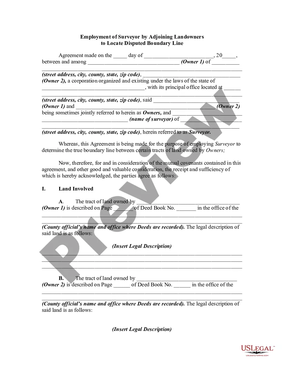
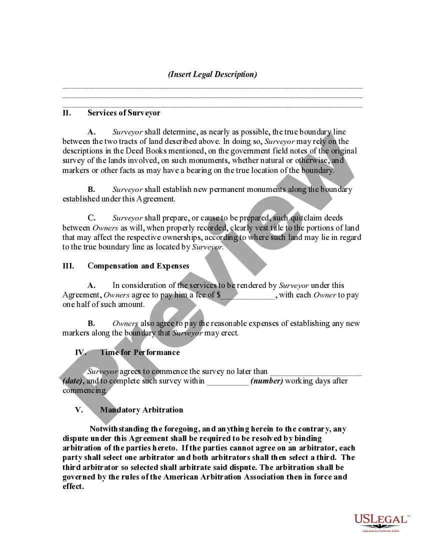
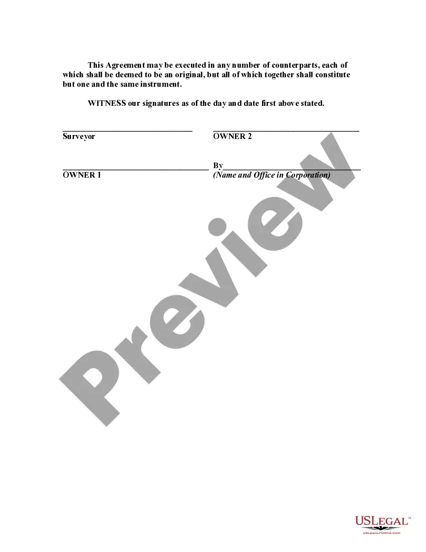
This is a generic sample of an agreement between two adjoining landowners to hire a surveyor to survey their lands in order to settle a dispute as to where the true boundary is regarding their properties.
Oklahoma Employment of Surveyor by Adjoining Landowners to Locate Disputed Boundary Line: A Detailed Description When two adjoining landowners find themselves at odds over the demarcation of a shared boundary, the need for an Oklahoma surveyor arises. The employment of a surveyor can help settle disagreements and determine the precise location of the disputed boundary line. Such disputes can arise due to a variety of reasons, including conflicting property descriptions or unclear historical records. In Oklahoma, the employment of a surveyor by adjoining landowners to locate a disputed boundary line is a crucial step towards resolving territorial conflicts. A surveyor is a trained professional who possesses the expertise to accurately measure and identify property boundaries. Their role is to conduct an in-depth survey of the affected area, utilizing various tools and techniques to establish the correct boundary line. This process often involves examining historical documents, including deeds, plats, and previous land surveys, to gather relevant information about the disputed boundary line. The surveyor liaises with both landowners to understand their respective claims and concerns, ensuring that the final determination is fair and unbiased. In Oklahoma, there are several types of employment of surveyors by adjoining landowners to locate a disputed boundary line. These types can include: 1. Residential Boundary Disputes: This type of survey involves resolving boundary conflicts that primarily affect residential properties. It may arise due to confusion caused by vague property descriptions or encroachments by neighboring structures or landscaping. 2. Agricultural and Rural Boundary Disputes: Disagreements over property boundaries in rural areas are quite common, particularly where large tracts of land are involved. These disputes may revolve around issues such as conflicting fence lines, access to resources such as water sources, or disagreements over easements and right-of-way. 3. Commercial and Industrial Boundary Disputes: In more urbanized areas or places with commercial and industrial developments, boundary disputes can arise due to the expansion of businesses, zoning changes, or the need for accurate property line identification for construction projects. Regardless of the type of dispute, the employment of a surveyor aims to provide a thorough analysis of the disputed boundary line. The surveyor will conduct field surveys using advanced measuring tools like the Global Positioning System (GPS), total stations, and other traditional surveying instruments. This allows them to create detailed maps, known as boundary surveys or plats, which accurately depict the disputed boundary and its surrounding features. The role of an Oklahoma surveyor in resolving boundary disputes extends beyond simply locating the disputed boundary line. They may also assist in providing expert testimony if the matter progresses to legal proceedings. Surveyors are expected to maintain a high level of professionalism, adhere to ethical standards, and uphold the principles of accuracy and fairness throughout the surveying process. In summary, an Oklahoma employment of a surveyor by adjoining landowners to locate a disputed boundary line is a vital step towards resolving conflicts and establishing clear property boundaries. Through meticulous research, on-site measurements, and the application of advanced surveying technology, surveyors play a significant role in ensuring a fair and accurate determination of property boundaries in Oklahoma.Oklahoma Employment of Surveyor by Adjoining Landowners to Locate Disputed Boundary Line: A Detailed Description When two adjoining landowners find themselves at odds over the demarcation of a shared boundary, the need for an Oklahoma surveyor arises. The employment of a surveyor can help settle disagreements and determine the precise location of the disputed boundary line. Such disputes can arise due to a variety of reasons, including conflicting property descriptions or unclear historical records. In Oklahoma, the employment of a surveyor by adjoining landowners to locate a disputed boundary line is a crucial step towards resolving territorial conflicts. A surveyor is a trained professional who possesses the expertise to accurately measure and identify property boundaries. Their role is to conduct an in-depth survey of the affected area, utilizing various tools and techniques to establish the correct boundary line. This process often involves examining historical documents, including deeds, plats, and previous land surveys, to gather relevant information about the disputed boundary line. The surveyor liaises with both landowners to understand their respective claims and concerns, ensuring that the final determination is fair and unbiased. In Oklahoma, there are several types of employment of surveyors by adjoining landowners to locate a disputed boundary line. These types can include: 1. Residential Boundary Disputes: This type of survey involves resolving boundary conflicts that primarily affect residential properties. It may arise due to confusion caused by vague property descriptions or encroachments by neighboring structures or landscaping. 2. Agricultural and Rural Boundary Disputes: Disagreements over property boundaries in rural areas are quite common, particularly where large tracts of land are involved. These disputes may revolve around issues such as conflicting fence lines, access to resources such as water sources, or disagreements over easements and right-of-way. 3. Commercial and Industrial Boundary Disputes: In more urbanized areas or places with commercial and industrial developments, boundary disputes can arise due to the expansion of businesses, zoning changes, or the need for accurate property line identification for construction projects. Regardless of the type of dispute, the employment of a surveyor aims to provide a thorough analysis of the disputed boundary line. The surveyor will conduct field surveys using advanced measuring tools like the Global Positioning System (GPS), total stations, and other traditional surveying instruments. This allows them to create detailed maps, known as boundary surveys or plats, which accurately depict the disputed boundary and its surrounding features. The role of an Oklahoma surveyor in resolving boundary disputes extends beyond simply locating the disputed boundary line. They may also assist in providing expert testimony if the matter progresses to legal proceedings. Surveyors are expected to maintain a high level of professionalism, adhere to ethical standards, and uphold the principles of accuracy and fairness throughout the surveying process. In summary, an Oklahoma employment of a surveyor by adjoining landowners to locate a disputed boundary line is a vital step towards resolving conflicts and establishing clear property boundaries. Through meticulous research, on-site measurements, and the application of advanced surveying technology, surveyors play a significant role in ensuring a fair and accurate determination of property boundaries in Oklahoma.