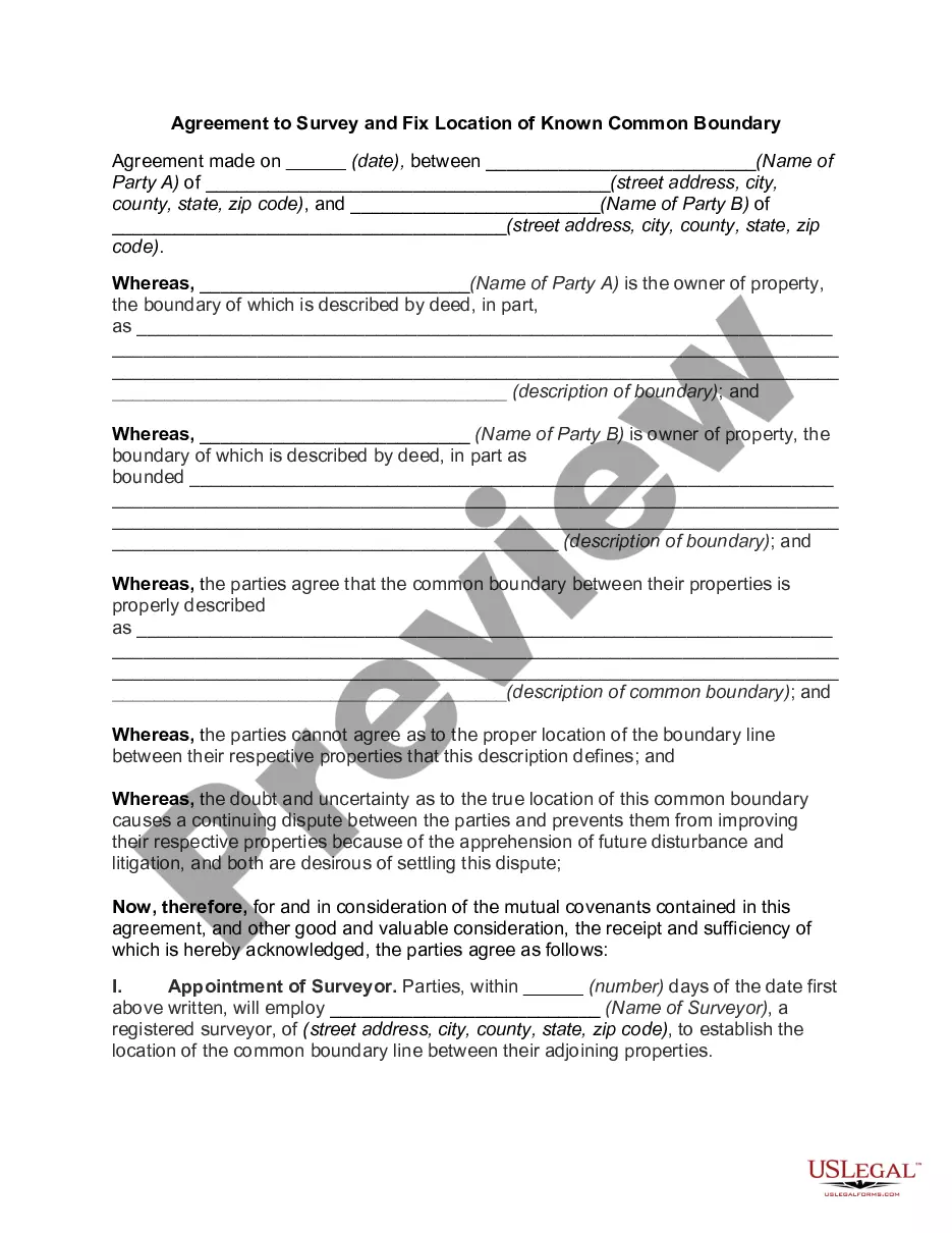
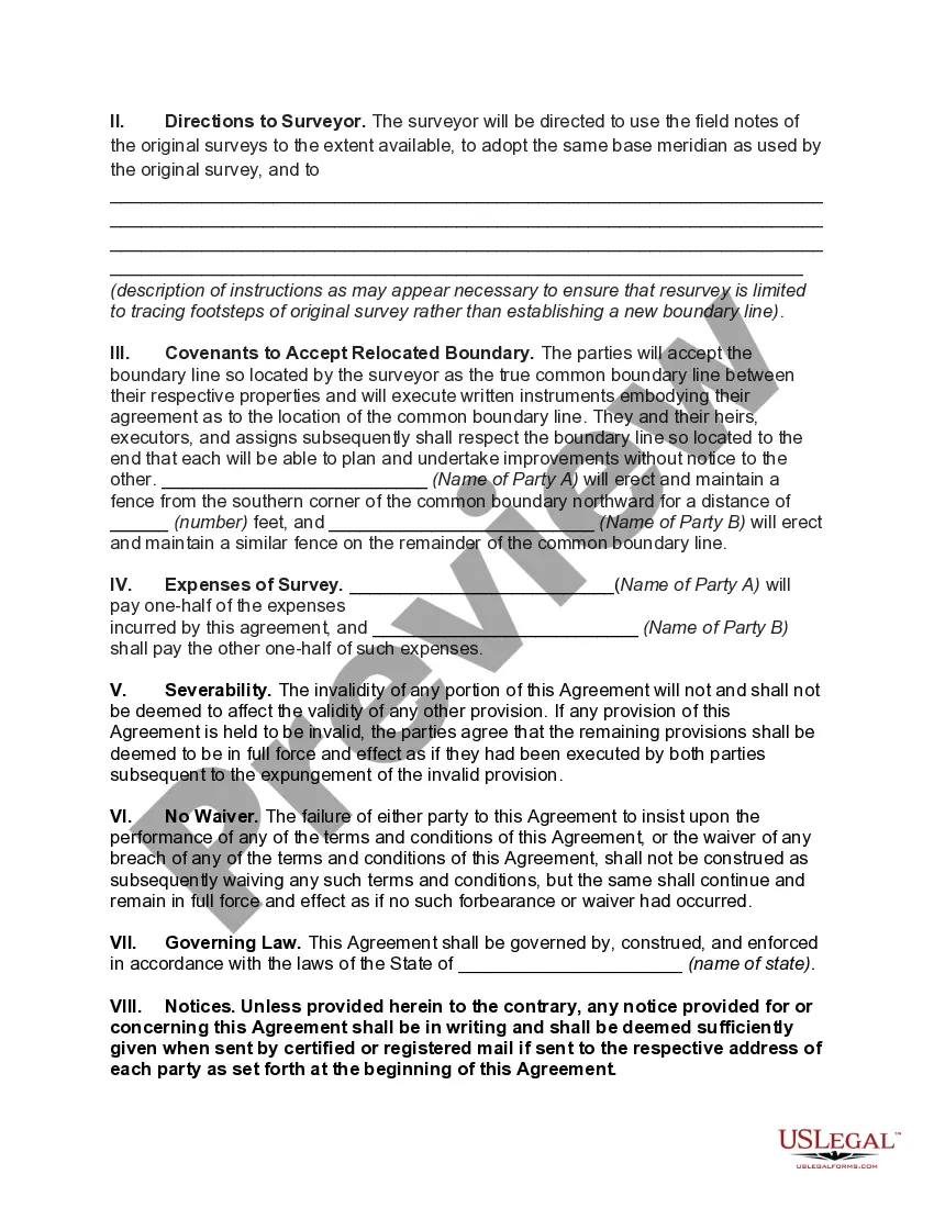
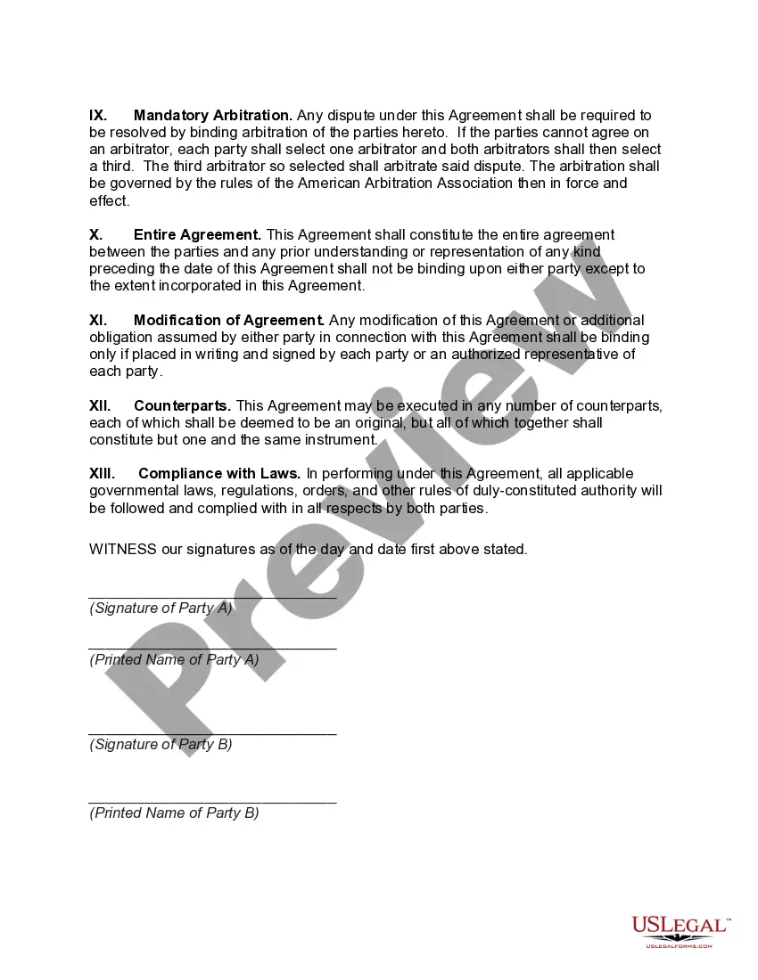
Oregon Agreement to Survey and Fix Location of Known Common Boundary is a legal document that helps resolve boundary disputes between adjacent landowners in the state of Oregon, United States. This agreement is used when there is uncertainty or disagreement about the exact location of a shared boundary line between two properties. The purpose of this document is to establish a clear and definitive boundary line that both parties can agree upon. It outlines the process of surveying the disputed area, conducting necessary measurements, and ultimately fixing the location of the common boundary. This agreement provides a framework for cooperation, negotiation, and resolution, all aimed at preventing or resolving conflicts related to property boundaries. Its importance lies in providing a legally binding solution to disputing parties and ensuring a fair and equitable outcome. By determining the exact position of the common boundary, this agreement helps prevent future conflicts and promotes a more harmonious relationship between neighbors. Different types of Oregon Agreement to Survey and Fix Location of Known Common Boundary may include: 1. Boundary Location Agreement: This type of agreement is used when both parties have a general understanding of the boundary's location but want to formalize it legally. It involves surveying the area and documenting the agreed-upon boundary line. 2. Boundary Dispute Resolution Agreement: This type is utilized when the parties have conflicting interpretations or significant uncertainty regarding the common boundary. It involves conducting a thorough survey, analyzing property deeds, historical records, and other relevant information to determine the accurate location of the boundary. This agreement aims to resolve the dispute amicably and establish a clear boundary line once and for all. 3. Boundary Re-establishment Agreement: This agreement is applicable when the existing boundary has been lost, damaged, or destroyed over time, causing confusion or disagreement between property owners. It entails conducting a detailed survey, examining historical documentation, and utilizing expert insights to re-establish the original boundary line accurately. Keywords: Oregon, Agreement to Survey and Fix Location of Known Common Boundary, boundary disputes, adjacent landowners, legal document, boundary line, surveying, measurements, resolution, negotiations, conflicts, property boundaries, legally binding solution, harmonious relationship, Boundary Location Agreement, Boundary Dispute Resolution Agreement, Boundary Re-establishment Agreement.
Oregon Agreement to Survey and Fix Location of Known Common Boundary is a legal document that helps resolve boundary disputes between adjacent landowners in the state of Oregon, United States. This agreement is used when there is uncertainty or disagreement about the exact location of a shared boundary line between two properties. The purpose of this document is to establish a clear and definitive boundary line that both parties can agree upon. It outlines the process of surveying the disputed area, conducting necessary measurements, and ultimately fixing the location of the common boundary. This agreement provides a framework for cooperation, negotiation, and resolution, all aimed at preventing or resolving conflicts related to property boundaries. Its importance lies in providing a legally binding solution to disputing parties and ensuring a fair and equitable outcome. By determining the exact position of the common boundary, this agreement helps prevent future conflicts and promotes a more harmonious relationship between neighbors. Different types of Oregon Agreement to Survey and Fix Location of Known Common Boundary may include: 1. Boundary Location Agreement: This type of agreement is used when both parties have a general understanding of the boundary's location but want to formalize it legally. It involves surveying the area and documenting the agreed-upon boundary line. 2. Boundary Dispute Resolution Agreement: This type is utilized when the parties have conflicting interpretations or significant uncertainty regarding the common boundary. It involves conducting a thorough survey, analyzing property deeds, historical records, and other relevant information to determine the accurate location of the boundary. This agreement aims to resolve the dispute amicably and establish a clear boundary line once and for all. 3. Boundary Re-establishment Agreement: This agreement is applicable when the existing boundary has been lost, damaged, or destroyed over time, causing confusion or disagreement between property owners. It entails conducting a detailed survey, examining historical documentation, and utilizing expert insights to re-establish the original boundary line accurately. Keywords: Oregon, Agreement to Survey and Fix Location of Known Common Boundary, boundary disputes, adjacent landowners, legal document, boundary line, surveying, measurements, resolution, negotiations, conflicts, property boundaries, legally binding solution, harmonious relationship, Boundary Location Agreement, Boundary Dispute Resolution Agreement, Boundary Re-establishment Agreement.