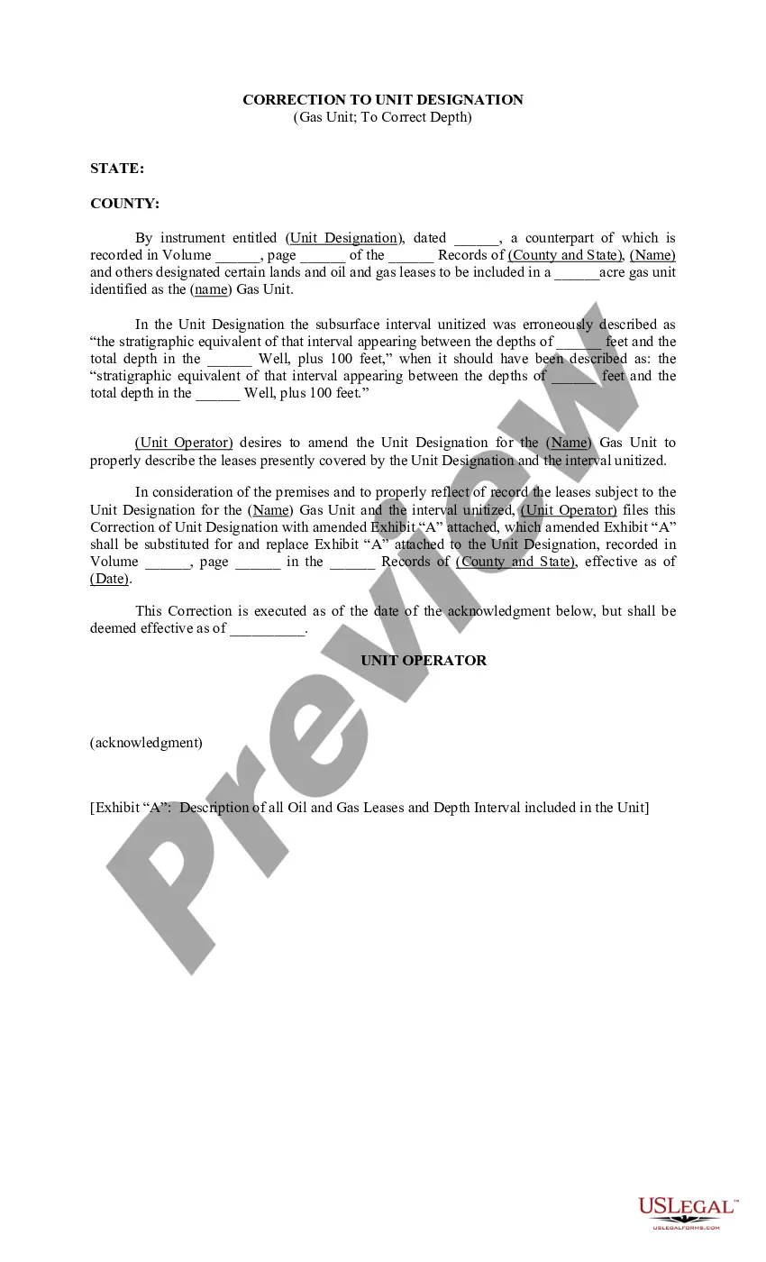
Tennessee Correction to Unit Designation to Correct Depth refers to the process undertaken to rectify errors or inaccuracies in the designation of units' depths in the state of Tennessee. This correction involves ensuring that the measurements and categorizations of various units within the state are accurately represented. The Tennessee Correction to Unit Designation to Correct Depth is crucial for maintaining the integrity and accuracy of geological and geographical data. It helps to eliminate inconsistencies in depth measurements, which may arise due to human error, technological limitations, or outdated information. Different types of Tennessee Correction to Unit Designation to Correct Depth can be classified based on the specific units being addressed. Here are a few examples: 1. Tennessee Correction to Unit Designation for Aquifers: This type of correction focuses on rectifying any errors in the designation of aquifer depths. Aquifers are crucial sources of groundwater, and accurate depth measurements are essential for effective water resource management. 2. Tennessee Correction to Unit Designation for Geological Strata: In this case, the correction aims to rectify inaccuracies in the designation of depths for various geological strata. Accurate depth representation is significant for geological studies, mineral exploration, and mapping. 3. Tennessee Correction to Unit Designation for Oil and Gas Reservoirs: This type of correction involves updating the depths of oil and gas reservoir units. Accurate depth information is crucial for exploration, production, and strategic planning in the energy sector. 4. Tennessee Correction to Unit Designation for Geological Formations: This correction focuses on ensuring accurate depths for distinct geological formations within the state. Accurate depth data aids in various applications like geologic mapping, hazard assessment, and understanding the state's geological history. The Tennessee Correction to Unit Designation to Correct Depth process typically involves extensive research, data analysis, and collaboration among geologists, hydrologists, and other relevant experts. Updated measurements are documented and incorporated into databases, maps, and reports providing reliable information for ongoing studies and future planning. In summary, the Tennessee Correction to Unit Designation to Correct Depth refers to the vital process of rectifying inaccuracies in depth measurements for various units in the state. It plays a critical role in maintaining the integrity of geological data, enabling efficient resource management, and facilitating informed decision-making in relation to aquifers, geological strata, oil and gas reservoirs, and geological formations.
Tennessee Correction to Unit Designation to Correct Depth
Description
How to fill out Tennessee Correction To Unit Designation To Correct Depth?
Finding the right lawful record web template can be a have difficulties. Obviously, there are a lot of templates available on the net, but how can you discover the lawful develop you will need? Make use of the US Legal Forms internet site. The services offers thousands of templates, including the Tennessee Correction to Unit Designation to Correct Depth, that you can use for business and personal needs. Every one of the types are checked out by professionals and meet up with state and federal specifications.
If you are already registered, log in to your bank account and click on the Download button to get the Tennessee Correction to Unit Designation to Correct Depth. Use your bank account to check through the lawful types you possess purchased formerly. Visit the My Forms tab of the bank account and acquire yet another copy in the record you will need.
If you are a fresh user of US Legal Forms, here are easy instructions that you can stick to:
- First, be sure you have chosen the right develop to your metropolis/area. You may look through the form while using Review button and browse the form explanation to make certain it is the best for you.
- When the develop will not meet up with your requirements, use the Seach industry to find the proper develop.
- Once you are sure that the form is proper, go through the Purchase now button to get the develop.
- Select the prices strategy you desire and enter the needed details. Create your bank account and buy the order utilizing your PayPal bank account or Visa or Mastercard.
- Select the document formatting and obtain the lawful record web template to your gadget.
- Comprehensive, change and printing and indication the attained Tennessee Correction to Unit Designation to Correct Depth.
US Legal Forms will be the largest catalogue of lawful types for which you can find numerous record templates. Make use of the service to obtain expertly-created papers that stick to state specifications.