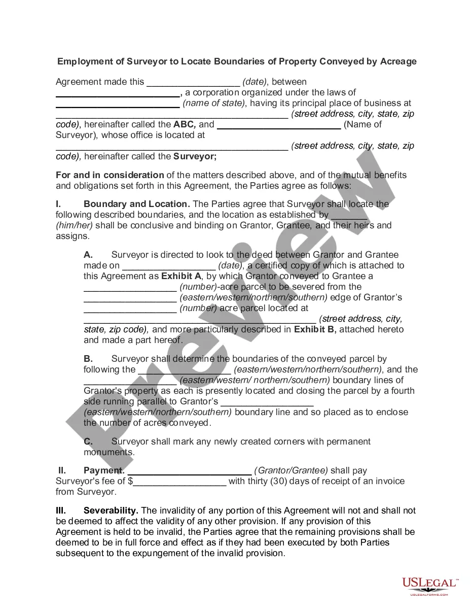
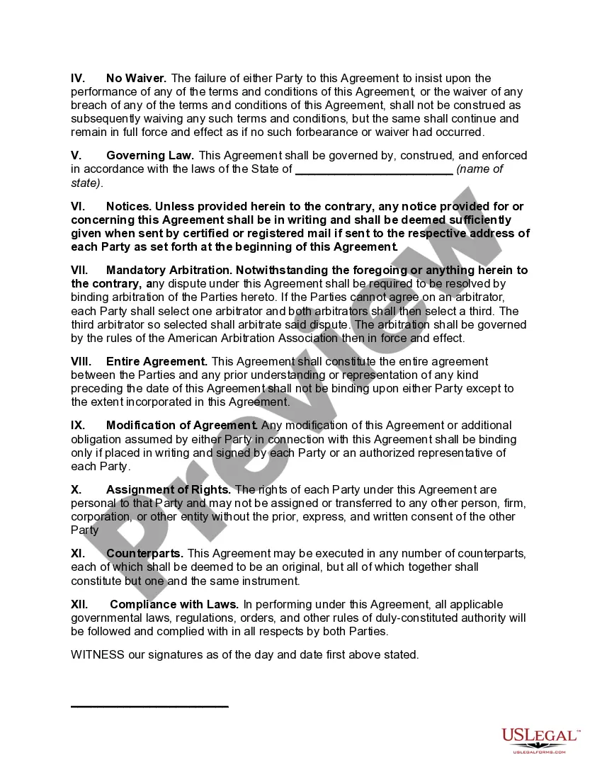
The Employment of Surveyor to Locate Boundaries of Property Conveyed by Acreage is a process used to measure, analyze, and map the land boundaries of properties conveyed by acreage. This process involves the use of surveying equipment and technology such as GPS, total station, and aerial photography, as well as the application of land surveying principles to accurately plot the boundaries of the properties. The land surveyor is responsible for measuring and recording the exact location of each boundary line, as well as creating a map of the property for legal documentation. There are two distinct types of Employment of Surveyor to Locate Boundaries of Property Conveyed by Acreage: Gravitational and Geodetic Surveys. Gravitational Surveys involve the use of survey grade instruments such as theodolites and levels to measure angles and elevations in order to precisely determine the location of boundary lines. These surveys are typically used to locate boundaries of large tracts of land. Geodetic Surveys are used for smaller properties and involve the use of GPS and aerial photography to accurately locate and map out the boundaries of the property. These surveys are often used in cases where the exact location of the boundaries is not known.
Employment of Surveyor to Locate Boundaries of Property Conveyed by Acreage
Description
How to fill out Employment Of Surveyor to Locate Boundaries Of Property Conveyed By Acreage?
How much time and resources do you normally spend on composing official paperwork? There’s a greater opportunity to get such forms than hiring legal experts or wasting hours searching the web for a suitable template. US Legal Forms is the premier online library that offers professionally designed and verified state-specific legal documents for any purpose, like the Employment of Surveyor to Locate Boundaries of Property Conveyed by Acreage.
To acquire and complete an appropriate Employment of Surveyor to Locate Boundaries of Property Conveyed by Acreage template, follow these simple instructions:
- Look through the form content to ensure it meets your state regulations. To do so, check the form description or take advantage of the Preview option.
- If your legal template doesn’t meet your requirements, find another one using the search bar at the top of the page.
- If you already have an account with us, log in and download the Employment of Surveyor to Locate Boundaries of Property Conveyed by Acreage. Otherwise, proceed to the next steps.
- Click Buy now once you find the right document. Choose the subscription plan that suits you best to access our library’s full service.
- Create an account and pay for your subscription. You can make a transaction with your credit card or through PayPal - our service is absolutely secure for that.
- Download your Employment of Surveyor to Locate Boundaries of Property Conveyed by Acreage on your device and complete it on a printed-out hard copy or electronically.
Another advantage of our library is that you can access previously acquired documents that you safely store in your profile in the My Forms tab. Obtain them at any moment and re-complete your paperwork as often as you need.
Save time and effort completing official paperwork with US Legal Forms, one of the most reliable web solutions. Sign up for us now!
Form popularity
FAQ
How do I see property lines on Google Maps? Google Maps will display property lines if you type your address into the 'Search Google Maps' search bar and zoom into the property closely enough.
Boundary Survey This type of land survey is used to locate the corners and property boundary lines of a parcel of land. A boundary survey will use both recorded deeds and physical markers to define the boundary lines on a piece of land. A boundary survey does require both record and field research.
Every parcel of land whose boundaries are surveyed by a licensed surveyor should be made conformable with the record title boundaries of such land.
How to Figure Out Your Boundaries Tune into your emotions. ing to Howes, the strongest indicator of our boundaries is our emotions.Tune into your thoughts.Ask others.Get clear on your values.
A property line basemap, or a ?plat,? is a drawing that maps out your property's boundary lines and includes details like elevations, bodies of water and structures. You might even be able to find property maps of neighboring properties if you have shared property lines.
The Arkansas Supreme Court requires a minimum of seven year to claim property through boundary by acquiescence. However, some cases merely require a ?long-period of time.? This opens the door for arguments that boundaries can be taken in less than seven years.
A boundary survey is a process carried out to determine property lines and define true property corners of a parcel of land described in a deed. It also indicates the extent of any easements or encroachments and may show the limitations imposed on the property by state or local regulations.