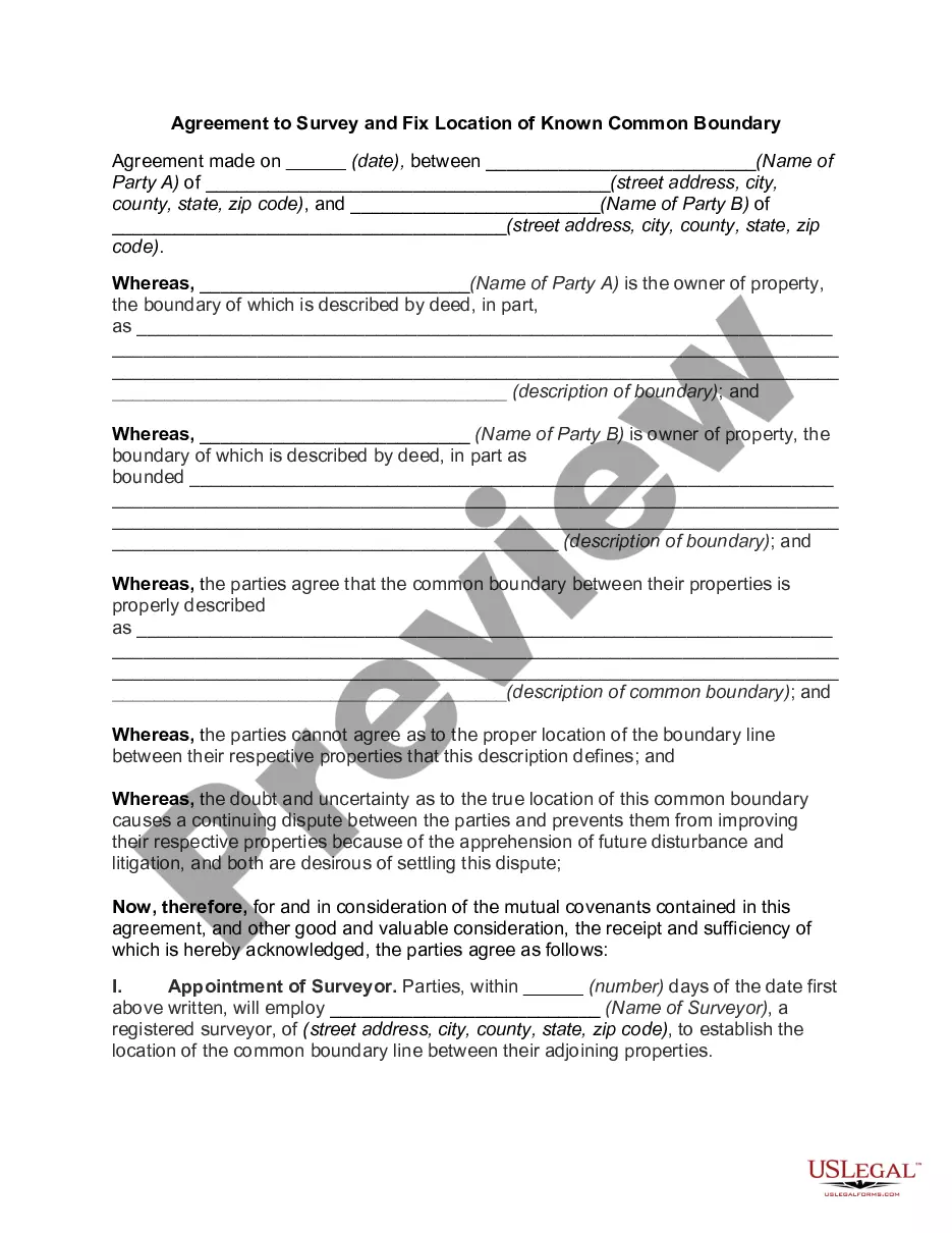
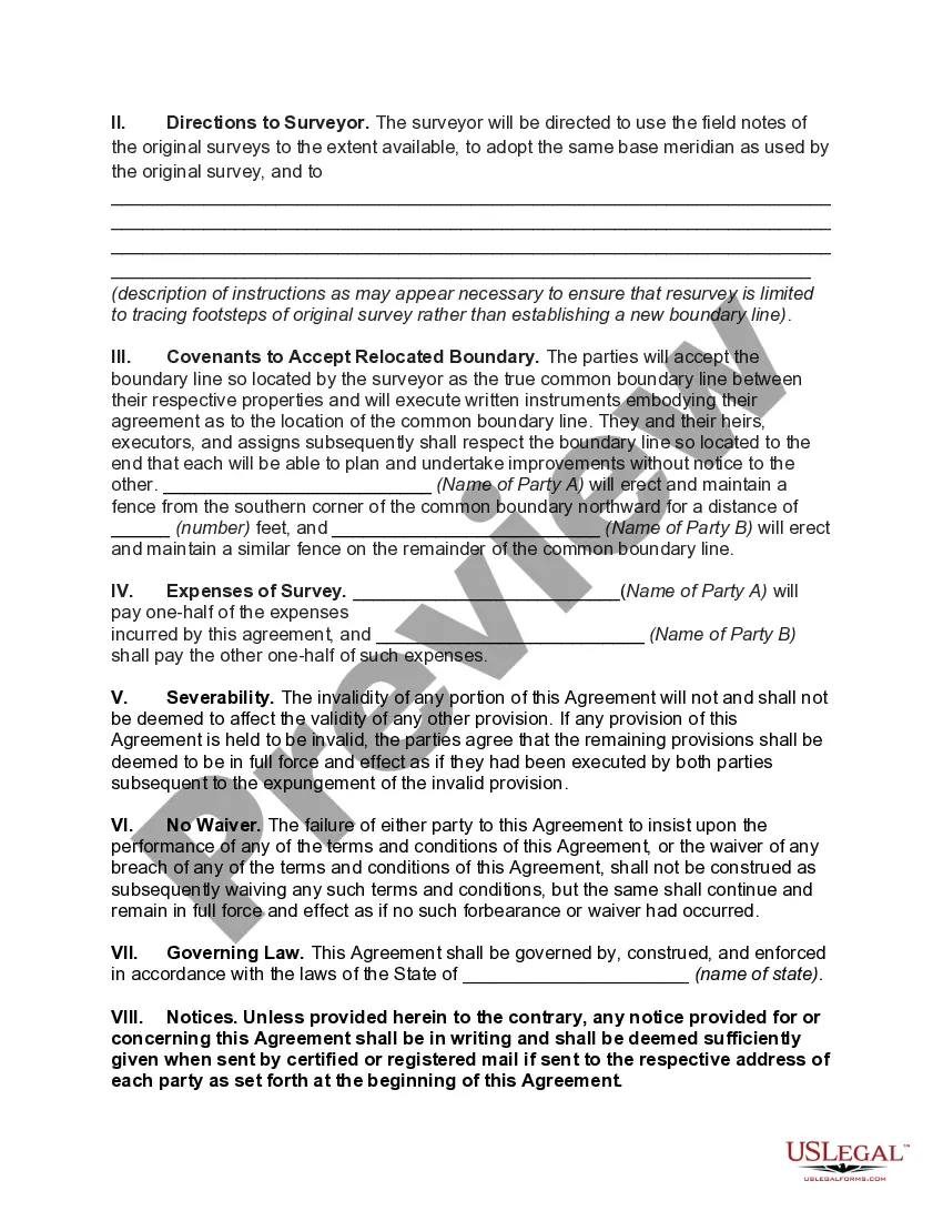
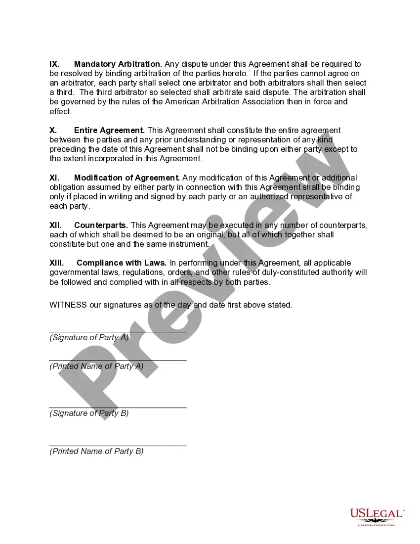
The Virgin Islands Agreement to Survey and Fix Location of Known Common Boundary is a legal document that outlines the process and terms for determining the exact location of a common boundary between two defined areas in the Virgin Islands. This agreement is crucial in resolving any disputes or uncertainties regarding property boundaries, as it ensures clarity and accuracy. The purpose of the Virgin Islands Agreement to Survey and Fix Location of Known Common Boundary is to provide a framework for conducting a comprehensive survey that will establish the precise location of the shared boundary line. This document serves as a reference for surveyors, landowners, and relevant authorities involved in defining and confirming property limits. There may be different types of Virgin Islands Agreement to Survey and Fix Location of Known Common Boundary, depending on the specific circumstances and properties involved. Some common variations may include: 1. Virgin Islands Agreement to Survey and Fix Location of Known Common Boundary for Residential Properties: This type of agreement is commonly used for adjacent residential properties that share a common border. It ensures that homeowners maintain a clear understanding of the exact boundaries of their respective properties. 2. Virgin Islands Agreement to Survey and Fix Location of Known Common Boundary for Commercial Properties: This variant focuses on setting precise boundaries for neighboring commercial properties. It is crucial for business owners and developers to accurately determine the limits of their land to avoid potential conflicts or legal issues. 3. Virgin Islands Agreement to Survey and Fix Location of Known Common Boundary for Public Land: This type of agreement applies to areas such as parks, public facilities, or natural reserves. It aims to establish clear boundaries to ensure proper management and protection of public land. In summary, the Virgin Islands Agreement to Survey and Fix Location of Known Common Boundary plays a critical role in clarifying property boundaries and resolving any disputes. It is a legally binding document that outlines the process and terms for conducting a survey to accurately determine the location of the shared boundary. Depending on the property type, specific variations of this agreement exist to cater to the unique requirements of residential, commercial, or public land.
Virgin Islands Agreement to Survey and Fix Location of Known Common Boundary
Description
How to fill out Virgin Islands Agreement To Survey And Fix Location Of Known Common Boundary?
Choosing the right authorized papers template can be quite a struggle. Of course, there are tons of web templates available on the Internet, but how will you get the authorized form you require? Make use of the US Legal Forms site. The service gives thousands of web templates, for example the Virgin Islands Agreement to Survey and Fix Location of Known Common Boundary, that can be used for business and private needs. Each of the forms are checked by experts and satisfy federal and state demands.
When you are currently authorized, log in for your profile and click the Obtain key to find the Virgin Islands Agreement to Survey and Fix Location of Known Common Boundary. Make use of profile to look throughout the authorized forms you might have bought earlier. Proceed to the My Forms tab of your respective profile and obtain yet another version of your papers you require.
When you are a fresh end user of US Legal Forms, listed here are simple guidelines that you should adhere to:
- Very first, make certain you have chosen the proper form to your metropolis/county. It is possible to look over the form using the Preview key and read the form description to ensure it will be the best for you.
- If the form is not going to satisfy your expectations, utilize the Seach field to find the appropriate form.
- When you are certain the form is acceptable, click on the Buy now key to find the form.
- Opt for the prices program you want and enter the needed details. Create your profile and pay money for an order using your PayPal profile or bank card.
- Opt for the document format and acquire the authorized papers template for your device.
- Total, modify and print and indicator the acquired Virgin Islands Agreement to Survey and Fix Location of Known Common Boundary.
US Legal Forms may be the largest library of authorized forms that you can find numerous papers web templates. Make use of the company to acquire skillfully-manufactured files that adhere to state demands.