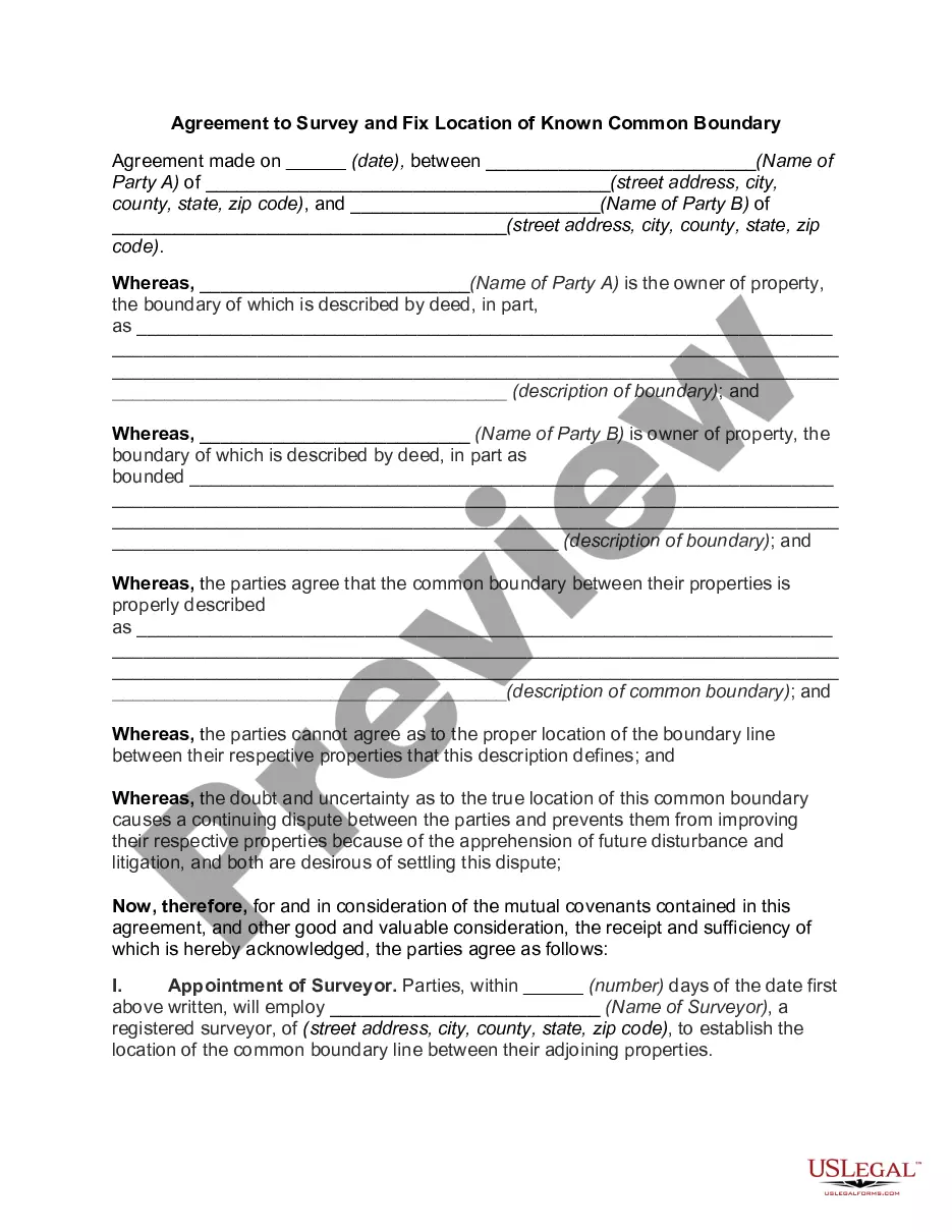
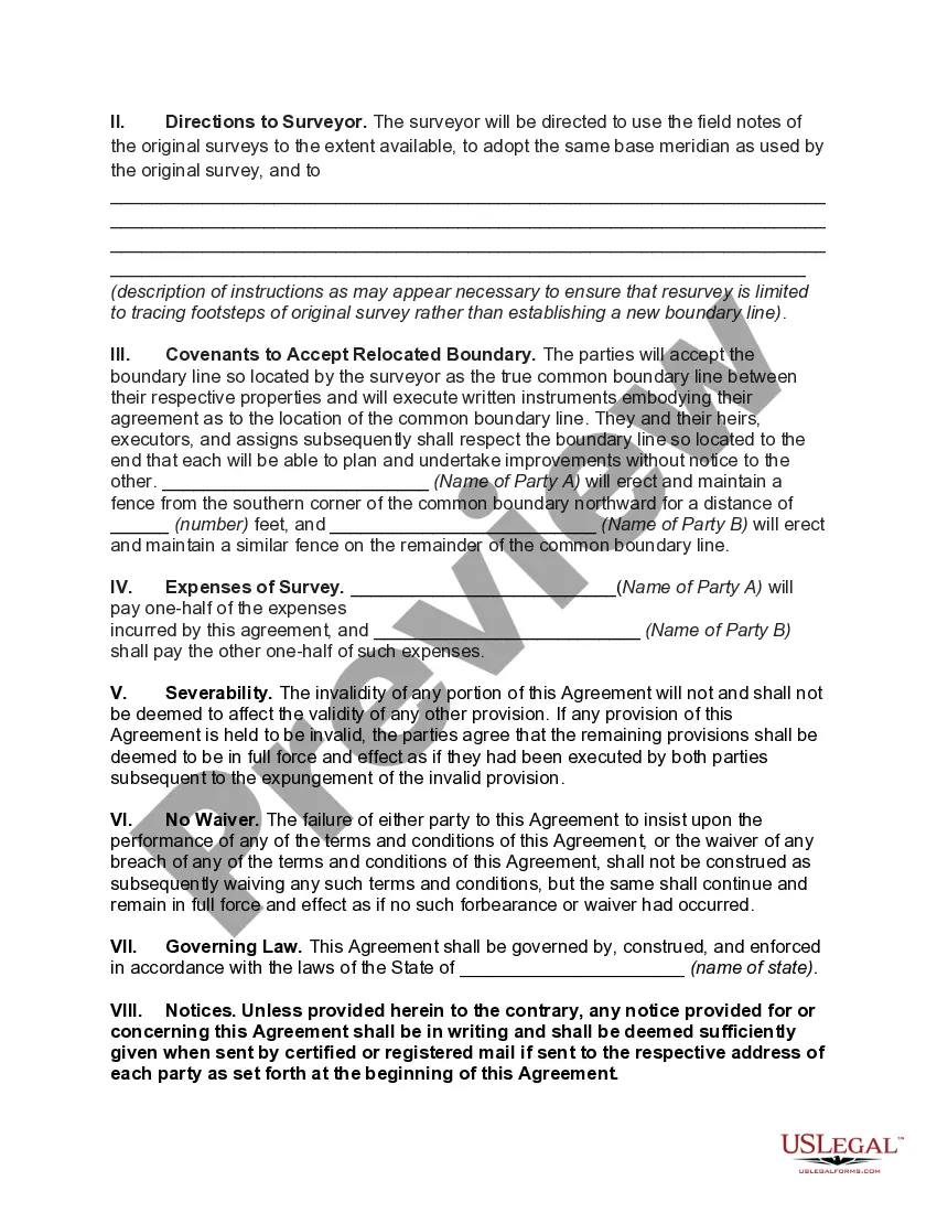
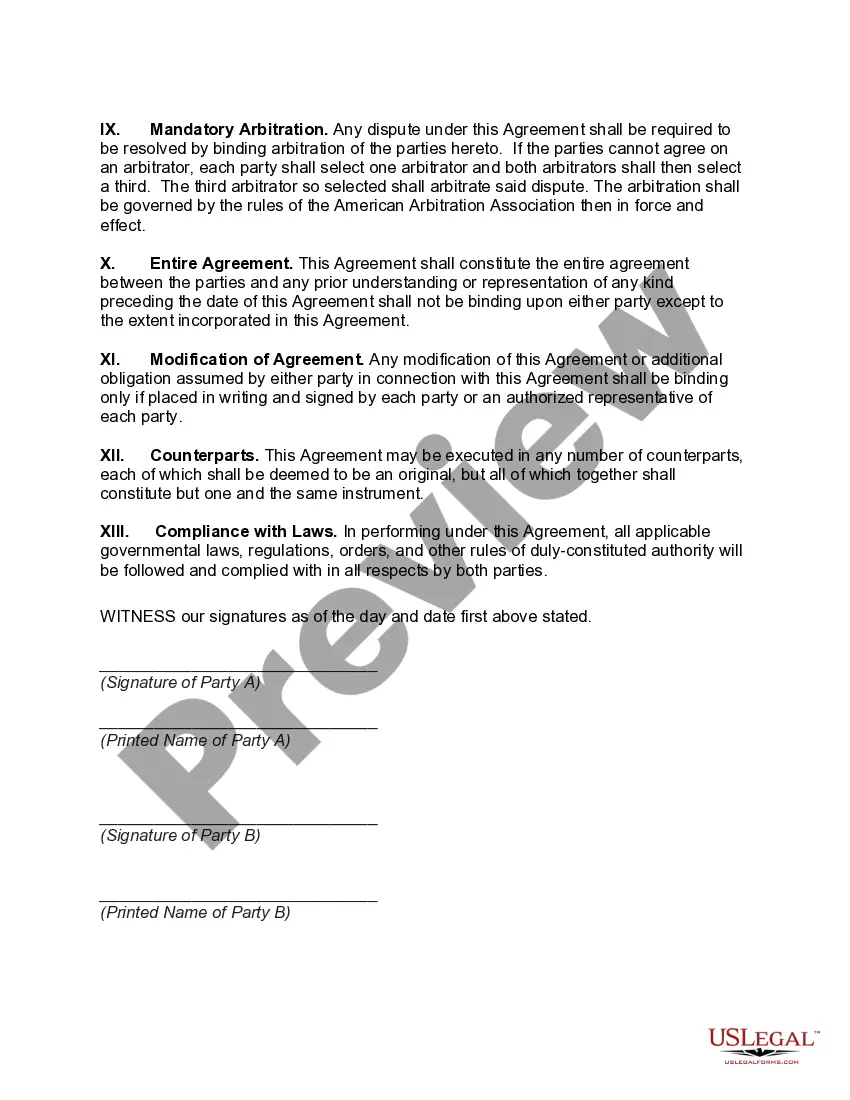
The Washington Agreement to Survey and Fix Location of Known Common Boundary refers to a significant treaty signed between two or more countries to delineate and establish the precise location of their shared or common boundary. This agreement aims to resolve any disputes, provide clarity, and prevent future conflicts related to territorial boundaries. The keyword "Washington Agreement" refers to the location where the agreement was concluded. The term "Survey and Fix Location" emphasizes the main objectives of the agreement, which include conducting surveys and mapping exercises to establish the accurate coordinates and demarcate the boundary line. "Known Common Boundary" specifies that the agreement pertains to an already established border that is recognized by the involved parties. Different types or variations of the Washington Agreement to Survey and Fix Location of Known Common Boundary may exist based on the specific countries involved or the circumstances of the agreement. Some possible examples could include: 1. The Washington Agreement to Survey and Fix Location of Known Common Boundary between Country A and Country B: This type of agreement would be specific to two particular nations and would focus on resolving any disputes or uncertainties regarding their shared boundary. 2. The Washington Agreement to Survey and Fix Location of Known Common Boundary in a Specific Region: This variation may involve multiple countries within a defined region. It aims to determine the precise locations of shared boundaries among these nations to enhance regional stability and cooperation. 3. The Washington Agreement to Survey and Fix Location of Known Common Maritime Boundary: This type of agreement might apply to countries with adjacent coastlines or maritime borders. It seeks to establish the precise line separating each nation's maritime territories and exclusive economic zones. In summary, the Washington Agreement to Survey and Fix Location of Known Common Boundary is a treaty that aims to accurately define and demarcate shared borderlines between countries. It emphasizes conducting surveys, mapping exercises, and resolving any disputes surrounding these boundaries. Different types of agreements can exist based on the countries involved or the specific region or maritime area being addressed.
Washington Agreement to Survey and Fix Location of Known Common Boundary
Description
How to fill out Washington Agreement To Survey And Fix Location Of Known Common Boundary?
US Legal Forms - one of the greatest libraries of legal kinds in the USA - gives a wide array of legal file web templates you are able to download or print out. Making use of the website, you may get a huge number of kinds for company and individual uses, categorized by categories, claims, or key phrases.You can get the latest versions of kinds such as the Washington Agreement to Survey and Fix Location of Known Common Boundary within minutes.
If you already have a registration, log in and download Washington Agreement to Survey and Fix Location of Known Common Boundary in the US Legal Forms local library. The Down load button will show up on each form you perspective. You gain access to all previously acquired kinds within the My Forms tab of your own account.
In order to use US Legal Forms initially, here are easy directions to get you started off:
- Be sure to have selected the correct form for your personal metropolis/area. Select the Review button to review the form`s articles. Browse the form outline to ensure that you have selected the proper form.
- When the form does not match your needs, make use of the Lookup field towards the top of the display screen to discover the one who does.
- If you are happy with the form, confirm your option by clicking the Acquire now button. Then, select the costs program you favor and supply your credentials to register for an account.
- Process the purchase. Utilize your Visa or Mastercard or PayPal account to perform the purchase.
- Pick the structure and download the form on your own product.
- Make adjustments. Fill up, modify and print out and sign the acquired Washington Agreement to Survey and Fix Location of Known Common Boundary.
Every design you put into your money does not have an expiry day which is your own property forever. So, in order to download or print out one more duplicate, just visit the My Forms portion and then click around the form you need.
Get access to the Washington Agreement to Survey and Fix Location of Known Common Boundary with US Legal Forms, by far the most substantial local library of legal file web templates. Use a huge number of specialist and state-specific web templates that meet up with your business or individual demands and needs.