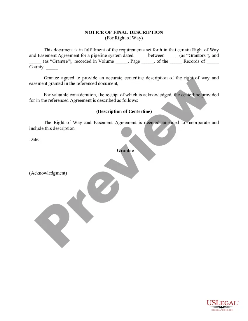
Wyoming Notice of Final Description (For Right of Way) is a legal document used in the state of Wyoming to provide an accurate and detailed description of a right-of-way property. This document is crucial, as it serves as a finalization of a right-of-way acquisition project, ensuring that all parties involved have a clear understanding of the property being acquired. The Wyoming Notice of Final Description outlines the specific details of the right-of-way, including the legal boundaries, dimensions, and any other significant features. It is prepared by a professional land surveyor or a licensed engineer, who thoroughly reviews the property and determines the precise measurements and boundaries. In Wyoming, there are different types of Notice of Final Description (For Right of Way) depending on the purpose and location. Some examples are: 1. Highway Right of Way Notice of Final Description: This type of Notice of Final Description pertains to road and highway projects. It includes detailed information about the land being acquired for the construction, expansion, or maintenance of highways, bridges, and related infrastructures. 2. Utility Easement Right of Way Notice of Final Description: This Notice of Final Description deals with the acquisition of land for utility purposes such as power lines, pipelines, telecommunication cables, or any other essential services. It provides a clear description of the land to be used by utility companies. 3. Railway Right of Way Notice of Final Description: This type of Notice of Final Description focuses on acquiring land for railway projects, including the tracks, stations, and associated facilities. It provides precise details about the boundaries along railway corridors. The Wyoming Notice of Final Description (For Right of Way) plays a critical role in ensuring the legal and accurate acquisition of properties for various projects. It helps prevent any disputes or misunderstandings by clearly defining the scope and boundaries of the right-of-way property. This document acts as a reference point for both the government entities acquiring the land and the affected property owners.
Wyoming Notice of Final Description (For Right of Way)
Description

How to fill out Wyoming Notice Of Final Description (For Right Of Way)?
US Legal Forms - one of many greatest libraries of authorized kinds in America - provides an array of authorized file web templates it is possible to acquire or print out. Making use of the internet site, you can get thousands of kinds for organization and specific reasons, categorized by categories, claims, or key phrases.You can get the most up-to-date types of kinds such as the Wyoming Notice of Final Description (For Right of Way) in seconds.
If you already have a membership, log in and acquire Wyoming Notice of Final Description (For Right of Way) in the US Legal Forms library. The Download key can look on each develop you see. You have accessibility to all in the past saved kinds inside the My Forms tab of your accounts.
If you wish to use US Legal Forms the first time, here are easy directions to help you began:
- Be sure you have chosen the correct develop for your area/area. Click on the Preview key to review the form`s content material. Read the develop explanation to ensure that you have selected the appropriate develop.
- When the develop does not suit your demands, utilize the Lookup discipline near the top of the display screen to get the one who does.
- When you are satisfied with the form, affirm your option by clicking the Get now key. Then, pick the costs program you want and supply your references to register for an accounts.
- Method the deal. Make use of your charge card or PayPal accounts to accomplish the deal.
- Select the format and acquire the form in your product.
- Make changes. Fill out, modify and print out and indicator the saved Wyoming Notice of Final Description (For Right of Way).
Every single format you added to your account does not have an expiry particular date which is your own property eternally. So, in order to acquire or print out yet another duplicate, just check out the My Forms section and click on on the develop you need.
Obtain access to the Wyoming Notice of Final Description (For Right of Way) with US Legal Forms, probably the most considerable library of authorized file web templates. Use thousands of expert and status-specific web templates that meet your business or specific demands and demands.