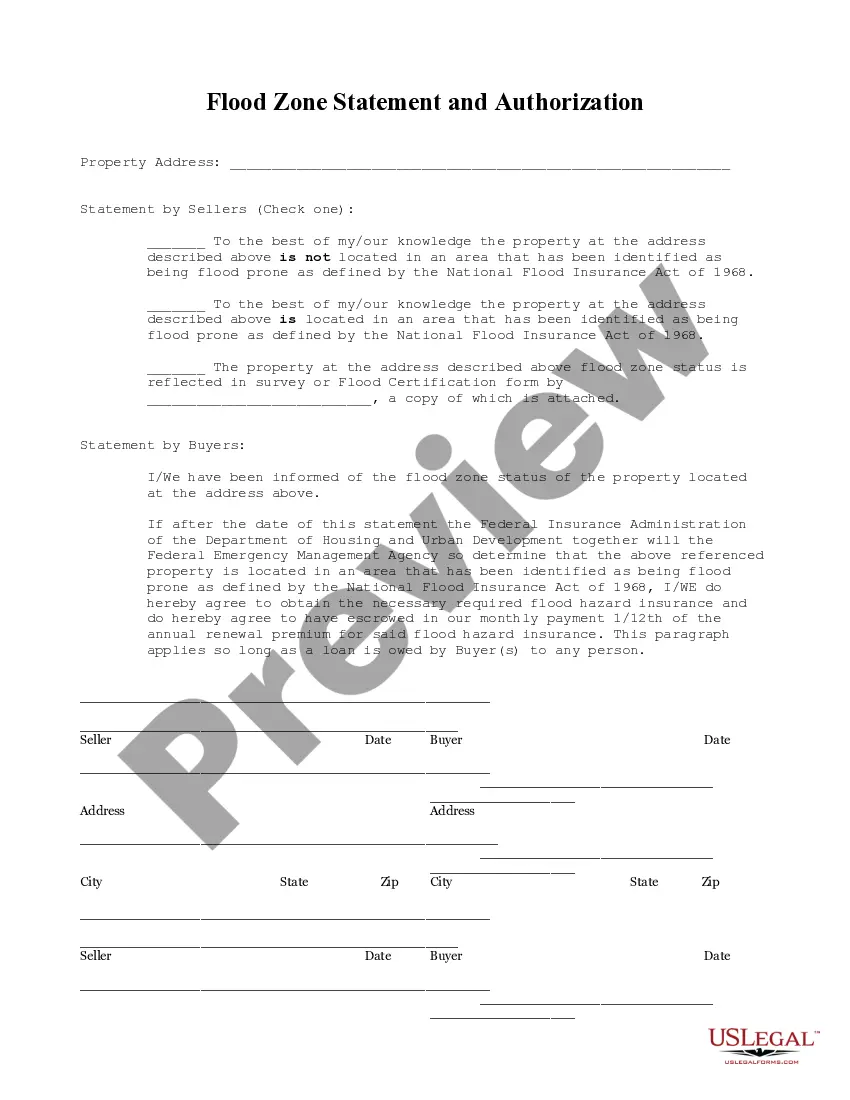
This Flood Zone Statement and Authorization form is for seller(s) to sign, stating the flood zone status of the property and for the buyers to acknowledge the same and state that should the property ever be determined to be in a flood zone, that they will obtain flood insurance.
The San Bernardino California Flood Zone Statement and Authorization is an official document that provides critical information regarding potential flood hazards within the specified area. This statement is essential for property owners, insurance companies, and developers to evaluate flood risks and make informed decisions. The Flood Zone Statement outlines the flood zone designation, flood insurance requirements, and other pertinent details related to the property's vulnerability to flooding. Keywords: San Bernardino California, Flood Zone Statement, Authorization, flood hazards, property owners, insurance companies, developers, flood risks, flood zone designation, flood insurance requirements, vulnerability to flooding. Different types of San Bernardino California Flood Zone Statement and Authorization: 1. Standard Flood Hazard Determination: This type of statement and authorization provides a comprehensive assessment of the flood risk associated with a particular property location within San Bernardino County. It includes details on the floodplain maps, flood zone designation, and any special flood hazard areas. 2. Flood Insurance Rate Map (FIRM): A FIRM is a specific type of Flood Zone Statement and Authorization that includes detailed information about the property's flood zone designation as per the Federal Emergency Management Agency (FEMA). It outlines the various flood zones such as Zone A, Zone AE, Zone X, and provides data on base flood elevations and flood way boundaries. 3. Floodplain Development Permit: This variant of the Flood Zone Statement and Authorization focuses on the specific requirements and restrictions imposed by local authorities for property development located within flood-prone areas. It outlines the conditions and guidelines for constructing, modifying, or renovating structures in these regions. 4. Letter of Map Amendment (COMA): A COMA is a specialized Flood Zone Statement and Authorization that certifies if a property is removed from a high-risk flood zone or qualifies for a lower-risk zone. It involves a detailed analysis of the property's elevation in relation to the base flood elevation, which allows for potential adjustments in flood insurance requirements. 5. Elevation Certificate: This document, related to the Flood Zone Statement and Authorization, provides detailed information about the property's elevation in relation to the base flood elevation. It includes the property's elevation survey data, ground elevations, and other significant measurements, serving as a crucial tool for assessing flood risks and determining appropriate flood insurance rates. Keywords: Standard Flood Hazard Determination, Flood Insurance Rate Map, FIRM, Floodplain Development Permit, Letter of Map Amendment, COMA, Elevation Certificate.The San Bernardino California Flood Zone Statement and Authorization is an official document that provides critical information regarding potential flood hazards within the specified area. This statement is essential for property owners, insurance companies, and developers to evaluate flood risks and make informed decisions. The Flood Zone Statement outlines the flood zone designation, flood insurance requirements, and other pertinent details related to the property's vulnerability to flooding. Keywords: San Bernardino California, Flood Zone Statement, Authorization, flood hazards, property owners, insurance companies, developers, flood risks, flood zone designation, flood insurance requirements, vulnerability to flooding. Different types of San Bernardino California Flood Zone Statement and Authorization: 1. Standard Flood Hazard Determination: This type of statement and authorization provides a comprehensive assessment of the flood risk associated with a particular property location within San Bernardino County. It includes details on the floodplain maps, flood zone designation, and any special flood hazard areas. 2. Flood Insurance Rate Map (FIRM): A FIRM is a specific type of Flood Zone Statement and Authorization that includes detailed information about the property's flood zone designation as per the Federal Emergency Management Agency (FEMA). It outlines the various flood zones such as Zone A, Zone AE, Zone X, and provides data on base flood elevations and flood way boundaries. 3. Floodplain Development Permit: This variant of the Flood Zone Statement and Authorization focuses on the specific requirements and restrictions imposed by local authorities for property development located within flood-prone areas. It outlines the conditions and guidelines for constructing, modifying, or renovating structures in these regions. 4. Letter of Map Amendment (COMA): A COMA is a specialized Flood Zone Statement and Authorization that certifies if a property is removed from a high-risk flood zone or qualifies for a lower-risk zone. It involves a detailed analysis of the property's elevation in relation to the base flood elevation, which allows for potential adjustments in flood insurance requirements. 5. Elevation Certificate: This document, related to the Flood Zone Statement and Authorization, provides detailed information about the property's elevation in relation to the base flood elevation. It includes the property's elevation survey data, ground elevations, and other significant measurements, serving as a crucial tool for assessing flood risks and determining appropriate flood insurance rates. Keywords: Standard Flood Hazard Determination, Flood Insurance Rate Map, FIRM, Floodplain Development Permit, Letter of Map Amendment, COMA, Elevation Certificate.