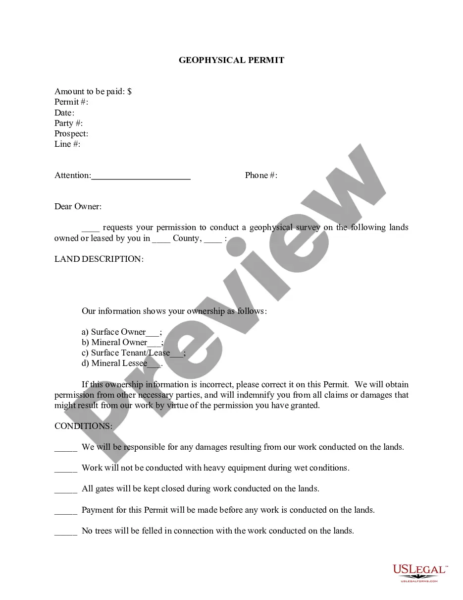
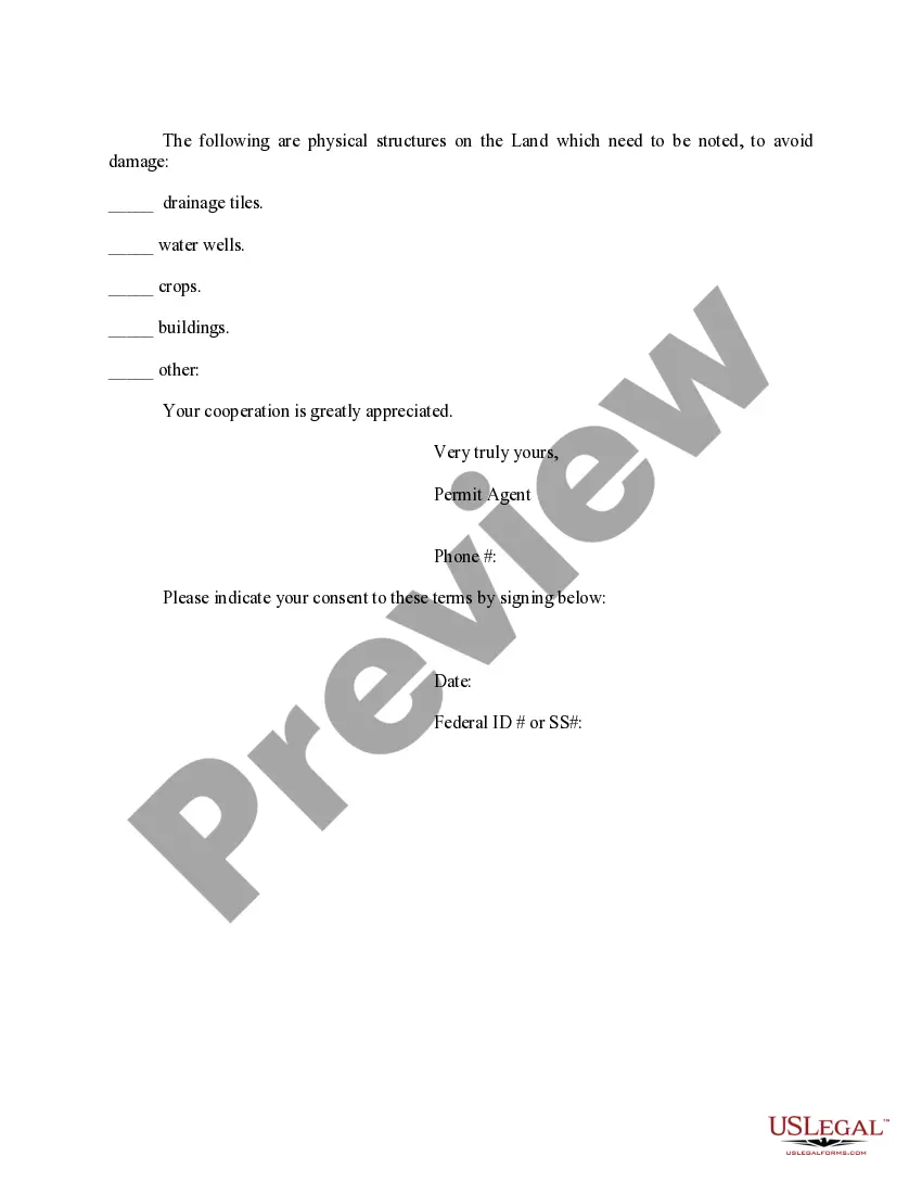
The Harris Texas Geophysical Permit is a document that grants permission to conduct geophysical activities in the county of Harris, Texas. Geophysical activities involve the use of specialized techniques and equipment to study the physical properties of the Earth's subsurface. These activities are often carried out for various purposes, including scientific research, mineral exploration, and environmental assessments. To acquire a Harris Texas Geophysical Permit, interested parties must apply to the relevant regulatory authority in Harris County. The permit application typically requires detailed information about the proposed geophysical activities, such as the specific techniques and equipment to be used, the purpose of the study, and the expected duration of the project. The regulatory authority evaluates these applications to ensure compliance with local regulations and to minimize any potential negative impacts on the environment, infrastructure, and public safety. There may be different types of Harris Texas Geophysical Permits, depending on the nature of the proposed activities. Some common types include: 1. Seismic Surveys Permit: This permit is required for conducting seismic surveys, which involve generating and recording seismic waves to map subsurface structures. Seismic surveys are commonly used in oil and gas exploration and geological mapping. 2. Magnetic or Gravitational Surveys Permit: This permit is necessary for conducting magnetic or gravitational surveys, which measure the variations in Earth's magnetic or gravitational fields. These surveys are often used in mineral exploration, archaeological studies, and geotechnical investigations. 3. Electromagnetic Surveys Permit: This permit is needed for conducting electromagnetic surveys, which utilize variations in the Earth's natural electromagnetic field to identify subsurface features. Electromagnetic surveys are particularly useful in geological mapping, groundwater exploration, and environmental studies. 4. Ground Penetrating Radar (GPR) Permit: This permit is essential for using ground-penetrating radar systems to image the shallow subsurface. GPR is commonly employed in utility mapping, concrete inspection, and archaeological investigations. The Harris Texas Geophysical Permit aims to regulate geophysical activities within the county to ensure that the exploration and research are conducted safely, with minimal disturbance to the environment and surrounding communities. Permit holders are often required to comply with specific conditions, such as notifying nearby residents, minimizing noise levels, and complying with environmental protection measures. In summary, the Harris Texas Geophysical Permit is a crucial authorization for conducting geophysical activities in Harris County, Texas. It ensures that these activities are carried out responsibly, respecting the natural and human environment while facilitating scientific research, resource exploration, and other relevant endeavors.
Harris Texas Geophysical Permit
Description


How to fill out Harris Texas Geophysical Permit?
Creating documents, like Harris Geophysical Permit, to take care of your legal affairs is a tough and time-consumming task. A lot of situations require an attorney’s involvement, which also makes this task expensive. However, you can consider your legal matters into your own hands and deal with them yourself. US Legal Forms is here to save the day. Our website comes with over 85,000 legal forms created for a variety of cases and life circumstances. We ensure each form is compliant with the laws of each state, so you don’t have to worry about potential legal pitfalls associated with compliance.
If you're already aware of our website and have a subscription with US, you know how effortless it is to get the Harris Geophysical Permit form. Go ahead and log in to your account, download the template, and customize it to your needs. Have you lost your form? No worries. You can find it in the My Forms tab in your account - on desktop or mobile.
The onboarding process of new users is fairly straightforward! Here’s what you need to do before downloading Harris Geophysical Permit:
- Ensure that your document is specific to your state/county since the rules for writing legal papers may vary from one state another.
- Learn more about the form by previewing it or reading a brief intro. If the Harris Geophysical Permit isn’t something you were looking for, then use the header to find another one.
- Sign in or register an account to start utilizing our service and download the form.
- Everything looks great on your side? Hit the Buy now button and select the subscription option.
- Select the payment gateway and type in your payment information.
- Your template is all set. You can try and download it.
It’s easy to locate and buy the needed document with US Legal Forms. Thousands of organizations and individuals are already benefiting from our rich library. Subscribe to it now if you want to check what other advantages you can get with US Legal Forms!