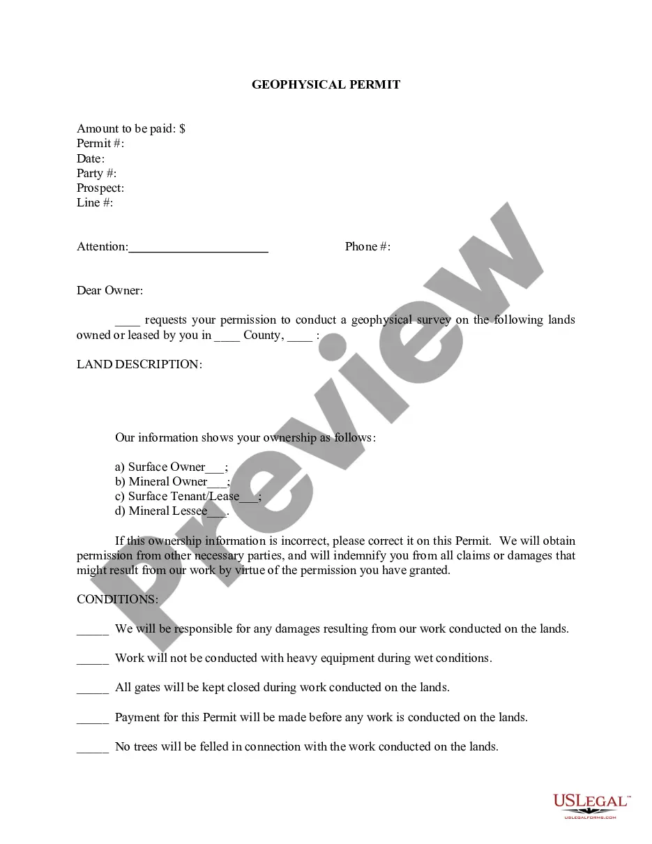
The Maricopa Arizona Geophysical Permit is a legal document issued by the authorities allowing individuals and organizations to conduct geophysical activities within the Maricopa region of Arizona. Geophysical studies involve the use of various scientific methods to analyze and interpret the Earth's physical properties, such as seismic surveys, magnetic surveys, gravity surveys, and electromagnetic surveys. This permit is essential for those wanting to perform geophysical exploration, resource surveys, or research for purposes related to geology, geothermal energy, mineral exploration, or environmental monitoring. It ensures that the necessary regulations and guidelines are followed, minimizing potential risks to the environment, public safety, and existing infrastructure. Types of Maricopa Arizona Geophysical Permits: 1. Seismic Survey Permit: This type of permit authorizes activities involved in the generation and detection of seismic waves, commonly used to study the structure of the Earth's subsurface or locate natural resources like oil and gas deposits. 2. Magnetic Survey Permit: This permit allows for the use of magnetic field measurement techniques to identify variations in the Earth's magnetic field. It is often used to map geological structures, locate buried metallic objects, or assess potential mineral deposits. 3. Gravity Survey Permit: This permit authorizes the measurement of gravitational field variations to study subsurface density variations. Gravity surveys are commonly employed in mineral exploration projects, mapping subsurface geology, or groundwater resource assessments. 4. Electromagnetic Survey Permit: This type of permit allows for the use of electromagnetic fields to map subsurface resistivity variations. It is commonly used in environmental studies, hydro geological investigations, or assessing the potential for mineral deposits. When applying for a Maricopa Arizona Geophysical Permit, applicants must submit a comprehensive proposal detailing the objectives, methodology, equipment to be used, and safety measures. The proposal should also include information on the qualifications and experience of the individuals undertaking the geophysical activities. Additionally, applicants are required to provide evidence of liability insurance and demonstrate compliance with any relevant local, state, or federal regulations. The Maricopa Arizona Geophysical Permit serves as a crucial tool for regulating and monitoring geophysical activities, ensuring responsible exploration and the protection of the region's natural resources and environment. By obtaining the appropriate permit, applicants can engage in their geophysical projects in a legal and environmentally conscious manner.
Maricopa Arizona Geophysical Permit
Description
How to fill out Maricopa Arizona Geophysical Permit?
Preparing documents for the business or personal needs is always a huge responsibility. When drawing up a contract, a public service request, or a power of attorney, it's crucial to consider all federal and state regulations of the particular area. Nevertheless, small counties and even cities also have legislative provisions that you need to consider. All these aspects make it stressful and time-consuming to create Maricopa Geophysical Permit without professional help.
It's possible to avoid spending money on lawyers drafting your paperwork and create a legally valid Maricopa Geophysical Permit by yourself, using the US Legal Forms online library. It is the most extensive online collection of state-specific legal documents that are professionally cheched, so you can be certain of their validity when selecting a sample for your county. Previously subscribed users only need to log in to their accounts to download the needed form.
In case you still don't have a subscription, adhere to the step-by-step instruction below to obtain the Maricopa Geophysical Permit:
- Look through the page you've opened and check if it has the sample you require.
- To do so, use the form description and preview if these options are available.
- To locate the one that meets your needs, use the search tab in the page header.
- Recheck that the template complies with juridical standards and click Buy Now.
- Opt for the subscription plan, then log in or register for an account with the US Legal Forms.
- Use your credit card or PayPal account to pay for your subscription.
- Download the selected document in the preferred format, print it, or fill it out electronically.
The great thing about the US Legal Forms library is that all the paperwork you've ever purchased never gets lost - you can access it in your profile within the My Forms tab at any time. Join the platform and quickly obtain verified legal forms for any use case with just a couple of clicks!