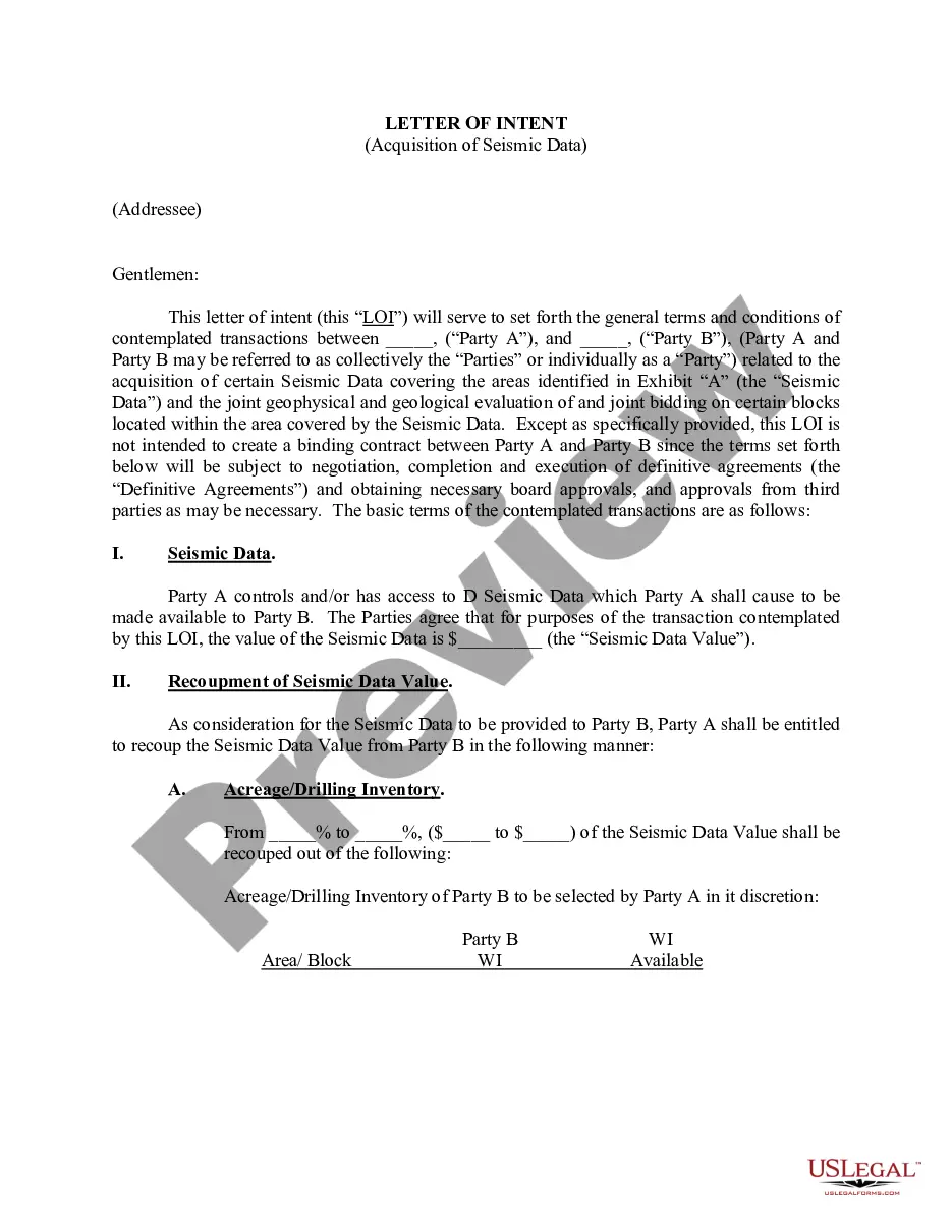
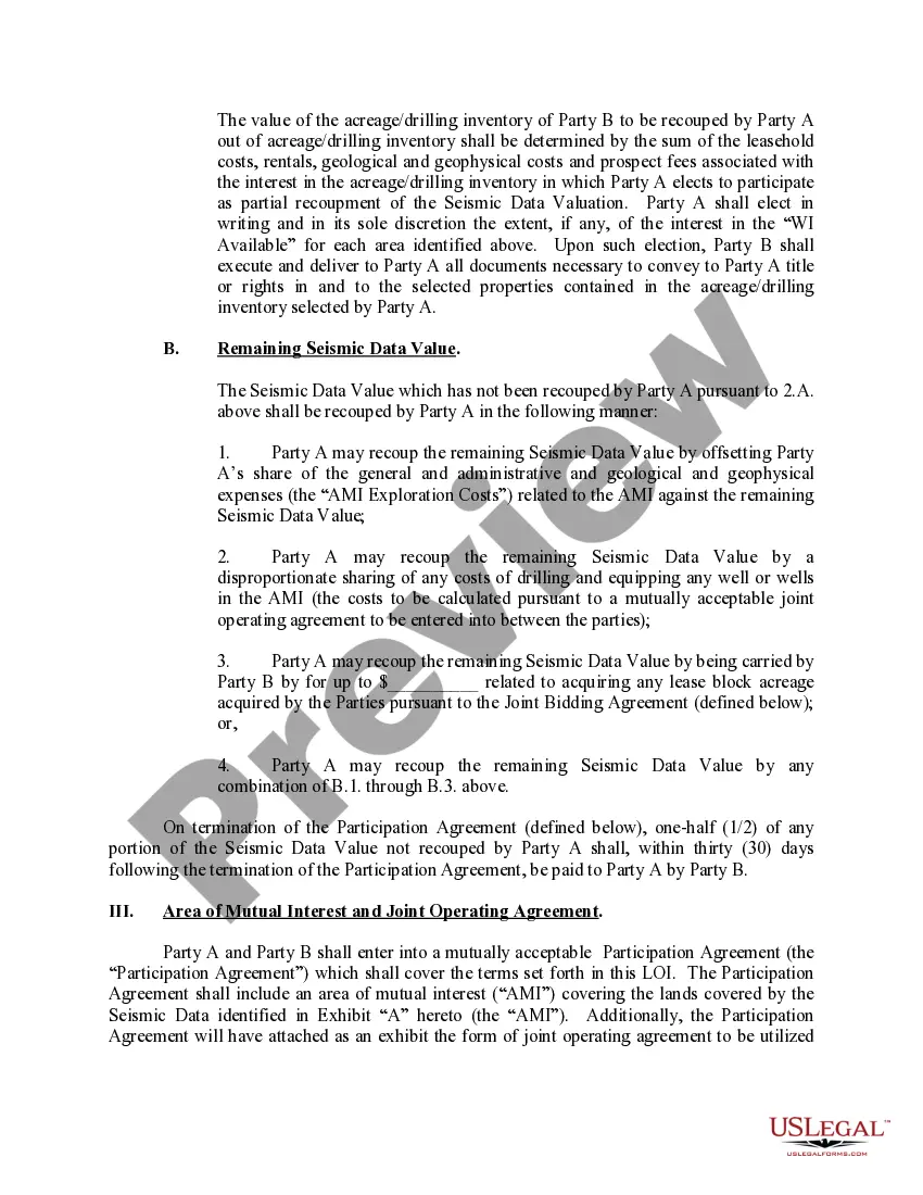
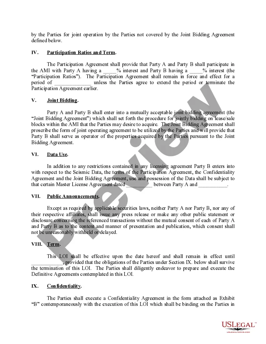
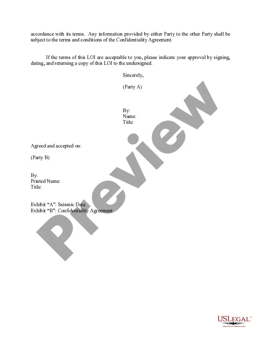
Montgomery Maryland Letter of Intent Acquisition of 3-D Data is a formal document that outlines the intention of an entity or organization to acquire three-dimensional (3-D) data in the Montgomery County region of Maryland. This letter serves as a preliminary agreement between the parties involved, detailing the terms, conditions, and objectives of the data acquisition process. The purpose of acquiring 3-D data in Montgomery Maryland is to gather comprehensive spatial information for various applications, such as urban planning, transportation management, environmental studies, and infrastructure development. This valuable data helps decision-makers gain insights into the physical characteristics, topography, and features of the region, aiding in better decision-making processes. The different types of Montgomery Maryland Letter of Intent Acquisition of 3-D Data may include: 1. Geographic Information Systems (GIS) Data Acquisition: This type involves capturing and collecting geospatial data through aerial or satellite imagery, LiDAR (Light Detection and Ranging), or other modern surveying techniques. It provides accurate and precise information about the terrain, buildings, vegetation, and other physical objects within the targeted area. 2. Lidar Data Acquisition: Lidar technology uses laser beams to create an accurate and detailed representation of the Earth's surface, capturing elevation, vegetation patterns, and building structures. This type of data acquisition is crucial for urban planning, flood modeling, forestry analysis, and 3-D modeling. 3. Photogrammetry Data Acquisition: Photogrammetry utilizes overlapping aerial photographs to create 3-D models. It reconstructs the 3-D position and shape of objects by analyzing the spatial relationships between multiple images. This method is commonly used in land surveying, architectural design, and cultural heritage documentation. 4. Remote Sensing Data Acquisition: Remote sensing involves gathering information about the Earth's surface from a distance, usually through satellite imagery or aerial photography. This method provides extensive coverage, allowing for the monitoring of land use, vegetation health, natural disasters, and environmental changes. The Montgomery Maryland Letter of Intent Acquisition of 3-D Data serves as a crucial document to facilitate collaboration between the acquiring party and the data provider. It ensures a clear understanding of project goals, data delivery timelines, licensing terms, and privacy regulations. This letter of intent lays the foundation for a successful data acquisition process, enabling effective decision-making and resource management in Montgomery County, Maryland.
Montgomery Maryland Letter of Intent Acquisition of 3-D Data
Description
How to fill out Montgomery Maryland Letter Of Intent Acquisition Of 3-D Data?
Whether you intend to start your company, enter into an agreement, apply for your ID update, or resolve family-related legal concerns, you need to prepare specific documentation corresponding to your local laws and regulations. Finding the right papers may take a lot of time and effort unless you use the US Legal Forms library.
The platform provides users with more than 85,000 expertly drafted and verified legal documents for any individual or business occasion. All files are collected by state and area of use, so opting for a copy like Montgomery Letter of Intent Acquisition of 3-D Data is quick and straightforward.
The US Legal Forms library users only need to log in to their account and click the Download key next to the required template. If you are new to the service, it will take you a couple of more steps to get the Montgomery Letter of Intent Acquisition of 3-D Data. Adhere to the instructions below:
- Make certain the sample fulfills your personal needs and state law requirements.
- Read the form description and check the Preview if available on the page.
- Use the search tab providing your state above to find another template.
- Click Buy Now to obtain the sample once you find the right one.
- Choose the subscription plan that suits you most to continue.
- Sign in to your account and pay the service with a credit card or PayPal.
- Download the Montgomery Letter of Intent Acquisition of 3-D Data in the file format you require.
- Print the copy or complete it and sign it electronically via an online editor to save time.
Forms provided by our library are multi-usable. Having an active subscription, you can access all of your previously purchased paperwork at any time in the My Forms tab of your profile. Stop wasting time on a endless search for up-to-date official documents. Join the US Legal Forms platform and keep your paperwork in order with the most extensive online form collection!
Form popularity
FAQ
How to write a letter of intent for business Write the introduction.Describe the transaction and timeframes.List contingencies.Go through due diligence.Include covenants and other binding agreements.State that the agreement is nonbinding.Include a closing date.
Purpose of a Letter of Intent (LOI) Parties can use an LOI to outline some of the basic, fundamental terms of an agreement before they negotiate and finalize all the fine points and details. Furthermore, the LOI may be used to signal that two parties are negotiating a deal such as a merger or joint venture (JV).
Acquisition Letters (ALs) are issued under the authorities of the Senior Procurement Executives of DOE and NNSA. ALs are intended for use by procurement professionals of DOE and NNSA, primarily Contracting Officers, and other officials involved in the acquisition process.
Acquisition Letters (ALs) are issued under the authorities of the Senior Procurement Executives of DOE and NNSA. ALs are intended for use by procurement professionals of DOE and NNSA, primarily Contracting Officers, and other officials involved in the acquisition process.
1. Letter of Intent (LOI) The Letter of Intent (LOI) is a nonbinding document in which the buyer outlines in writing the terms and price to which you've informally agreed, and commits to confidentiality so that they can further examine your company.
The Letter of Intent (LOI) in M&A is a written, non-binding document which outlines an agreement in principle for the buyer to purchase the seller's business, stating the proposed price and terms. The mutually signed LOI is required before the buyer proceeds with the due diligence phase of acquisition.
The Letter of Intent (LOI) in M&A is a written, non-binding document which outlines an agreement in principle for the buyer to purchase the seller's business, stating the proposed price and terms. The mutually signed LOI is required before the buyer proceeds with the due diligence phase of acquisition.
Follow these steps when writing an LOI: Write the introduction.Describe the transaction and timeframes.List contingencies.Go through due diligence.Include covenants and other binding agreements.State that the agreement is nonbinding.Include a closing date.
In many M&A deals, one of the first documents negotiated by the parties is a letter of intent (often called an LOI), which is a written expression of the parties' intent to enter into a transaction and a summary of the material terms of the deal.