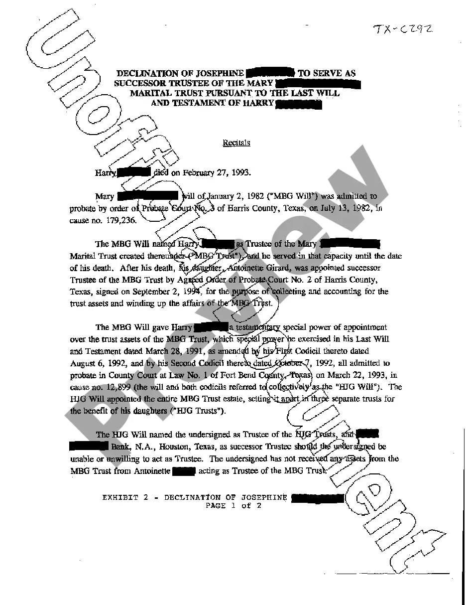
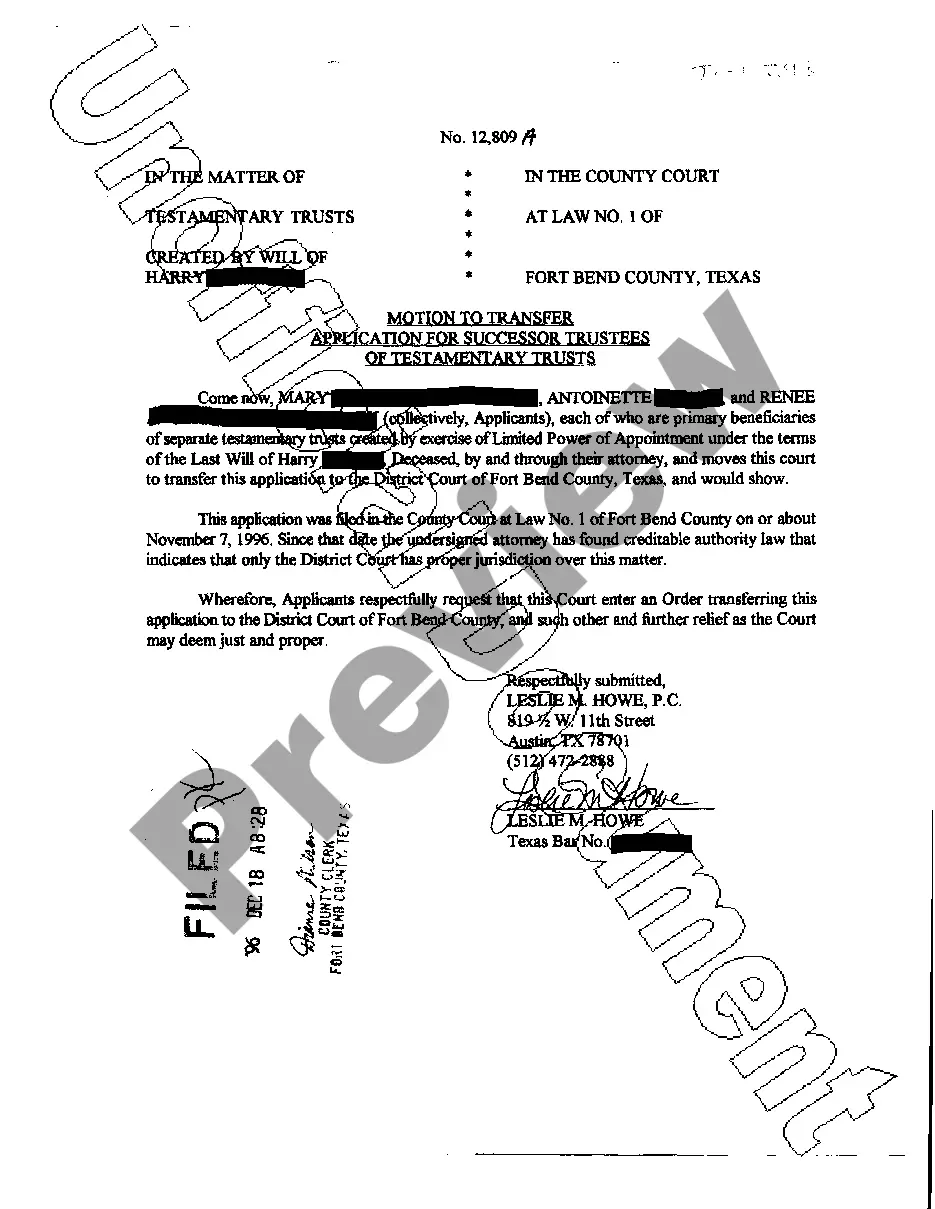
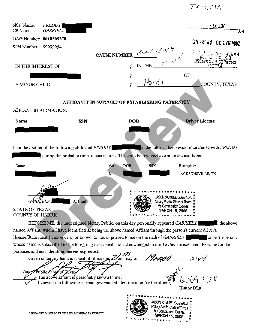
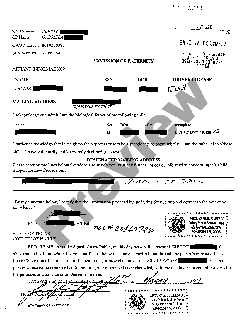
This lease rider form may be used when you are involved in a lease transaction, and have made the decision to utilize the form of Oil and Gas Lease presented to you by the Lessee, and you want to include additional provisions to that Lease form to address specific concerns you may have, or place limitations on the rights granted the Lessee in the “standard” lease form.
Harris Texas Geophysical and Seismic Operations refer to the diverse range of activities conducted in Harris County, Texas, related to the exploration and production of natural resources, primarily oil and gas. These operations involve the utilization of advanced geophysical and seismic techniques to assess the subsurface geology and identify potential hydrocarbon reservoirs. Geophysical operations in Harris Texas primarily involve the mapping and analysis of geological structures and properties using non-invasive methods. These methods typically include seismic surveys, electromagnetic surveys, gravity and magnetic surveys, and ground penetrating radar. These techniques allow geophysicists to detect subsurface features, such as faults, folds, and sedimentary layers, which are crucial in determining the presence and commercial viability of oil and gas reserves. Seismic operations play a vital role in Harris Texas Geophysical and Seismic Operations. Seismic surveys are conducted by generating controlled energy sources, such as explosions or mechanical vibrations, which create sound waves that propagate through the Earth's subsurface. These waves are then recorded by specialized instruments (seismic sensors or aerophones) to create detailed images of the subsurface geological structures. Seismic data interpretation aids in locating potential hydrocarbon reservoirs and determining reservoir characteristics, such as porosity, permeability, and fluid saturation. Harris Texas Geophysical and Seismic Operations encompass several specific types of activities, including: 1. 2D Seismic Surveys: In this method, seismic data is collected along a straight line to generate a two-dimensional image of the subsurface. It helps explore large areas and identify potential drilling locations. 2. 3D Seismic Surveys: This technique involves collecting seismic data in a grid pattern, creating a three-dimensional model of the subsurface. It provides a more detailed representation of reservoir structures, improving exploration success rates. 3. 4D Seismic Surveys: This advanced method aims to monitor changes in the reservoir over time. By repeating seismic surveys periodically, it helps identify reservoir dynamics, optimize production strategies, and manage reservoir depletion. 4. Seismic Data Processing: Once seismic data is acquired, it undergoes complex processing procedures to enhance the quality and accuracy of interpretation. This includes filtering, noise removal, velocity analysis, migration, and seismic inversion. 5. Seismic Interpretation: Geoscientists and geophysicists analyze processed seismic data to identify potential drilling targets, evaluate reservoir characteristics, and estimate the magnitude and distribution of hydrocarbon reserves. Harris Texas Geophysical and Seismic Operations play a crucial role in the oil and gas industry by providing valuable insights into subsurface geology and supporting the exploration and production of hydrocarbon resources. These operations contribute to ensuring efficient and sustainable energy production in the region while adhering to industry regulations and environmental considerations.Harris Texas Geophysical and Seismic Operations refer to the diverse range of activities conducted in Harris County, Texas, related to the exploration and production of natural resources, primarily oil and gas. These operations involve the utilization of advanced geophysical and seismic techniques to assess the subsurface geology and identify potential hydrocarbon reservoirs. Geophysical operations in Harris Texas primarily involve the mapping and analysis of geological structures and properties using non-invasive methods. These methods typically include seismic surveys, electromagnetic surveys, gravity and magnetic surveys, and ground penetrating radar. These techniques allow geophysicists to detect subsurface features, such as faults, folds, and sedimentary layers, which are crucial in determining the presence and commercial viability of oil and gas reserves. Seismic operations play a vital role in Harris Texas Geophysical and Seismic Operations. Seismic surveys are conducted by generating controlled energy sources, such as explosions or mechanical vibrations, which create sound waves that propagate through the Earth's subsurface. These waves are then recorded by specialized instruments (seismic sensors or aerophones) to create detailed images of the subsurface geological structures. Seismic data interpretation aids in locating potential hydrocarbon reservoirs and determining reservoir characteristics, such as porosity, permeability, and fluid saturation. Harris Texas Geophysical and Seismic Operations encompass several specific types of activities, including: 1. 2D Seismic Surveys: In this method, seismic data is collected along a straight line to generate a two-dimensional image of the subsurface. It helps explore large areas and identify potential drilling locations. 2. 3D Seismic Surveys: This technique involves collecting seismic data in a grid pattern, creating a three-dimensional model of the subsurface. It provides a more detailed representation of reservoir structures, improving exploration success rates. 3. 4D Seismic Surveys: This advanced method aims to monitor changes in the reservoir over time. By repeating seismic surveys periodically, it helps identify reservoir dynamics, optimize production strategies, and manage reservoir depletion. 4. Seismic Data Processing: Once seismic data is acquired, it undergoes complex processing procedures to enhance the quality and accuracy of interpretation. This includes filtering, noise removal, velocity analysis, migration, and seismic inversion. 5. Seismic Interpretation: Geoscientists and geophysicists analyze processed seismic data to identify potential drilling targets, evaluate reservoir characteristics, and estimate the magnitude and distribution of hydrocarbon reserves. Harris Texas Geophysical and Seismic Operations play a crucial role in the oil and gas industry by providing valuable insights into subsurface geology and supporting the exploration and production of hydrocarbon resources. These operations contribute to ensuring efficient and sustainable energy production in the region while adhering to industry regulations and environmental considerations.